Chinatown-International District, Seattle
|
Seattle Chinatown Historic District | |
 | |
|
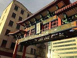
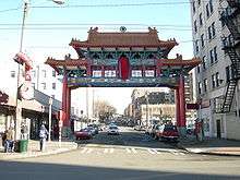
Historic Chinatown Gate in the Seattle Chinatown Historic District | |
| Location | Roughly bounded by Main, Jackson, I-5, Weller, and Fifth, Seattle, Washington |
|---|---|
| Area | 23 acres (9.3 ha) |
| Architectural style | Beaux Arts |
| NRHP Reference # | 86003153[1] |
| Added to NRHP | November 6, 1986 |


The Chinatown-International District of Seattle, Washington (also known by the three individual neighborhood names of Chinatown, Japantown and Little Saigon, or simply as the CID) is the center of Seattle's Asian American community. The name was established by City Ordinance 119297 in 1999 as a result of the three neighborhoods' work and consensus on the Seattle Chinatown International District Urban Village Strategic Plan submitted to the City Council in December 1998. Like many other areas of Seattle, the neighborhood is multiethnic, but the majority of its residents are of Chinese ethnicity.[2] It is one of eight historic neighborhoods recognized by the City of Seattle.[3]
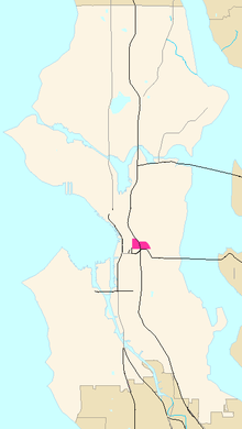
Within the Chinatown International District are the three neighborhoods known as Seattle's Chinatown, Japantown and Little Saigon. The geographic area once included Seattle's Manilatown.[4] Boundaries of the CID are from 4th Avenue South to Rainier Avenue and from Yesler Way to Charles Street/Dearborn. Also within the CID is the Seattle Chinatown Historic District, so designated by the U.S. National Register of Historic Places in 1986. Chinatown is roughly south of Jackson, with Japantown north of Jackson and Little Saigon to the east of I-5. Rather than drawing static boundaries, each neighborhood agreed to being defined by a "spine," or core area (term coined by Dr. Lynn Manzo of the University of Washington). The spine of Chinatown is King Street, with Hing Hay Park at its heart. The spine of Japantown is Main Street, while the spine of Little Saigon is the portion of Jackson Street east of I-5.
Hing Hay Park, at the corner of S. King Street and Maynard Avenue S., is a popular gathering place in the Chinatown International District. The Wing Luke Asian Museum is an important cultural institution in the neighborhood, as was the Nippon Kan Theatre until its closure. Kobe Terrace, on the steep slope adjacent to I-5, is another important site, as is the Danny Woo Chinatown International District Community Garden.
While the exact ethnic makeup of the CID has not been determined, the 2010 Census contains ethnic self-identification counts by ZIP code. Much of the CID lies in 98104. The numbers and percentages of residents identifying as an Asian ethnicity in 98104 are: Chinese—1,572 (12.1%); Vietnamese—463 (3.5%); Filipino—373 (2.8%); Japanese—229 (1.7%); Korean—150 (1.1); East Indian—111, Indonesian—20, Laotian—20, Cambodian—19, and Hmong—2.[2]
Location
The neighborhood stretches from Fourth Avenue S., beyond which are Pioneer Square and SoDo, east to Rainier Avenues South, beyond which is Rainier Valley. South of the Dearborn and Charles Street boundaries are Beacon Hill and the Industrial District; while north of Yesler Way, the northern boundary of the Chinatown International District, lies Downtown and First Hill. Within the CID are the three neighborhoods of Chinatown, Japantown, and Little Saigon. The portion east of Interstate 5 has been dubbed "Little Saigon" because of the high concentration of Vietnamese businesses there. The main thoroughfares in Chinatown are South Jackson Street (south of I-5) and South King Street; the primary thoroughfare in Japantown is Main Street; and the prominent street in Little Saigon is South Jackson Street. The nexus of Little Saigon is the intersection of 12th Avenue South and S. Jackson. For Japantown, it's 6th and Main. In Chinatown, the core is Hing Hay Park, centering on the King and Maynard intersection.
History

19th century
Chinese immigrants first came to the Pacific Northwest in the 1850s, and by the 1860s, some had settled in Seattle. The first Chinese quarters were near Yesler's Mill on the waterfront. According to Chinese oral history, the waterfront was the first Chinatown, where the Chinese dock workers lived. In 1886 whites drove out most of Seattle's Chinese population. However, some took shelter with Native Americans on the reservations while others came under the protection of white employers and a judge. The Great Seattle Fire of 1889 further hindered the community. Eventually, the Chinese re-established new quarters farther inland, along Washington St. and Second Avenue South. This was the second Chinatown. Land values rose, especially with impending construction of the Smith Tower, and the people of Chinatown moved again, to the present and third location along King Street. Only the Hop Sing Tong managed to retain its building on 2nd and Washington. It sold this building about 2006 in order to purchase the former China Gate building in the current Chinatown.
Near the end of the 19th century, Japanese immigrants also began arriving, settling on the south side of the district on the other side of the railroad tracks. Part of present-day Dearborn Street, between 8th and 12th avenues, was known as Mikado Street, after the Japanese word for "emperor."[5] Japanese Americans developed Nihonmachi, or Japantown, on Main Street, two blocks north of King Street. By the mid-1920s, Nihonmachi extended from 4th Avenue along Main to 7th Avenue, with clusters of businesses along Jackson, King, Weller, Lane, and Dearborn streets.[6]
20th century

As downtown property values rose, the Chinese were forced to other areas. By the early 1900s, a new Chinatown began to develop along King Street. In 1910, Goon Dip, a prominent businessman in Seattle's Chinese American community,[7] led a group of Chinese Americans to form the Kong Yick Investment Company, a benefit society. Their funding and efforts led to the construction of two buildings—the East Kong Yick Building and the West Kong Yick Building.[8] Meanwhile, Filipino Americans began arriving to replace the Chinese dock workers, who had moved inland. According to Pamana I, a history of Filipino Americans in Seattle, they settled along First Hill and the hotels and boarding houses of Chinatown and Japantown beginning in the early 1920s. They were attracted to work as contract laborers in agriculture and salmon canneries.[9][10] Among them was Filipino author Carlos Bulosan, who wrote of his experiences and those of his countrymen in his novel America Is In The Heart (1946).[11]
In 1942 the federal government forcibly removed and detained people of Japanese ancestry from Seattle and the West Coast in the wake of the attack on Pearl Harbor. Authorities moved them to inland internment camps, where they lived from 1942 to 1946. Most of Seattle's Japanese residents were sent to Minidoka in Idaho.[12] After the war, many returned to the Pacific Northwest but relocated to the suburbs or other districts in Seattle. A remaining vestige of the old community is the office of the North American Post, a Japanese-language newspaper founded in 1902. Another is the Panama Hotel, which was proclaimed a National Treasure in 2015 with a prior listing on the U.S. National Register of Historic Places.[13] Uwajimaya, originally a Japantown store, moved down the hill into Chinatown.
African Americans moved to Seattle in the Great Migration, mostly out of the South, to work in the war industry during World War II, occupying many of the houses left vacant by the internment of the Japanese Americans. They filled the empty businesses along Jackson Street with notable jazz clubs. The history of Jazz Alley, as Jackson Street became known, is well documented by Paul de Barros in his book, Jackson Street After Hours: The Roots of Jazz in Seattle (1993).
Many Chinese and Japanese buildings and businesses were destroyed for the construction of Interstate 5 in the 1960s. In the 1970s, ethnic Asians formed new civic organizations (as compared to the traditional Chinese family associations, tongs and social clubs) serve needs ranging from community health, care of the elderly, information and referrals, counseling, historic preservation, marketing of the area, and building low-income housing.
In 1975 with the fall of Saigon, a new wave of immigrants from Vietnam and Southeast Asia established Seattle's Little Saigon east of I-5. Many of these immigrants were of Chinese descent. Viet Wah became Little Saigon's anchor store, and the famous boat-shaped restaurant Pho Bac introduced Vietnamese pho to Seattle palates, kicking off a pho craze that has not abated. Pho entered the American culinary lexicon, becoming as familiar as chicken chow mein and sushi.

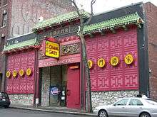
The worst mass murder in the history of Seattle took place at the Wah Mee Club on Maynard Alley on February 18, 1983. Thirteen people were killed in a tong attack.
In 1986, a portion of Chinatown and Japantown was listed on the National Register of Historic Places as the "Seattle Chinatown Historic District."[14] That year the Wing Luke Memorial Museum moved to 7th Avenue, a location it would occupy for two decades.
In 1999, the City Council approved the "Chinatown-International District Urban Village Strategic Plan" for the future of the neighborhood. This plan, agreed to by all major organizations in the CID, led to City Ordinance 119297. This ordinance enshrined the three neighborhoods of Chinatown, Japantown, Little Saigon and the Chinatown Historic District into one larger neighborhood with a compromise name. Since then, the often conflicting interests of development, preservation and the conversion of old buildings to low-income housing have clashed as office developments (e.g., Union Station) and market-rate housing developments are overwhelmed by drastic increases in low-income housing stock. In addition, controversy erupted over vacating S. Lane Street as part of a large redevelopment by the private business Uwajimaya. Protesters formed the Save Lane Street organization. They insisted as business owners they supported re-development, but opposed vacating a public street for a private business use. After losing a lawsuit filed over the matter, the Save Lane Street group dissolved.[15]
See also
- Festál at Seattle Center, a series of festivals celebrating the culture and contributions of Seattle's various Asian American and other ethnic communities
- History of the Chinese Americans in Seattle
References
- ↑ Staff (July 9, 2010). "National Register Information System". National Register of Historic Places. National Park Service. Retrieved July 9, 2010.
- 1 2 "2010 Census Data". United States Census. 2010. Retrieved October 4, 2015.
- ↑ "International District". Seattle Department of Neighborhoods. City of Seattle. Retrieved October 2, 2015.
- ↑ "Filipino Community". Seattle Chinatown-International District Preservation and Development Authority. Retrieved October 2, 2015.
- ↑ Lei, Owen (July 17, 2011). "Seattle man champions changing a century-old street name". KING-TV. Retrieved July 17, 2011.
City ordinance 4044, enacted Dec. 23, 1895, changed the name "Mikado" to Dearborn Street as part of a city-wide plan to standardize street names in a booming urban area. Section 276 of the bill stated, 'That the names of Alaska Street, Mikado Street, Modjeska Street, Cullen Street, Florence Street and Duke Street, from Elliott Bay to Lake Washington, be and the same are changed to Dearborn Street.'
- ↑ Takami, David A. (1998), Divided Destiny: A History of Japanese Americans in Seattle, United States: University of Washington Press, p. 29, ISBN 0-295-97762-0
- ↑ "Seattle's Chinatown/International District". Wing Luke Museum. Retrieved October 15, 2007.
- ↑ "Building and Architecture > Wing Luke Museum". Wing Luke Museum. Retrieved October 2, 2015.
- ↑ Mejia-Giudici, Cynthia (December 3, 1998). "Filipino Cannery Workers". HistoryLink. Retrieved January 1, 2012.
- ↑ "Filipino Cannery Unionism Across Three Generations 1930s-1980s". Seattle Civil Rights and Labor History Project, University of Washington. Retrieved January 4, 2012.
- ↑ Mejia-Giudici, Cynthia (February 14, 2003). "Bulosan, Carlos (1911?-1956), Writer". HistoryLink. Retrieved January 1, 2012.
- ↑ "Japanese American Internment during World War II". Friends of Minidoka. Retrieved January 4, 2012.
- ↑ Broom, Jack (July 26, 2015). "Seattle’s Panama Hotel deemed a National Treasur". Seattle Times (Seattle Times Company). Retrieved October 2, 2015.
- ↑ Turkiya L. Lowe, Quintard Taylor, [www.cfr.washington.edu/research.cesu/reports/UW-01-7-B-Recs-for-National-Register-FR.pdf Recommendations for National Register Designation of Properties Associated With Civil Rights in Idaho, Oregon, and Washington], submitted to National Park Service. p. 13 of PDF (entry on Rainier Heat and Power Company). Accessed January 4, 2012.
- ↑ Jacklet, Ben (July 15, 1999). "The Great Mall of Chinatown". The Stranger. Retrieved July 17, 2011.
Further reading
- Bulosan, Carlos. America is in the Heart (1946)
- Chew, Ron, ed. Reflections.
- City Ordinance 119297. www.seattle.gov
- De Barros, Paul. Jackson Street After Hours: The Roots of Jazz in Seattle (1993)
- Filipino American National Historical Society. Pamana I. Seattle, Washington.
- Filipino American National Historical Society. Pamana II. Seattle, Washington.
- Filipino American National Historical Society. Pamana III. Seattle: 2012.
- George, Kathy. "Seattle's Japantown remembered" (Archive). Seattle Post-Intelligencer, Sunday November 21, 2004.
- Ho, Chui Mei. Goon Dip.
External links
| Wikivoyage has a travel guide for Seattle/Pioneer Square-International District. |
| Wikimedia Commons has media related to International District, Seattle, Washington. |
- Official website of the Chinatown-International District
- International Special Review District from the City of Seattle
- Seattle's Asian American Movement, a multimedia collection of resources on the International District Preservation Movement and the Kingdome protests by the Seattle Civil Rights and Labor History Project
- International District from Seattle Post-Intelligencer
- Guide to the International Special Review District Records 1973-1997 from the Northwest Digital Archives
| ||||||||||||||||||||||||||||||||||||||||||
Coordinates: 47°35′51″N 122°19′15″W / 47.59750°N 122.32083°W