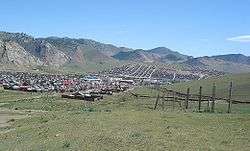
Khangai Mountains
| Khangai | |
|---|---|
| Хангай | |
 Panorama of Lake Terkhiin Tsagaan in the Khangai Mountains | |
| Highest point | |
| Peak | Otgontenger |
| Elevation | 4,031 m (13,225 ft) |
| Geography | |
| Country | Mongolia |
| Aimags | Arkhangai, Övörkhangai, Bayankhongor and Zavkhan |
| Settlements | Tsetserleg, Bayankhongor and Uliastai |
| Range coordinates | 47°30′N 100°00′E / 47.5°N 100°ECoordinates: 47°30′N 100°00′E / 47.5°N 100°E |
The Khangai mountains (Mongolian : Хангайн нуруу) are a mountain range in central Mongolia, some 400 kilometres west of Ulaanbaatar.
Name
Khangai has become a generally used term by Mongolians to describe the entire lush forest-steppe area to the north as opposed to the southern desert, which is called Govi (Gobi). The intermediary steppe area is called Kheer or Tal. The word Khangai is composed of the verb "khanga-" which means "provide, supply with necessities" and the Mongolian nominalizing suffix "-ai". The word Khan (King) is also a possible root, probably even related to the verb "khanga-". Therefore, Khangai is usually interpreted as provident lord, munificent king, generous gracious lord or bountiful king. The ancient name denotes the sacredness of the mountain and the special place it holds in the hearts of those who depend on it. A similar Mongolian word for sacred mountains is Khairkhan which means loving king (for example Asralt Khairkhan, a particularly intimate name meaning caring loving king). Its forbidden to say the name of a Khairkhan when the mountain is in view. If the mountain is in view, it should simply be called Khairkhan, not its full name. This strict custom applies in all regions of Mongolia. Any mountain or hill that is pleasing to the sight or in any other way pleasant is praised with the words "that is indeed a special Khairkhan" or "what a majestic Khairkhan!" etc. Any area of the mountainous forest-steppe region understood alone or along with all that it contains (rivers, springs, plants, animals) may be praised with the words "that is indeed a great Khangai" or "there is no denying that that is a unique Khangai!" etc.
Two provinces of Mongolia are named after the Khangai mountains: Arkhangai (Northern Khangai) and Ovorkhangai (Southern Khangai). The mild climate area where the two provinces meet (eastern Khangai) is known as the cradle of Mongolian and nomadic civilization. The plains at the foot of the eastern Khangai host the Orkhon Valley World Heritage Site. The Xiongnu (209BC - 93AD) capital Luut Khot (Lungcheng), the Xianbei (93AD -234 AD) capital Ordo and the Rouran (330-555) capital Moomt (Mume) are said to have been located there. Later empires also established their capitals there, for example the Uyghur Empire (745-840) built their capital Ordu-Baliq in the region.
Features


The tallest mountain is the Otgontenger (lit. "youngest sky"), the height of which is given as 3,905, 4,021, and 4,031 m depending on the source. It is one of the four paramount sacred mountains of Mongolia. State ceremonies are held there.
Suvraga Khairkhan (Stupa Khairkhan, height 3,117m) is another sacred mountain to the east of Tsetserleg.
Khorgo is an extinct volcanic field on the northern slopes of the Khangai Mountains.
The mountains feed the rivers Orkhon, Selenge, Ider, Zavkhan and the lakes Orog and Böön tsagaan. In the west the Khangai mountains transition into the Great Lakes Depression.
The Khangai mountain region is known for its mild microclimates in certain areas. Winters there are not as harsh as in other parts of the country. As noted in Brzezniak and Niedzwiedz's "Vertical Variability of Climatic Conditions in the Khangai Mountains" p. 34:[1]
Because of strong winter inversions which have become known as a singularity of the mesoclimate of Mongolia (Gavrilova 1974) the Khangai tends to be some 10°C warmer than the surrounding areas. It is likely that even the highest mountain tops are some 5°C warmer than the sub-Khangai basins.

References
|