Champigneulles
For the commune in the département of Ardennes, see Champigneulle.
| Champigneulles | ||
|---|---|---|
| ||
 Champigneulles | ||
|
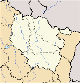
Location within Lorraine region  Champigneulles | ||
| Coordinates: 48°44′03″N 6°09′55″E / 48.7342°N 6.1653°ECoordinates: 48°44′03″N 6°09′55″E / 48.7342°N 6.1653°E | ||
| Country | France | |
| Region | Alsace-Champagne-Ardenne-Lorraine | |
| Department | Meurthe-et-Moselle | |
| Arrondissement | Nancy | |
| Canton | Pompey | |
| Intercommunality | Communauté de communes du Bassin de Pompey | |
| Government | ||
| • Mayor (2008–2014) | Claude Hartmann (PR) | |
| Area1 | 23.99 km2 (9.26 sq mi) | |
| Population (2012)2 | 6,884 | |
| • Density | 290/km2 (740/sq mi) | |
| INSEE/Postal code | 54115 / 54250 | |
| Elevation |
186–364 m (610–1,194 ft) (avg. 199 m or 653 ft) | |
|
1 French Land Register data, which excludes lakes, ponds, glaciers > 1 km² (0.386 sq mi or 247 acres) and river estuaries. 2 Population without double counting: residents of multiple communes (e.g., students and military personnel) only counted once. | ||
Champigneulles is a commune in the Meurthe-et-Moselle department in north-eastern France.
Arboretum de Bellefontaine.
It is home to L'Arboretum de Bellefontaine.
The Champigneulles brewery, founded on 20 June 1897, was for a long time the most important production site of the Société Européenne de Brasserie (SEB), which owned more than twenty production sites in France. In 1987 SEB merged with Kronenbourg Brewery. In 2006 Kronenbourg sold the site to Frankfurter Brauhaus, a German brewery in Frankfurt an der Oder.
See also
| Wikimedia Commons has media related to Champigneulles. |
This article is issued from Wikipedia - version of the Wednesday, July 01, 2015. The text is available under the Creative Commons Attribution/Share Alike but additional terms may apply for the media files.
