Carajás Mountains
| Carajás Mountains | |
|---|---|
| Serra dos Carajás | |
 | |
| Highest point | |
| Peak | Monte Redenção |
| Elevation | 716 m (2,349 ft) |
| Coordinates | 6°16′37″S 50°34′54″W / 6.27694°S 50.58167°WCoordinates: 6°16′37″S 50°34′54″W / 6.27694°S 50.58167°W |
| Geography | |
| Country | Brazil |
| State/Province | North |
| Borders on | Carajás Mountains |
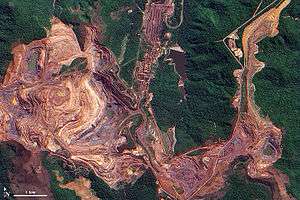
The Carajás Mountains or Serra dos Carajás are a mountain range to the west of the municipality of Marabá in the Pará state of Brazil. Monte Redenção, Marabá's highest point, is located there.
Bibliography
- Newton Pereira de Rezende, Carajás: memórias da descoberta, Editora Gráfica Stamppa, 2009, 316 pg. Book in Portuguese telling the history of Carajás' iron mines' discovery.
This article is issued from Wikipedia - version of the Sunday, February 15, 2015. The text is available under the Creative Commons Attribution/Share Alike but additional terms may apply for the media files.