Cambridge, Ontario
| Cambridge | ||
|---|---|---|
| City (lower-tier) | ||
| City of Cambridge | ||
 | ||
| ||
| Nickname(s): The Bridge, The Tri-City | ||
| Motto: A fine place for business, a great place to call home. | ||
 Cambridge Location of Cambridge in southern Ontario | ||
| Coordinates: 43°22′N 80°19′W / 43.367°N 80.317°WCoordinates: 43°22′N 80°19′W / 43.367°N 80.317°W | ||
| Country |
| |
| Province |
| |
| Region | Waterloo | |
| Established | January 1973 | |
| Government | ||
| • Mayor | Doug Craig | |
| • Governing Body | Cambridge City Council | |
| Area[1] | ||
| • Land | 112.86 km2 (43.58 sq mi) | |
| Elevation | 329 m (1,079 ft) | |
| Population (2011)[1] | ||
| • Total | 126,748 (Ranked 38th) | |
| • Density | 1,121.7/km2 (2,905/sq mi) | |
| Time zone | Eastern (EST) (UTC−5) | |
| Postal code span | N1(P-T); N3(C-H) | |
| Area code(s) | 519 and 226 | |
| Website | www.cambridge.ca | |
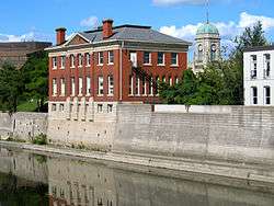
Cambridge (2011 population 126,748) is a city located in Southern Ontario at the confluence of the Grand and Speed rivers in the Regional Municipality of Waterloo, Ontario, Canada. It is an amalgamation of the City of Galt, the towns of Preston and Hespeler, and the hamlet of Blair.[2] Galt covers the largest portion of Cambridge, making up the southern half of the city. Preston and Blair are located on the western side of the city, while Hespeler is in the most northeasterly section of Cambridge.
History
History of the City of Cambridge
Cambridge began as a composite city in 1973, when the City of Galt, Towns of Preston and Hespeler, and the hamlet of Blair were amalgamated.
There was considerable resistance among the local population to this "shotgun marriage" arranged by the provincial government and a healthy sense of rivalry had always governed relations among the three communities. Even today, though many residents will tell the outside world that they call Cambridge home, they will often identify themselves to each other as citizens of Galt or Preston or Hespeler. Each unique centre has its own history that is well documented in the Cambridge City Archives.[3]
The first mayor of Cambridge was Claudette Millar, who at the time was one of the few female mayors and, at 35, the youngest mayor in Canada.
As Cambridge has developed and the open spaces between the original municipalities have been filled in, a fourth commercial core, entirely modern in its construction, has emerged. The Macdonald-Cartier Freeway Highway 401 runs through its midst.[4]
On May 17, 1974, flooding on the Grand River was so intense it filled city streets with water to a depth of about four feet. Hundreds of businesses and homes were severely damaged.
History of the City of Galt
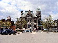
In 1784 the British Crown granted to the Six Nations Indians, in perpetuity, all the land along the Grand River six miles (10 km) deep on each side of the river from its source to Lake Erie. The First Nations, led by Joseph Brant, had the land surveyed in 1791 and divided into Indian Reserve lands as well as large tracts which they intended to sell to land developers. One such developer was the Honourable William Dickson who, in 1816, came into sole possession of 90,000 acres (360 km2) of land along the Grand River that was later to make up North and South Dumfries Townships.
Mr. Dickson decided that a new name was needed for the Post Office and consequently the settlement. He chose Galt in honour of the Scottish novelist and Commissioner of the Canada Company, John Galt. The settlers resisted the introduction of the new name preferring the more familiar Shade's Mills. However, after Mr. Galt visited Mr. Dickson in the settlement in 1827 the name Galt received more widespread acceptance. In its early days Galt was an agricultural community serving the needs of the farmers in the surrounding countryside. By the late 1830s, however, the settlement began to develop an industrial capacity and reputation for quality products. Galt was the largest town in the area until the beginning of the 20th century when it was overtaken by Kitchener. The town continued its steady if unspectacular growth and reveled in its reputation as an industrial town whose products reached all over the globe.[5]
History of the town of Preston
The story of Preston, Ontario begins in the early 1800s with the arrival of a group of German-speaking Mennonites from Pennsylvania. The land upon which they settled was acquired from the Six Nations Indians through a land speculator named Richard Beasley.
Among the first settlers to arrive in what was later to become Preston was John Erb who acquired 7,500 acres (30 km2) including land at the confluence of the Grand and Speed Rivers. Mr. Erb and his wife settled on his Speed River lands in 1805 and built a sawmill on the banks of the river in 1806. A gristmill followed in 1807. The sawmill has long since disappeared but the gristmill was the beginning of a flour milling business that has operated continuously on that spot to the present day. The site is recognized as the oldest continuously operating industrial site in the region.
It was around Mr. Erb's mills, known locally as Cambridge Mills, that the settlement that grew into Preston began and began to attract a significant number of tradesmen, artisans and craftsmen primarily young German immigrants who had recently arrived in North America.
By the middle of the nineteenth century European travellers were being joined in increasing numbers by people who were attracted to the town's mineral springs which were thought to possess remarkable curative powers in the treatment of a variety of ailments and discovered accidentally. The water, with its high sulphur content, was well named "stinky water" and was initially thought to be worthless. It was not long, however, before some enterprising businessmen and medical practitioners let it be known that the mineral springs, while not heated like that of some European health spas, could offer relief if not an outright cure for a number of ailments including arthritis and rheumatism.
While the town became an important destination for those seeking to renew their sometimes fragile health, the well-being of the town itself was in question. It was not until 1900 that the population broke through the 2,000 barrier. Part of the reason for this turnaround can be traced to the coming of the electric railway systems that began to serve the community in 1894.
The idea of an electric railway to connect Preston with Galt, its larger neighbour to the southeast, was first proposed in 1890. At first, Preston's town council was not eager to get the town involved in a potentially hazardous railway scheme and it was not until 1893 that Preston council decided to enter negotiations. In many ways, the building of the electric railway marked Preston's emergence from its well earned identity as a "sleepy German town" where very little happened to a much more energetic presence in the region.
A steady growth followed and the decades of the 1950s and the 1960s saw the continuing growth of Preston's industrial base and the gradual expansion of the town toward the borders of its nearest neighbours Galt and Hespeler.[6]
History of the town of Hespeler
The area that eventually came to be occupied by the town of Hespeler was originally part of the land granted to the Six Nations Indians by the British Crown in 1784. The Indians led by Joseph Brant decided to sell a part of their grant and had the land surveyed. In 1798 a block of land, known as Block 2 and measuring over 90,000 acres (360 km2) was sold to Richard Beasley and his partners who looked to resell the land in small parcels. This land came to the attention of a group of Mennonites in Pennsylvania who were looking for land on which to settle.
The first of the Pennsylvanian Mennonites to own land in the Hespeler area was Abraham Clemens who arrived in 1809 having purchased 515 acres (2.1 km2) from Mr. Beasley. The following year Cornelius Pannabecker, said to be Hespeler's first blacksmith, arrived and sometime thereafter built a forge on his farm in the Beaverdale area.
The settlement's first name, Bergeytown, commemorates the arrival of the first inhabitants, Susanna Bergey and her husband Michael around 1830. This name did not last long, however, and by the mid-1830s the settlement was known as New Hope.
It was to the settlement of New Hope that Jacob Hespeler, for whom the town was later renamed, brought many of his hopes and ambitions in 1845. That year Mr. Hespeler purchased a total of 145 acres (0.59 km2) fronting on the Speed River. He then proceeded to build an industrial complex that would provide the footings for the settlement's later industrial strength. Over the following years the community continued its slow but steady growth and in January 1901, Hespeler attained a new status when it was incorporated as a town.
The town's industrial strength continued throughout the 20th century and successfully attracted new businesses after World War II even though the population remained small reaching the 6,000 level only in the late 1960s.[7]
History of the Village of Blair
The settlement of the area around what was to become Blair began in 1800 with the arrival of Samuel D. Betzner, one of a group of German-speaking Mennonites who originated in Pennsylvania. Although he was the first settler in Blair and Cambridge, Samuel D. Betzner had little influence on the development of the community. The land they settled on had recently been acquired from the Six Nations Indians through a land speculator named Richard Beasley.
It was the Bowman and Bechtel families who are credited with initiating the development of the village of Blair.
In about 1876 the Sheaves Tower, sometimes known as the Power Tower, was built by Allan Bowman to provide extra power for the flour-mill. The tower was erected on Bowman Creek and was located two hundred and forty feet from the mill. The Sheaves Tower is particularly significant because it represents a unique method of the mechanical transfer of power and may be the only early example of this technology still extant.
The name chosen was Blair around 1858, selected in honour of Adam Johnston Fergusson-Blair, the first judge of Wellington District and a colonel in the local militia. He won election to the Upper Canada legislature in 1850 and won re-election by acclamation in both 1854 and 1857.
The village of Blair had a number of other names in its early history. One was Durham or Durhamville, derived from the Durham Flour Mill built by Henry Bechtel in the early 1830s. Another name was Lamb's Bridge, which was used for a short time in the early 1850s in recognition of John Lamb's Tavern and store, located at the village end of the bridge that spanned the Grand River. The first recorded name for the settlement was Shinglebridge, from the shingle-roofed covered bridge that crossed the Grand River at the settlement as early as 1835.[8]
Government
Cambridge City Council consists of a mayor and eight councillors, each representing a ward.
City councillors by ward:
- Ward 1: Donna Reid
- Ward 2: Mike Devine
- Ward 3: Mike Mann
- Ward 4: Jan Liggett
- Ward 5: Pam Wolf
- Ward 6: Shannon Adshade
- Ward 7: Frank Monteiro
- Ward 8: Nicholas Ermeta
The City of Cambridge also has seats on Region of Waterloo council. Cambridge is represented by 3 members:
- Cambridge Mayor Doug Craig
- Regional Councillor Karl Kiefer
- Regional Councillor Helen Jowett
Cambridge is represented in Ottawa by Bryan May (Liberal), who defeated the previous incumbent MP (Gary Goodyear, Conservative – 2004 to 2015) in the October 2015 election.
The MPP for Cambridge is Kathryn McGarry (Ontario Liberal Party), who was first elected to this position in 2014.
Municipal services
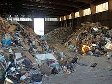
The City is responsible for Community Services, Economic Development, Transportation & Public Works, Corporate Services, Fire Department and Planning Services. Many municipal services are provided through the Regional Municipality of Waterloo (often referred to as Waterloo Region or the Region of Waterloo), which consists of the cities of Cambridge, Kitchener, and Waterloo, and the townships of Woolwich, Wilmot, Wellesley, and North Dumfries. Region of Waterloo responsibilities include Social Services, Community Health Services, Grand River Transit and Community Policing through Waterloo Regional Police Service.
Climate
The climate in Cambridge is typical of southwestern Ontario, with mostly moderate winters but the occasional deep freeze. In summer, the temperatures tend to be in the high twenties on the Celsius scale, and like most of southern Ontario, there can be stretches of high humidity creating some discomfort. On most days, Cambridge tends to be slightly warmer than Kitchener and Guelph, just to the north.
The last frost date of the season is around May 11,[9] though most gardeners plant on the May 24 long weekend to be safe. Environment Canada issues frost warnings for the area from October 30 through to May 9.[10][11]
| Climate data for Cambridge, Ontario (1981−2010) | |||||||||||||
|---|---|---|---|---|---|---|---|---|---|---|---|---|---|
| Month | Jan | Feb | Mar | Apr | May | Jun | Jul | Aug | Sep | Oct | Nov | Dec | Year |
| Record high °C (°F) | 17.8 (64) |
14.4 (57.9) |
24.0 (75.2) |
30.0 (86) |
35.0 (95) |
36.0 (96.8) |
37.8 (100) |
37.8 (100) |
37.2 (99) |
32.2 (90) |
25.0 (77) |
19.5 (67.1) |
37.8 (100) |
| Average high °C (°F) | −1.7 (28.9) |
−0.8 (30.6) |
4.2 (39.6) |
12.3 (54.1) |
19.0 (66.2) |
23.9 (75) |
26.7 (80.1) |
25.1 (77.2) |
20.3 (68.5) |
13.7 (56.7) |
6.8 (44.2) |
0.6 (33.1) |
12.5 (54.5) |
| Daily mean °C (°F) | −6 (21) |
−5.5 (22.1) |
−0.9 (30.4) |
6.8 (44.2) |
12.8 (55) |
17.6 (63.7) |
20.6 (69.1) |
19.4 (66.9) |
14.6 (58.3) |
8.4 (47.1) |
2.8 (37) |
−3.2 (26.2) |
7.3 (45.1) |
| Average low °C (°F) | −10.2 (13.6) |
−10.1 (13.8) |
−6.0 (21.2) |
1.2 (34.2) |
6.6 (43.9) |
11.3 (52.3) |
14.4 (57.9) |
13.5 (56.3) |
8.9 (48) |
3.0 (37.4) |
−1.1 (30) |
−7.1 (19.2) |
2.1 (35.8) |
| Record low °C (°F) | −35.6 (−32.1) |
−31.7 (−25.1) |
−30.0 (−22) |
−15.6 (3.9) |
−5.0 (23) |
−0.6 (30.9) |
4.4 (39.9) |
1.0 (33.8) |
−3.9 (25) |
−10.0 (14) |
−20.0 (−4) |
−28.5 (−19.3) |
−35.6 (−32.1) |
| Average precipitation mm (inches) | 55.4 (2.181) |
47.4 (1.866) |
50.2 (1.976) |
71.3 (2.807) |
84.2 (3.315) |
74.1 (2.917) |
111.6 (4.394) |
91.5 (3.602) |
86.9 (3.421) |
71.9 (2.831) |
86.8 (3.417) |
74.0 (2.913) |
905.2 (35.638) |
| Average rainfall mm (inches) | 18.1 (0.713) |
18.1 (0.713) |
35.4 (1.394) |
68.9 (2.713) |
84.2 (3.315) |
74.1 (2.917) |
111.6 (4.394) |
91.5 (3.602) |
86.9 (3.421) |
71.0 (2.795) |
81.3 (3.201) |
44.3 (1.744) |
785.4 (30.921) |
| Average snowfall cm (inches) | 37.8 (14.88) |
29.3 (11.54) |
14.8 (5.83) |
2.4 (0.94) |
0.0 (0) |
0.0 (0) |
0.0 (0) |
0.0 (0) |
0.0 (0) |
0.91 (0.358) |
7.3 (2.87) |
29.7 (11.69) |
122.2 (48.11) |
| Average precipitation days (≥ 0.2 mm) | 11.7 | 8.9 | 9.6 | 12.9 | 12.0 | 9.2 | 10.1 | 10.2 | 11.9 | 12.7 | 12.7 | 12.2 | 133.8 |
| Average rainy days (≥ 0.2 mm) | 3.2 | 2.3 | 5.9 | 12.0 | 12.0 | 9.2 | 10.1 | 10.2 | 11.9 | 12.6 | 11.5 | 6.2 | 106.8 |
| Average snowy days (≥ 0.2 cm) | 9.2 | 7.0 | 3.8 | 1.1 | 0.0 | 0.0 | 0.0 | 0.0 | 0.0 | 0.23 | 1.9 | 6.2 | 29.3 |
| Source: Environment Canada[12] | |||||||||||||
Economy
In 1988, Toyota Motor Manufacturing Canada opened a plant in Cambridge, which employs approximately 4,500 people and is the city's largest employer. Several other industrial companies also have locations in Cambridge, including Rimowa, Gerdau, ATS Automation Tooling Systems, Loblaw Companies Limited, Frito-Lay Canada (formerly Hostess), Babcock & Wilcox, Rockwell Automation and COM DEV International in addition to service companies such as Coronation Dental Specialty Group.[13]
Education

Public English-language schooling is provided by the Waterloo Region District School Board, which operates 26 elementary and five secondary schools in Cambridge. High schools in the city include the 150-year-old Galt Collegiate Institute and Vocational School; Southwood Secondary School; Glenview Park Secondary School; Preston High School; Monsignor Doyle Catholic Secondary School, St. Benedict Catholic Secondary School and Jacob Hespeler Secondary School.
Publicly funded Catholic education is available through schools operated by the Waterloo Catholic District School Board. The WCDSB runs 15 elementary and two secondary schools in the city. Cambridge is also home to École secondaire Père-René-de-Galinée, the only French Catholic High School in the region.
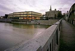
The University of Waterloo School of Architecture campus is located in Cambridge in the Riverside Silk Mill, also known as the Tiger Brand Building. Inside there is a theatre, a fitness room, and the gallery "Design at Riverside", which is one of two publicly funded galleries dedicated to architecture in Canada. The School of Architecture is home to 380 students who live, study, and learn within the Cambridge community.
As of 2009, Conestoga College Institute of Technology and Advanced Learning set up a new School of Engineering Technology specializing in advanced technology programs related to: Robotics, Process Automation, Electronics, Communications, Engineering, and Information Technology. With over 200,000 square feet (19,000 m2) of applied learning and research space.[14]
Attractions
_in_the_Cambridge_Butterfly_Conservatory.jpg)

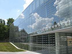
Cambridge is home to many cultural events and activities, including the Mill Race Festival and the Rock the Mill music festivals in downtown Galt. Cambridge also has the Cambridge Highland Games in Churchill Park in July. There's also Cambridge Butterfly Conservatory the annual dragon boat festival, the Cambridge fall fair which has been entertaining locals and visitors alike for over 100 years.
The Cambridge Santa Claus Parade is one of the first city parades in Ontario to go to the night-time format.
There is also the festive 'Christmas in Cambridge' winter festival at Christmas featuring events like Unsilent Night, which began in New York City by Phil Kline. The City of Cambridge's take on this event uniquely involves other aspects of the community such as Christie digital projection technology. University of Waterloo School of Architecture Cambridge students in Dr. Jeff Lederer’s Urban Revitalization and Design class designed the spectacular light installations.
The Cambridge Farmers’ Market has been in operation in the original building on the original site circa 1830; making it the third oldest market in the country. The Cambridge Farmers’ Market is now ranked as one of the top 10 markets in the country by Best Health Magazine. All the vendors come from within a 100 km radius to sell fresh fruits, cheese, vegetables, baked goods and more.
The Cambridge Centre of the Arts is a municipally operated community Arts Centre that is available to area residents, artists and organizations. The Arts Centre officially opened May 2001. Cambridge Galleries are a part of the Cambridge Public Library system with art exhibition spaces at Queen's Square, Preston and the new Design at Riverside location. Together, the three galleries host approximately 23 exhibitions per year.
In June 2008, the new Cambridge City Hall facility opened as the first city hall in Canada to achieve the ranking of gold in the LEED from the Canada Green Building Council. The $30 million project was completed on time and on budget, and financed through a settlement of a loan with the city’s hydro utility. A conservative estimate comparing a standard 85,000-square-foot (7,900 m2) building to the new City Hall LEED standard building results in a $160,000 savings on energy per year or some $1.6 Million over 10 years. The open concept of the facility allows for greater air flow, reducing cooling costs and increasing the penetration of natural light to offset other light sources. A four-story "living wall" of tropical plants is located in the atrium and cleanses the air of pollutants such as formaldehyde, volatile organic compounds, dust, and spores. Behind the living wall is a running water supply that provides humidity during the winter months and a soothing sound for employees and visitors to enjoy all year round.
The historic city hall in Cambridge was built in 1858 by local architect H.B. Sinclair for $3,650, replacing the original structure built in 1838. Built of granite and white limestone, locally-found blue granite was used as a decorative feature. The Historic City served as the community's town hall and market place. Today, the Historic City Hall and the New City Hall are connected by a hallway constructed shortly after the New City Hall was built.
In the tradition of environmental stewardship, Cambridge preserves over 365 hectares of parkland which make up more than 80 parks in the city, as well as over 140 km of bike on-road cycling lanes.
Demographics
| Census | Population |
|---|---|
| Galt | |
| 1841 | 1,000 |
| 1871 | 3,827 |
| 1881 | 5,187 |
| 1891 | 7,535 |
| 1901 | 7,866 |
| 1911 | 10,299 |
| 1921 | 13,216 |
| 1931 | 14,006 |
| 1941 | 15,126 |
| 1951 | 19,207 |
| 1961 | 27,830 |
| 1971 | 38,897 |
| Cambridge | |
| 1981 | 77,183 |
| 1991 | 92,772 |
| 2001 | 110,372 |
| 2006 | 120,371 |
| 2011 | 126,748 |
Cambridge has been characterized by rapid growth in recent years. According to recent Economic Development estimates, the projected population for 2031 is 180,000.
According to the Canada 2006 Census, Cambridge is populated by people of a European ethnic background – 90.2%,[15] mostly those of English (31,400), Scottish (20,625), Irish (19,040), German (14,110), Portuguese (10,685) and French (10,040) origins.[16] Many Newfoundlanders (mostly from the Conception Bay and Bell Island area) have migrated to Cambridge, mostly due to the closure of the iron ore mines on Bell Island.[17]
The city is largely Christian at 80.2%, followed by non-religious people who number 15%. Muslims, Hindus and other faiths make a little over 5% of the population. Over the last few years the numbers of Indians, Pakistanis and Afghans moving in from other urban areas or immigrating from their respective countries, has doubled and tripled. Cambridge is also much younger than the national average. 21.6% of the population are under 14 years of age. Only 11% of the population is over 65, resulting in an average age of 35.2, slightly lower than the national average.
Transport
Interurban streetcar system

The Galt and Preston Street Railway was the first name of an interurban streetcar service, that commenced service in 1890.[18] The service was extended to Hespeler in 1896. Eventually service was extended to Berlin (now Kitchener), Brantford and Port Dover.
Roads
There are two main arterial roads that form an 'X' through the city. The intersecting point is colloquially referred to as the Delta. The Delta is adjacent to a Canadian Pacific Rail spur and the Babcock & Wilcox plant, and at peak rush hour times traffic will back up for miles radiating outwards from the Delta. A number of strategies were investigated to alleviate delays caused by trains and as of December 2012 construction of a bridge over Hespeler Road commenced, and was completed 18 months later. Highway 8 (Ontario) travels through the city as Shantz Hill Road, King Street in Preston, Coronation Boulevard, and Dundas Street, linking Cambridge to Kitchener and Waterloo in the west, and Hamilton in the east. Highway 24 runs through Cambridge as Hespeler Road, Water Street, and Ainslie Street, connecting to Guelph in the northeast and Brantford in the south.
Bridges
Cambridge has some of the most historic bridges in Waterloo Region. The Black Bridge Road Bridge (1916) is Cambridge’s only truss bridge and has been designated a heritage site since 1997. It is still driven upon, though it is prone to major flooding and subsequent closure in the spring. The Main Street Bridge (1931) is a bowstring arch bridge made of concrete and is set over the Grand River. Also in Cambridge is the Park Hill Road Bridge (2002), formally known as the Queen Street Bridge (1933). This bridge was one of the three bridges credited with contributing to the development of early Galt. The bridge was reconstructed and widened to four lanes in 2002 retaining much of the original appearance. The Mill Creek Bridge (1837) in Cambridge is the oldest remaining bridge structure in Ontario and one of only two stone masonry arch bridges in the Region of Waterloo.
In 2007, the Region of Waterloo completed the first pedestrian/cycling bridge to cross the 401. This bridge connects Morningside Drive (Cambridge) with Doon Valley Drive (Kitchener) and is an integral part of the Grand River Trails.
Public transportation
Since 2000, public transport throughout the Region of Waterloo has been provided by Grand River Transit, which was created by a merger of the former Cambridge Transit and Kitchener Transit.
GRT operates a number of routes in Cambridge, four of which travel outside of the city: presently the 52, 61, 72, and 111 buses run to southern Kitchener, while the iXpress limited-stop express route runs from the Ainslie St. Transit Terminal through Kitchener to the north end of Waterloo.
Intercity service is served by Greyhound Lines, from a terminal near Highway 401 and Hespeler Road. Commuter service to and from Toronto is the key routing, and no local trips are permitted to or from Kitchener. On October 31, 2009, Go Transit started service with a line from Square One shopping centre in Mississauga to the University of Waterloo, therefore allowing a trip to Kitchener from a terminal outside the Wal-Mart Power Centre. Coach Canada run almost every two hours during the daytime between Hamilton and Kitchener, and connect to Niagara Falls.
In June 2009 Regional Council voted to approve a plan to construct a light rail line, which has been named the Ion rapid transit.[19] The first phase would run from Conestoga Mall in the north of Waterloo, to Fairview Park Mall in the south of Kitchener. The second phase of the line would run from Fairview Mall to Cambridge. Cambridge mayor Doug Craig has been a determined opponent of the plan.[20][21]
Railways
Although freight trains serving the Toyota factory are a common sight in Cambridge, the city at present has no passenger rail service. The nearest Via Rail stations in the Quebec City-Windsor Corridor are Kitchener station, Guelph station, and Brantford.
The most easily accessible GO Transit railway station is Milton station. GO bus service between Mississauga, Cambridge, and Kitchener was introduced in 2009 as a forerunner to GO train service to Kitchener. Greyhound Lines has been reported to be a major player in the proposed bus links between Cambridge and the GTA.
Air
The nearest airport to Cambridge is the Region of Waterloo International Airport in neighboring Breslau, Ontario. While it is a thriving general-aviation field, the airport serves three destinations in Canada and one seasonal international destination.
Sports and recreation
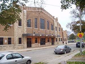
Cambridge has 365 ha of parkland, 99 parks, over 140 sports fields, and many golf courses. As well, the city has over 70 km of urban and natural trails, 18 km of which run along the Grand and Speed Rivers.
Teams
Cambridge is the home of the Greater Ontario Junior Hockey League's Cambridge Winterhawks. The Winterhawks have been the winners of the 2006 and 2007 Sutherland Cup. Cambridge also was the home of the four-time Allan Cup winning Cambridge Hornets of the Original OHA Senior A League, the last OHA Senior A Hockey League, and Major League Hockey. The team folded in 2006 after a dispute with the Ontario Hockey Association involving the use of the phrase "get the puck off the ice." As well, the Cambridge Turbos (Girls' Ringette) won the 2009 Tim Hortons Canadian ringette championships held in April in Charlottetown, PEI.
The Scorpions Youth Volleyball Club was formed in 2009 and has over 400 youth registered in their indoor and beach volleyball programs. The Scorpions have 8 competitive indoor teams. In September 2012 the Scorpions have the City of Cambridge 1st every boys competitive team (15U team) playing in the Ontario Volleyball Association. The club is a member of the Ontario Volleyball Association, with Learn to Play and House League programs for girls and boys Grades 3–12. They also have one of the largest youth beach volleyball programs in Ontario.[22]
The Cambridge Aquajets are a competitive swim team that was originally founded in the early 1950s. The club practices at all of the City of Cambridge pools throughout the year.
Cambridge also has had back-to-back competitive football championships in the "Ontario Varsity Football League"., "Southwestern Ontario Football Association of Leagues". and the "Ontario Minor Football League".. These Football teams are either named The Cambridge Lions or the Cambridge Wolverines.
Outstanding athletic achievement has been honoured in Cambridge every November at the Cambridge Sports Awards banquet since 1974.
The Galt Red Wings were a junior ice hockey team based in Galt that played in the Ontario Hockey Association from 1944 to 1947. They were operated as an affiliate of the Detroit Red Wings of the National Hockey League. During the 1944–45 season, the Red Wings were led by Gordie Howe. They reached the league finals for the J. Ross Robertson Cup in 1945, but lost to Toronto St. Michael's Majors in four games. Their home arena was the Galt Arena Gardens.
Recreational buildings
The City of Cambridge has 6 public skating arenas: Dickson Centre, Duncan McIntosh Arena, Galt Arena Gardens, Hespeler Memorial Arena, Karl Homuth Arena, and Preston Auditorium; and 2 private skating areas: Cambridge Ice Centre and Ice Park. As well, the city has 2 public indoor pools (John Dolson Centre and W.G. Johnson Centre) and 3 public outdoor pools (Edward Newland Pool, George Hancock Pool, and Kinsmen – Soper Pool), in addition to the indoor pool at the Chaplin Family YMCA.[23]
Cambridge has one lawn bowling club: the Preston Lawn Bowling Club is on Queenston Road in the Preston area of the city. This club is open to the public and caters to all age groups and are members of District 7 of the Ontario Lawn Bowling Association.[24]
On October 24, 2008, the city completed the COM DEV Indoor Soccer Park. The $2.8 million project was funded by the City of Cambridge, COM DEV, and the Cambridge Youth Soccer Club, and will help accommodate the large number of kids playing soccer in the Waterloo Region.
Notable residents
- Rich Beddoe, drummer for Canadian Rock band Finger Eleven
- Tim Brent, hockey player
- Derrick Campbell, Olympic short-track speedskater (1994 and 1998)
- Chibi, singer in The Birthday Massacre
- Rob Ducey, baseball player, first Ontario-born player to play for the Toronto Blue Jays
- J.R. Fitzpatrick, NASCAR racer
- Peter Gzowski, writer, newspaper and magazine editor, CBC Radio host
- The Highlanders, Derek Graham-Couch and Russell Murray, a professional wrestling tag-team, who wrestled in World Wrestling Entertainment
- Ian Leggatt, pro golfer
- Bryan Little, hockey player
- Kirk Maltby, hockey player
- Steve McKenna, hockey player
- Victoria Moors, Canadian Olympic Gymnast (2012)
- Jim Schoenfeld, hockey player
- Donald Shaver, poultry industry pioneer
- Ron Shaver, figure skater, 1977 Canadian national champion
- Scott Thorman, baseball player
- Yvonne Tousek, Canadian Olympic gymnast (1996 and 2000)
- Madeline Gardiner, Canadian Olympic gymnast Alternate 2012
- Sherry Hawco, Canadian gymnast, 1981 National Champion[25]
- Cynthia Kerr, singer songwriter of folk-rock duo Open Mind, wrote anthem 'Give Us Back The Night' 1989[26]
See also
- Grand River Railway
- Grand River Transit
- Grand Trunk Railway
- Great Western Railway
- Haldimand Proclamation
- Highway 401
- Quebec City – Windsor Corridor
- Regional Municipality of Waterloo
- Speed River
Locations from Cambridge
 |
Kitchener, Waterloo via Highway 8 |
Breslau via Fountain St |
Guelph via Highway 24 |
 |
| Roseville, Ayr via Highway 401 |
|
Milton via Highway 401 | ||
| ||||
| | ||||
| Paris via Waterloo Road 75/Brant County Highway 24a |
Brantford via Highway 24 |
Dundas via Highway 8 |
References
- 1 2 "Cambridge, City Ontario (Census Subdivision)". Census profile, Canada 2011 Census. Statistics Canada. February 8, 2012. Retrieved 2012-02-24.
- ↑
- ↑
- ↑ City Archives Historical Information-Evolution of Cambridge
- ↑ City Archives Historical Information-Evolution of Galt
- ↑ City Archives Historical Information-Evolution of Preston
- ↑ City Archives Historical Information-Evolution of Hespeler
- ↑ City Archives Historical Information-Evolution of Blair
- ↑ Farmer's Almanac – Kitchener Last Frost Date
- ↑ Winter Weather Fact Sheet
- ↑ Frost Warning Southern Ontario Map
- ↑ "Cambridge Galt MOE, Ontario". Canadian Climate Normals 1981−2010. Environment Canada. Retrieved September 15, 2013.
- ↑ "Cambridge Industries". City of Cambridge. Retrieved 2013-07-19.
- ↑ "Conestoga College Officially Takes Ownership of" (PDF). The City of Cambridge. October 22, 2008. Retrieved September 6, 2011.
- ↑ Cambridge ON statistical data from Statistics Canada
- ↑ Cambridge ON ethnicity data from Statistics Canada See also Karen Dearlove, "Diaspora and Community Building: The Portuguese in Cambridge, Ontario," paper presented to the Narrating the Portuguese Diaspora International Conference on Storytelling, Lisbon University, October 2008.
- ↑ Karen Dearlove, "(Im)migration and Community Building: Newfoundlanders in Cambridge, Ontario," paper presented to the Annual Meeting of the Canadian Historical Association, York University, May 2006.
- ↑ "History of Electrical Rail Transportion". Cambridge Web. Archived from the original on 2014-04-01.
- ↑ Frances Barrick (2009-06-25). "Region approves rail plan: Council votes 15-1 in favour of bringing electric trains to region". KW Record. Archived from the original on 2009-06-27. Retrieved 2013-11-07.
- ↑ Ray Martin (2013-11-19). "Mayor wants Cambridge exempt from paying for Light Rail Transit in Kitchener, Waterloo". Kitchener-Waterloo Record. Archived from the original on 2014-10-11. Retrieved 2013-11-20.
While Waterloo Region has promised to bring light rail transit to Cambridge in the second phase of its development, no one can say for sure when that will be.
- ↑ "Cambridge mayor wants to look at cost of cancelling LRT: Doug Craig favours bus rapid transit". CBC News. 2013-08-20. Retrieved 2013-09-16.
While Craig called for examining the cost of the potential cancellation of the LRT, he stopped short of providing what would constitute a reasonable price tag, saying instead that he believed the region could easily opt out of its current plan in favour of something else, even though construction on light rail had already started.
- ↑ "Scorpions Volleyball is a Hit in Cambridge".
- ↑ "Chaplin Family Y". Retrieved June 3, 2011.
- ↑ "OBLA District 7". Retrieved June 3, 2011.
- ↑ Foster, Leslie. "Sherry Hawco". Gymn.ca. Retrieved 15 April 2013.
- ↑ http://www.cdbaby.com/artist/OpenMind
14 "Hall of Fame Members | City of Cambridge, Ontario, Canada". http://www.cambridge.ca/cs_pubaccess/hall_of_fame.php Retrieved 2010-11-23.
External links
| Wikimedia Commons has media related to Cambridge, Ontario. |
 |
Woolwich | Guelph/Eramosa |  | |
| Kitchener | |
Puslinch | ||
| ||||
| | ||||
| North Dumfries |
| ||||||||||||||||||
|
