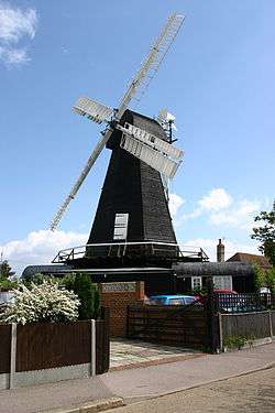
Herne, Kent
Coordinates: 51°20′57″N 1°07′59″E / 51.3492°N 1.1331°E
Herne /hɜːrn/ is a village in South East England, divided by the Thanet Way from the seaside resort of Herne Bay. Administratively it is in the civil parish of Herne and Broomfield in Kent. Between Herne and Broomfield is the former hamlet of Hunters Forstal; Herne Common lies to the south.
The hamlet of Bullockstone is about one mile to the west.
The original Micropub, The Butchers Arms, opened in Herne in 2005.
References
- ↑ National Statistics Census 2001
Bibliography
- Bundock, Mike, Historic Herne and Broomfield (Herne Bay, Pierhead Publications, 1 August 2007), ISBN 9781904661047
External links
![]() Media related to Herne, Kent at Wikimedia Commons
Media related to Herne, Kent at Wikimedia Commons
This article is issued from Wikipedia - version of the Saturday, January 23, 2016. The text is available under the Creative Commons Attribution/Share Alike but additional terms may apply for the media files.


