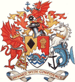
Bridgend County Borough
 | |
| Geography | |
| Area - Total - % Water |
Ranked 17th 246 km² ? % |
|---|---|
| Admin HQ | Bridgend |
| ISO 3166-2 | GB-BGE |
| ONS code | 00PB (ONS) W06000013 (GSS) |
| Demographics | |
| Population: - (2011) - Density |
Ranked 9th 139,200 Ranked 8th 547 / km² |
| Ethnicity | 98.4% White. |
| Welsh language - Any skills |
Ranked 14th 19.9% |
| Politics | |
 Bridgend County Borough Council http://www.bridgend.gov.uk/ | |
| Control | Labour |
| MPs | |
| AMs |
|
| MEPs | Wales |
Bridgend (Welsh: Pen-y-bont ar Ogwr) is a county borough in South Wales, UK. The county borough has a total population of 139,200 people, and contains the settlements of Bridgend, after which it is named, Maesteg, and the seaside town of Porthcawl. Its member of the National Assembly for Wales is Carwyn Jones, the First Minister of Wales, and its Member of Parliament is Madeleine Moon.
The county borough lies at the geographical heart of south Wales. Its land area of 285 square kilometres stretches 20 km from east to west and occupies the Llynfi, Garw and Ogmore valleys. The largest town is Bridgend (pop: 39,773), followed by Maesteg (pop: 20,700) and seaside resort of Porthcawl (pop: 19,238).
It is situated on the Ogmore River and its tributaries, although the Ewenny and Ogwr Fach rivers are considered the border with the Vale of Glamorgan for much of their length.
It was formed on 1 April 1996 under the Local Government (Wales) Act 1994. It includes all of the former Ogwr borough apart from the communities of Wick, St Bride's Major and Ewenny, which went to Vale of Glamorgan. Bridgend County Borough was divided into 20 communities: Brackla, Bridgend, Cefn Cribwr, Coity Higher, Coychurch Higher, Coychurch Lower, Cornelly, Garw Valley, Laleston, Llangynwyd Lower, Llangynwyd Middle, Maesteg, Merthyr Mawr, Newcastle Higher, Ogmore Valley, Pencoed, Porthcawl, Pyle, St Bride's Minor and Ynysawdre. The communities of Brackla, Bridgend and Coychurch Lower make up the town of Bridgend.
Government
The region is governed by Bridgend County Borough Council. It is currently in the control of the Labour party with 39 seats out of 54.
Schools
Notable people
- See Category:People from Bridgend and Category:People from Bridgend county borough
See also
- List of places in Bridgend County Borough
- List of Scheduled Monuments in Bridgend
- Bridgend suicide incidents
References
External links
| |||||||||||||||||||||||||||||
Coordinates: 51°30′24″N 3°34′46″W / 51.50667°N 3.57944°W