Brasstown Ranger District

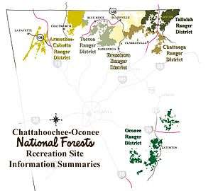
Map showing the old ranger districts of the Chattahoochee National Forest
This is historical. The Toccoa and Brasstown districts were combined into the Blue Ridge district. Also, the Tallulah district was combined into the Chatooga district.[1]
The Brasstown Ranger District was one of the five ranger districts of the Chattahoochee National Forest. The district included land located in Lumpkin, Towns and Union counties, Georgia. Comprising approximately 157,000 acres (640 km2), the district's features include Georgia's highest peak, Brasstown Bald, and Sosebee Cove.
The headquarters for the Brasstown Ranger District is located in Blairsville, Georgia.
External links
References
- ↑ Current Districts of CONF including a current map
This article is issued from Wikipedia - version of the Friday, September 07, 2012. The text is available under the Creative Commons Attribution/Share Alike but additional terms may apply for the media files.