Bojohagur Duanasir
| Bojohagur Duanasir | |
|---|---|
 | |
| Highest point | |
| Elevation | 7,329 m (24,045 ft) |
| Prominence | < 300 metres (984 ft) |
| Listing | List of mountains in Pakistan |
| Coordinates | 36°23′59″N 74°41′31″E / 36.39972°N 74.69194°ECoordinates: 36°23′59″N 74°41′31″E / 36.39972°N 74.69194°E [1] |
| Geography | |
 Bojohagur Duanasir Location in Pakistan | |
| Location | Hunza Valley, Gilgit-Baltistan, Pakistan |
| Parent range | Karakoram, Batura |
| Climbing | |
| First ascent | 1984, by a Hiroshima Alpine Club(Japan) |
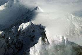
Bojohagur or Bojohaghur Duanasir is a summit in the Batura Muztagh, a subrange of the Karakoram range in Pakistan. It is the west summit of a short ridge whose high point is Ultar Sar, also known as Bojohaghur Duanasir II (despite being higher). It was first climbed in 1984 by E. Kisa, M. Nagoshi, and R. Okamoto, members of a Japanese expedition led by Tsumeo Omae, which ascended from the Hasanabad Glacier via the Southwest Ridge
Location
It lies about 10 km (6.2 mi) northeast of the Karimabad, a town on the Karakoram Highway in the Hunza Valley, part of the Gilgit district of Gilgit-Baltistan.
Nearby summits and glaciers
To the northwest of the Bojohaghur/Ultar massif is the huge pyramid of Shispare (7,611 m/24,970 ft). Along the southwest ridge of the massif are Hunza Peak and the striking rock spire of Bublimotin (Ladyfinger Peak). The glaciers draining the slopes of the massif are (clockwise from north): the Ghulkin Glacier, the Gulmit Glacier, the Ahmad Abad Glacier, the Ultar Glacier, and the Hasanabad Glacier. (Many of these have other names as well.)
See also
Notes
References
- ↑ "Northern Pakistan detailed placemarks in Google Earth". Retrieved 2009-03-11.
Sources
|