Boardman River
| Boardman River | |
|---|---|
|
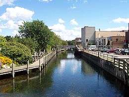
Boardman River between downtown Traverse City and Grand Traverse Bay | |
| Main source |
Union Township, Grand Traverse County, Michigan |
| Source elevation | 1,090 ft (330 m) |
| River mouth |
Grand Traverse Bay, Lake Michigan |
| Mouth elevation | 580 ft (180 m) |
| Basin area | 295 sq mi (760 km2) |
| Length | 28 mi (45 km) |
The Boardman River is a 28.2-mile-long (45.4 km)[2] river that flows into the west arm of Grand Traverse Bay in Traverse City, Michigan. The Boardman's upper tributaries rise near Kalkaska, Michigan, and its watershed drains an area of 295 square miles (760 km2) through 130 miles (210 km) of river and tributaries. The Boardman River is considered one of the top ten trout streams in Michigan.[3] Before entering the Grand Traverse Bay, it becomes Boardman Lake, a natural lake that was originally 259 acres (1.05 km2) in size and increased to 339 acres (1.37 km2) after the Union Street Dam was constructed in 1867.
After flowing through Boardman Lake, the river descends through downtown Traverse City, following a hairpin-shaped course to Grand Traverse Bay. This Traverse City section of the Boardman River is accessible by motorboat from the lakeshore up to a weir upstream from the lakeshore. A short distance upstream from the weir is the Union Street Dam, a small decommissioned mill dam located between Cass and Union Streets.
The other three dams on the river are being removed: Sabin, Boardman and Brown Bridge.[4] On October 6, 2012, a temporary structure put in place to facilitate drawdown at Brown Bridge Dam was breached, flooding the river valley.[5] In June 2014 the Michigan DEQ issued a report identifying erosion around the temporary drawdown structure as the likely cause of the failure.[6]
Brown Bridge Dam removal was completed in January 2013 and resulted in the reestablishment of 2.5 miles of river channel.[7] Revegetation and restoration work in the project area is ongoing. In preparation for the removal of the Boardman and Sabin Dams, both spillways have been opened and the impoundments have been drawn down as low as permitted by the permanent structures in place today. Deconstruction and removal are pending.
References
- ↑ "Boardman River". Geographic Names Information System. United States Geological Survey.
- ↑ U.S. Geological Survey. National Hydrography Dataset high-resolution flowline data. The National Map, accessed November 21, 2011
- ↑ Boardman River Natural River Plan Michigan Department of Natural Resources
- ↑ Dam Project Boardman River Dams Project
- ↑
- ↑ Michigan Department of Environmental Quality
- ↑ Dam Project
