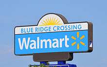
Blue Ridge Crossing
 | |
| Location | Kansas City, Missouri |
|---|---|
| Opening date |
1957 (As Blue Ridge Mall) January 2007 |
| Developer | MBS Mall Investor-98, LLC |
| Owner | IAS Partners, Inc. |
| Architect | Piper-Wind Architects, Inc. |
| No. of stores and services | 19 |
| No. of anchor tenants | 2 |
| No. of floors | 1 |
| Website | www.blueridgecrossing.com |
Blue Ridge Crossing is a shopping center located in Kansas City, Missouri and Independence, Missouri at the intersections of I-70, US 40 Highway at Exit 11 & Sterling Avenue at Exit 10.
Location
The location surrounds the area from Interstate 70/US Highway 40 - to 43rd Street on the North/South and Northern Avenue to Blue Ridge Boulevard on the West/East. It sits on the site of the former Blue Ridge Mall and is about one mile (1.6 km) from the Truman Sports Complex at Exit 9. Phase I of the development began in 2005 with the first stores opening in early 2007. Phase II 18 acres (73,000 m2) consists of land West of Sterling Avenue, and is slated to begin construction in late 2012. Phase III 8 acres (32,000 m2) consists of land East of Blue Ridge Boulevard on the former site of the Blue Ridge Cinema East in Independence, Missouri.
Tenants
- Wal-Mart Supercenter - Wal-Mart's first "high-efficiency" store which opened January 19, 2007
- Lowe's
- Applebee's - one of two with new Applebee's design
- McDonald's
- Verizon Wireless
- Starbucks
- Vintage Stock
- Mattress Firm
- T-Mobile
- IHOP[1]
- Chipotle[2]
- Sports Clips
- Foxy Nails and Spa
- Radioshack
- Games Workshop
- Yogurtopia
- Firehouse Subs
- East Buffet
- General Nutrition Center
- Good Nails
- Burlington Coat Factory
Blue Ridge Mall
Blue Ridge Mall was one of the first shopping malls built in the United States. Located in Kansas City, Missouri, on I-70 & Sterling Avenue at Exit 10. The location surrounds the area from U.S. Route 40 to 43rd Street on the North/South and Sterling Avenue to Blue Ridge Boulevard on the West/East. It sits on the site of Blue Ridge Crossing and is about one mile (1.6 km) from the Truman Sports Complex at Exit 9. It opened on October 17, 1957 as an open-air shopping center and included a location of Harzfeld's. H. Roe Bartle, the Mayor of Kansas City, cut the ribbon that officially opened the shopping center.
Blue Ridge Mall had the added distinction of being located in two cities at the same time. The city limits of Kansas City, Missouri and Independence, Missouri bisected The Jones Store Co. on the northeast corner of the store.
During the 1960s, Blue Ridge Mall was the most popular shopping center in the Kansas City Metropolitan area and in 1971, the J. C. Penney store expanded moving from the south court of the mall to become an anchor store on the west end. With that move, the shopping center was fully enclosed and the hey-day of the Blue Ridge Mall would continue for two more decades.
By the mid-1990s, the Kansas City Metropolitan Area had a 'mall glut' and with the close proximity of two newer enclosed malls within a ten mile radius, Blue Ridge Mall started to show its age and declining popularity with shoppers. After several ownership changes and a failed attempt at redevelopment when Montgomery Ward suddenly announced its bankruptcy and the closure of all stores nationwide at the close of 2000, the current ownership decided to demolish the old mall and start again.
Tax Increment Financing was obtained from the City of Kansas City and demolition began in 2005. The redeveloped site is now known as Blue Ridge Crossing and the old mall site represents Phase I in a three phase development.
Anchors
- Woolworth – (closed 1997)
- Harzfeld's – (Closed 1984)
- JCPenney – (closed 2001)
- The Jones Store Co. – (closed 2003)
- Montgomery Ward – (closed 2000)
Cancelled Anchor
Competition
- Bannister Mall (Demolished)
- Independence Center – opened in 1974
References
External links
- LANE4 Projects
- Rebuild Remarkable
- Parent Company
- Always Low Prices AND Environmental Clean-ups?
- Labelscar page on Blue Ridge Mall
- Dead Malls.com feature on Blue Ridge Mall
- TIF Plan For Redevelopment
Coordinates: 39°02′44″N 94°26′41″W / 39.0455°N 94.4447°W
| ||||||||||||||