Green Lake (Wisconsin)
| Green Lake | |
|---|---|
|
| |
| Location | Green Lake County, Wisconsin, United States |
| Coordinates | 43°49′28″N 88°57′52″W / 43.82444°N 88.96444°WCoordinates: 43°49′28″N 88°57′52″W / 43.82444°N 88.96444°W |
| Type | Natural, pre-glacial valley |
| Primary inflows | Silver Creek |
| Primary outflows | Puchyan Creek |
| Catchment area | 100 sq mi (260 km2) |
| Basin countries | United States |
| Max. length | 7.5 mi (12.1 km) |
| Max. width | 3.0 mi (4.8 km) |
| Surface area | 7,325 acres (30 km2) |
| Average depth | 101 ft (31 m) |
| Max. depth | 237 ft (72 m) (deepest natural lake in Wisconsin) |
| Water volume | 255,000,000,000 US gal (0.97 km3) |
| Residence time | 21 years |
| Shore length1 | 29.3 mi (47.2 km) |
| Surface elevation | 796 ft (243 m) |
| Islands | 1, manmade at Green Lake Conference Center |
| Settlements | Green Lake |
| 1 Shore length is not a well-defined measure. | |
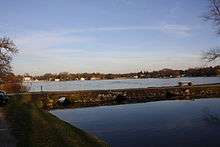
Green Lake — also known as Big Green Lake — is a lake in Green Lake County, Wisconsin, United States.
The lake has a maximum depth of 237 feet (72 m), making it the deepest natural inland lake in Wisconsin. The lake covers 7,346 acres (30 km2), has 29.3 miles (47.2 km) of shoreline and has an average depth of 100 feet (30 m).[1]
Many large, wooden hotels and one short-lived casino populated the north shore during the late 19th century in the city of Green Lake, but most have burnt down. There are three golf courses in Green Lake - Tuscumbia, Mascoutin, and Lawsonia.

Big Green Lake is known for its fishing. Fish found in Big Green Lake include northern pike, largemouth bass, muskellunge, crappie, walleye, smallmouth bass, channel catfish, white bass, perch, rock bass and cisco and lake trout. The Wisconsin inland lake record lake trout was caught on Big Green Lake by Joseph Gotz on June 1, 1957 and weighed 35 lb 4 oz (16.0 kg) The Wisconsin record cisco was caught on Big Green on June 12, 1969 by Joe Miller and weighed 4 lb 10.5 oz (2.11 kg)
The sources of Green Lake's water, in approximate percentages, are: direct precipitation, 51%; surface water, 41%; ground water, 8%. It is spring-fed & empties into the Fox River through the Puchyan River. The lake's Native American name is Day Cho Lah.
References
- ↑ "Wisconsin's Largest Water Areas". Wisconsin Blue Book, 2005. p. 691.