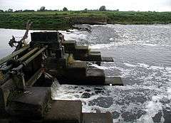
Beal, North Yorkshire
Coordinates: 53°43′23″N 1°11′38″W / 53.723°N 1.194°W
Beal is a village and civil parish in the District of Selby in North Yorkshire, England. It is situated on the River Aire, 3.5 miles (6 km) north-east of Knottingley, 8 miles (13 km) south-west of Selby, and 21 miles (34 km) south of York. The parish includes the village of Kellingley, and borders the City of Wakefield in West Yorkshire. At the 2001 census it had a population of 720,[1] increasing to 738 at the 2011 census.[2]
The name "Beal" is of Old English origins and means "Nook of land in a river-bend". It is composed of the elements bēag ("river-bend") and halh ("nook of land"). The village was recorded as Begale in the Domesday Book of 1086.
Kellingley Colliery, the last operating deep coal mine in the United Kingdom, was located in the parish until its closure in December 2015.
Fishing on the River Aire is controlled by Leeds and District Amalgamated Society of Anglers. The main catches are roach and bream.[3]
Bus service 150, operated by Arriva Yorkshire, connects the village with Pontefract, Selby and Wakefield.[4]
Governance
The village of Beal was a township in the ancient parish of Kellington in the wapentake of Osgoldcross and liberty of Pontefract in the West Riding of Yorkshire.[5] It became a separate parish in 1866, and was incorporated into Pontefract poor law union in 1869. In 1875 the area of the poor law union became a rural sanitary district, which in 1894 was superseded by Pontefract Rural District. The rural district was abolished in 1938, and Beal became part of Osgoldcross Rural District, which was itself abolished under local government reorganisation in 1974, with the eastern part incorporated into the District of Selby in the new county of North Yorkshire.[6]
Nigel Adams has been the member of parliament for Selby and Ainsty since the constituency was created in 2010; he represents the Conservative Party. In 2009 an Independent, John McCartney, was elected for the North Yorkshire County Council seat of Osgoldcross. At the 2011 Selby District Councillocal elections, Gillian Ivey and Susan Ryder, both Conservatives, were elected; six Independent councillors were elected unopposed to the parish council.[7][8]
References
- ↑ "Parish Headcounts: Selby". Neighbourhood Statistics. Office for National Statistics. Retrieved 29 September 2011.
- ↑ "Parish population 2011". Retrieved 16 August 2015.
- ↑ "Leeds and District Amalgamated Society of Anglers". Leeds and District Amalgamated Society of Anglers. Retrieved 28 September 2011.
- ↑ "150: Selby–Kellington–Pontefract–Wakefield" (PDF). Transport in North Yorkshire. North Yorkshire County Council. Retrieved 28 September 2011.
- ↑ "The Ancient Parish of Kellington". GenUKI. Retrieved 29 September 2011.
- ↑ "Beal or Beaghall Civil Parish and Township". A Vision of Britain Through Time. University of Portsmouth. Retrieved 29 September 2011.
- ↑ "Elections 2011: District Results: Live Updates: Whitley". Selby District Council. Retrieved 28 September 2011.
- ↑ "Election of Parish Councillors for Beal on Thursday 5 May 2011" (PDF). Selby District Council. Retrieved 28 September 2011.
External links
 Media related to Beal, North Yorkshire at Wikimedia Commons
- A Vision of Britain Through Time
- Genuki
- Geograph
- Office for National Statistics
| ||||||||||||||||||||||||||

