Bastar district
| Bastar district | |
|---|---|
| District of Chhattisgarh | |
 Location of Bastar district in Chhattisgarh | |
| Country | India |
| State | Chhattisgarh |
| Administrative division | Bastar |
| Headquarters | Jagdalpur |
| Tehsils | 4 |
| Government | |
| • Lok Sabha constituencies | 1 |
| • Assembly seats | 7 |
| Area | |
| • Total | 10,470 km2 (4,040 sq mi) |
| Population (2011) | |
| • Total | 1,411,647 |
| • Density | 130/km2 (350/sq mi) |
| • Urban | 1,93,328 |
| Demographics | |
| • Literacy | 54.94 per cent |
| • Sex ratio | 1084 females for every 1004 men |
| Website | Official website |
Bastar District is a district of the state of Chhattisgarh in central India. Jagdalpur is the district headquarters. The district has an area of 10755.79 km². Bastar District is bounded on the northwest by Rajnandgaon District, on the north by Kondagaon District, on the east by Nabarangpur and Koraput districts of Odisha state, on the south and southwest by Dantewada District, and on the west by Gadchiroli District of Maharashtra state. It possesses a unique blend of tribal and odia culture.
History
Bastar and Dantewada districts were formerly part of the princely state of Bastar. Bastar state was a princely state in India during the British Rule. It was founded in the early 14th century,[1] by Annama Deva, the brother of Kakatiya king Pratapa Rudra Deva of Warangal (Telangana).After Indian independence in 1947, the princely states of Bastar and Kanker acceded to the Government of India, and were merged to form Bastar District of Madhya Pradesh state. The district, which had an area of 39,114km², was one of the largest in India.
In 1999, the district was divided into the present-day districts of Bastar, Dantewada, and Kanker, and in 2012 it was divided in one more distrct named as Kondagaon which constitute Bastar Division. In 2000, Bastar was one of the 16 Madhya Pradesh districts that formed a part of the new state of Chhattisgarh.
The Chitrakoot and Teerathgarh waterfalls are situated close to Jagdalpur. Bastar is famous for its traditional Dasara (Dussera) festival.
The district is currently a part of the Red Corridor.[1]
Divisions
Administratively, the district is divided into two tehsils, Jagdalpur, and Bastar The district has one municipalities, Jagdalpur. Jagdalpur, the administrative headquarters, is a beautiful city having a population of about 150,000. Transport railway stations- 11 ; RTc depoits - 03 ; Airports- jagdalpur.
Demographics
According to the 2011 census Bastar district has a population of 1,411,644,[2] roughly equal to the nation of Swaziland[3] or the US state of Hawaii.[4] This gives it a ranking of 348th in India (out of a total of 640).[2] The district has a population density of 140 inhabitants per square kilometre (360/sq mi) .[2] Its population growth rate over the decade 2001-2011 was 17.83%.[2] Bastar has a sex ratio of 1024 females for every 1000 males,[2] and a literacy rate of 54.94%.[2]
In 1981 Bastar had a population of 1,842,854 with 1,249,197 of the residents being members of scheduled tribes. This also represented about 70% of the population.[5] However these figures are for the pre-1999 Bastar District which had the same boundaries as the modern Bastar Division.
Languages
Languages spoken include Halbi, Bhatri, which falls within the Odia language group but only shares about 60% lexical similarity with Oriya, spoken by about 600 000.[6]It possesses tribal odia culture in chattisgarh.
Economy
Agriculture
Rice is grown predominantly during kharif season as rain fed crop having 2.38.9 million hectare area but the productivity of this crop is low 08.53 qt/ha in Bastar region of Chhattisgarh. The irrigated area (1.67%) and fertilizer use (4.6 kg/ha.) in the Bastar district are very less, which is insufficient to supply adequate nutrient to the crop.[7]
The pattern of livelihood in Bastar continues to be dictated by tradition. Even today, agricultural practices are traditional. Use of wooden ploughs is overwhelming while the number of iron ploughs is negligible. The same is true of bullock carts. The number of tractors is negligible while the bullock carts are all pervasive.
The usage of traditional agricultural implements has lowered the production of agriculture. The kharif crops grown here are paddy, urad, arhar, jowar and maize. The rabi crops include til, alsi, moong, mustard and gram. Collection and sale of forest produce and other forest-related work supplements meager agricultural incomes.
Most people do not find employment all year round. The cycle of floods and droughts makes livelihoods extremely vulnerable. The people are often forced to resort to moneylenders in times of crisis, which usually means a life of continued indebtedness. The absence of alternate employment opportunities is responsible for the high incidence of poverty in the area. In the Bastar plateau, irrigation coverage is only 1.2 percent.[8]
Exceptionally fortunate in its water resources, the region has good rainfall and rapid run off due to the undulating terrain. There is potential for rainwater harvesting .[9]
Forest Produce
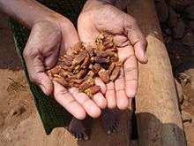
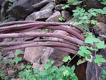
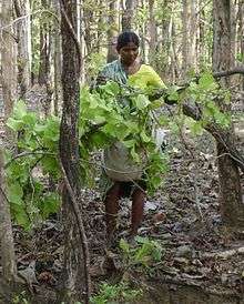
Forests play an important role in the lives of the people, providing food security and livelihood through the collection of minor forest produce, and employment (as casual labour) in the Forest Department. The forests provide for people’s consumption needs – fuel and firewood, medicines, food and drink, implements and housing materials


Major Industries
Nagarnar Steel Plant
National Mineral Development Corporation (NMDC) is setting up a 3 MTPA capacity greenfield Integrated Steel Plant in Nagarnar, located 16 km from Jagdalpur, with an estimated outlay of Rs 210 billion. The land for the plant has already been acquired as of August 2010 and, as of February 2012, five major packages of the steel plant have already been awarded to internationally acclaimed companies at a cost of around Rs. 65 billion.[10]
Tata Steel Plant
Tata Steel had inked the deal with the Chhattisgarh Government in June 2005 to set up a green field integrated steel plant at Lohandiguda, about 20 km from Jagdalpur. The proposed 5.5-million-tonne per annum plant has an estimated outlay of Rs 195 billion.[11]
An environment ministry panel has recommended the diversion of forest land for the steel plant in a decision that was taken in the meeting of a Forest Advisory Committee (FAC) of the Ministry of Environment and Forests (MoEF), Government of India[12]
Lambodhar cement products
LCP is situated in kasturi near nagarnar. The owner of these factory is chavi narayan sethiya. it is 20 km from jagdalpur.
Livelihood[9]
Forty percent of livelihoods are forest based, 30 percent are agriculture based and 15 percent of livelihoods are dependent on animal husbandry. Another 15 percent of the income of people comes from wage labour.[9]
Agriculturists
People with land, who depend almost entirely on cultivation, either on their own holdings or on the holdings of others. They supplement their income and consumption with animal husbandry, and sundry labour at times. Some of them have also diversified into small services or small manufacturing activities.
Labourers
People without their own land or with very little land. They survive by working as farm and casual labour. They also work in the nonfarm sector, in mines, small shops, on construction sites and as part of the urban work force.
Agriculturists and forest gatherers
Those with some land, and living in the vicinity of forests. In areas adjacent to the forests, most people (including those who own some land) gather minor forest produce. A major part of the household consumption and income is based on forest gathering, with agricultural activities providing supplementary income.
Forest gatherers and labourers
People living close to the forests with very little land or without their own land. They are primarily dependent on forest produce, which they gather and sell or directly consume. Occasional labour on fields or in the forest supplements their income. Sometimes they migrate to other places to sell their labour.
Manufacturers
These are traditional occupation based producers. These include the weavers, the blacksmiths, carpenters, chattai (woven mats of bamboo or other grasses) weavers and tailors, bamboo craftsmen and the potters. They operate in the cottage or household sectors, in tiny units, which may be family-owned and worked, or may even have some contracted workers. Some people have taken to modern manufacturing, operating electrical repair or lathe shops. These are located in the big villages or along main roads.
Service persons
These include traditional as well as modern service providers. This group is bridging traditional livelihoods and new opportunities, sometimes replacing but often merging with each other. It is a growing segment, its expansion fuelled by the need for manufacturers and users to establish common ground. It tends to be based on simple and easily understood transactions.
Entry barriers and requirements are few. Even as the demand for some services is declining – for those offered by cobblers, for example, there are newer trades that are springing up – car and tractor mechanics, for instance, based on apprenticeship and 'on the job training' systems. The processes of skill acquisition tend to break social and cultural barriers, as people work together at dhabas, (food stalls) workshops and construction sites.
Organised sector
People with jobs in the public / private organised sector. Typically requiring formal education, this segment includes public sector service, and employment in offices, industries, and educational institutions and in development related services.
Culture
Tribals of Bastar[8]
Bastar, the land of tribes and about 70% of the total population of Bastar comprises tribals, which is 26.76% of the total tribal population of Chhattisgarh. The major tribes of the Bastar region are the Gond, Abhuj Maria, Bhatra Bhatra are divided into Sub Cast San Bhatra, Pit Bhatra, Amnit Bhatra Amnit Hold Highest Status, Halbaa, Dhurvaa, Muria and Bison Horn Maria. The Gonds of Bastar are one of the most famous tribes in India, known for their unique Ghotul system of marriages. Gonds are also the largest tribal group of central India in terms of population.
The tribes of Bastar region are known for their unique and distinctive tribal culture and heritage in all over the world. Each tribal group in Bastar has their own distinct culture and enjoys their own unique traditional living styles. Each tribe has developed its own dialects and differs from each other in their costume, eating habits, customs, traditions and even worships different form of god and goddess.
A large number of Bastar tribals are still living in deep forests and avoid mixing with outsiders in order to protect their own unique culture. The tribes of Bastar are also known for their colorful festivals and arts and crafts. The Bastar Dussehra is the most famous festival of the region. The tribals of Bastar were also amongst the earliest to work with metal and have expertise in making beautiful figurines of tribal gods, votive animals, oil lamps, carts and animals.

Arts and Crafts
An area where Handicraft is most widely practiced in Bastar is Kondagaon. Many products are made from such art such as vessels, jewellery and the images of the local deities and some decorative. The method of preparation of the products is quite simple and also called as the lost wax technique that happens to be perfect for the tribal settings.
The Bastar district specializes in the preparation of items from the Dhokra Handicraft and Bastar Wooden Craft. This process calls for a great deal of precision and skill. The artifacts prepared from Dhokra technique of this art use the cow dung, paddy husk and red soil in the preparation, beeswax being the most important one. Apart from contouring, wax wires are also used for decoration purpose and for giving a finishing touch to artifacts. From the Bell Metal Handicraft of Chhattisgarh in India, the real genius and creative faculty of the artisans come into picture and thus make for some of the most wonderful pieces of art.
The Dhokra and Bell Metal Handicraft can be found all over the world but the way in which the artisans of Chhattisgarh carve the things by the impression of their sheer dexterity is worth watching. Some of the handicraft items are so appealing that the tourists take them back as souvenirs.
References
- ↑ "83 districts under the Security Related Expenditure Scheme". IntelliBriefs. 11 December 2009. Retrieved 17 September 2011.
- 1 2 3 4 5 6 "District Census 2011". Census2011.co.in. 2011. Retrieved 30 September 2011.
- ↑ US Directorate of Intelligence. "Country Comparison:Population". Retrieved 1 October 2011.
Swaziland 1,370,424
line feed character in|quote=at position 10 (help) - ↑ "2010 Resident Population Data". U. S. Census Bureau. Retrieved 30 September 2011.
Hawaii 1,360,301
line feed character in|quote=at position 7 (help) - ↑ Gell, Simeran Man Singh. The Ghotul in Muria Society (Singapore: Hardwood Academic Publishers, 1992) p. 1
- ↑ M. Paul Lewis, ed. (2009). "Bhatri: A language of India". Ethnologue: Languages of the World (16th ed.). Dallas, Texas: SIL International. Retrieved 28 September 2011.
- ↑ http://plantarchives.org/paper/Plant%20Archive%20vol%20(11-1)%20351-354.pdf
- 1 2 http://planningonline.gov.in/data/report/DP2009-2010_374Merge.pdf
- 1 2 3 http://chhattisgarh.nic.in/book/hdr.pdf
- ↑ http://www.moneycontrol.com/livefeed_pdf/Feb2012/NMDC_Ltd_040212.pdf
- ↑ http://www.tata.com/media/reports/inside.aspx?artid=scQib0BmW8A=
- ↑ "MoEF panel recommends land diversion for Tata Steel's plant". The Times of India. 11 March 2012.
- Bastar The Imperial Gazetteer of India, 1908. v. 7, p. 121-124.
- Dr.Sanjay Alung-Chhattisgarh ki Riyaste/Princely stastes aur Jamindariyaa (Vaibhav Prakashan, Raipur1, ISBN 81-89244-96-5)
- Dr.Sanjay Alung-Chhattisgarh ki Janjaatiyaa/Tribes aur Jatiyaa/Castes (Mansi publication, Delhi6, ISBN 978-81-89559-32-8)
External links
| Wikimedia Commons has media related to Bastar district. |
- places in Bastar
- Lost Wax-Dhokra art Process complete Video
- Official website
 |
Kanker district | Dhamtari district | Nabarangpur district, Odisha |  |
| Narayanpur district | |
|||
| ||||
| | ||||
| Dantewada district | Koraput district, Odisha |
| ||||||||||
| ||||||||||||||||||||||||||||||
Coordinates: 19°04′00″N 82°01′59″E / 19.06667°N 82.03306°E


