Bahundangi
| Bahundangi बाहुनडाँगी | |
|---|---|
| Village development committee | |
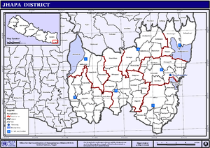
 Map of the village development committees in Jhapa District | |
| Country |
|
| Zone | Mechi Zone |
| District | Jhapa District |
| Population (2001) | |
| • Total | 22,897 |
| Time zone | Nepal Time (UTC+5:45) |
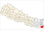
Bahundangi is a village development committee in Jhapa District in the Mechi Zone of South-Eastern Nepal. At the time of the 1991 Nepal census it had a population of 21,395 people living in 3908 individual households.[1]
It is bordered with India towards East and South. The total population is 22897 according to 2001 census.
History
Bahundangi, the name is believed to be founded by a Brahmin man who was a very kind hearted and selfless. He spent all his life towards helping people and since hewas Brahmin and every single person was very happy with him; they soon decided to pronounce the area as, “Bahundangi”.It is also believed that, he died of high fever at an age about 57 and was buried near the river in Bahundangi and today it is also known as, “Bahunijhoda” which also means the River of Brahmin.
Economy
A weekly market has been scheduled on every Thursday where all the Vendors from many different places comes in Banundangi to sell their products such as, Clothes, Cosmetics and other basic needs. It helps the people to avail all the basic needs without going anywhere. Also, many Traders from native country, "India" also comes here in Bahnundangi to sell or buy products. This trend has been followed by the native of Bahundangi since more than 100 years. The majority of the people are farmers, mostly cultivating rice, tea, Areca nuts, ginger, Mushroom etc. Because of its open border most of the people have free access to India where they go for Trading Goods, Shopping and medication to the adjoining Indian market Naxalbari. To and fro illegal trade between the two areas is also present mostly in Areca nuts, ginger, paddy and timber. Many people here are working in several Government and Private sectors and more than 2% of people are working as an Indian and British Army.[2]
Demography
The total population is 22897 according to 2001 census and the major ethnicity living here are Brahmins, Cheetri, Newar, Magar, Marwari, Rai, Limbu.
Transportation
Transportation is an important means for Trading goods. Since, Bahundangi lies at the border of India, people mostly uses Trucks, Tractors to trade their goods to India and vice-versa.There are several Buses that directly runs from Bahundangi to Kathmandu, the capital city of Nepal on a daily basis. Also, several Buses and Cabs are available that runs from Bahundagi and connects to major cities like, Kakarvitta, Birtamode, Biartnagar, Dharan etc.
Climate
Bahundangi which lies at the bank of Mechi River and near Illam District has a Moderate Climate. The average Temperature in summer is recorded as 33 °C and 6 °C in Winter Season. [3]
Sports
The "Jhapa Jaycees" Club had organized an invitational football tournament on 30 August 2012 (14 Bhadra 2069) in Bahundangi. The participating teams were Munal Club(Host Team) Birtamod Youth Club, APF Jhapa, Morang XI, Sunsari XI, UKFC Darjeeling and SAI Academy Siliguri.[4]
References
- ↑ "Nepal Census 2001". Nepal's Village Development Committees. Digital Himalaya. Archived from the original on 12 October 2008. Retrieved 24 November 2008.
- ↑ Jhapa Economy Data for 2012-2013
- ↑ National Climate Data for 2012-2013
- ↑ "Football Tournament in Bahundangi". 17 August 2012. Retrieved 7 November 2015.
Coordinates: 26°44′N 88°10′E / 26.74°N 88.16°E
http://www.goalnepal.com/news.php?id=8632
