Arderin
| Arderin | |
|---|---|
| Ard Éireann | |
 Arderin from the Glendine Gap | |
| Highest point | |
| Elevation | 527 m (1,729 ft) [1][2] |
| Prominence | 420 m (1,380 ft) [1][2] |
| Listing | Marilyn |
| Coordinates | 53°02′17″N 7°39′14″W / 53.03806°N 7.65389°WCoordinates: 53°02′17″N 7°39′14″W / 53.03806°N 7.65389°W [1] |
| Naming | |
| Translation | Ireland's Height (Irish) |
| Geography | |
 Arderin | |
| Parent range | Slieve Bloom Mountains |
| OSI/OSNI grid | S232989 |
| Topo map | OSi Discovery 54 |
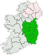
Arderin (Irish: Ard Éireann, meaning "Ireland's Height") is a mountain on the border between counties Laois and Offaly in Ireland. With a height of 527 metres (1,729 ft) it is the highest point in the Slieve Bloom Mountains and the 399th highest summit in Ireland. Uniquely it is the highest point in County Laois and County Offaly.
An Arderin is also a descriptive word for a specific category of Irish mountains in the series of lists maintained by Mountainviews.ie; those over 500m with a prominence of at least 30m.[3] This list, along with other complimentary ones, has been published in book form by Collins Press.[4] Mountainviews.ie classifies a mountain as being above 500m, but also maintains a number of lists of hills below this threshold.[3]
See also
References
- 1 2 3 "Arderin". Peakbagger.com. Retrieved 2014-12-24.
- 1 2 "Arderin". mountainviews.ie. Retrieved 2014-12-24.
- 1 2 "Mountain Views". mountainviews.ie. Retrieved 2014-12-24.
- ↑ Mountainviews, (2013), "A Guide to Ireland's Mountain Summits: The Vandeleur-Lynams & the Arderins", Collins Books, Cork, ISBN 978-1-84889-164-7
| ||||||||||
