Alakode

| Alakode (ആലക്കോട്) | |
|---|---|
| village | |
|
Road to the town | |
 Alakode (ആലക്കോട്) Location in Kerala, India | |
| Coordinates: 12°11′20″N 75°27′59″E / 12.189020°N 75.466280°ECoordinates: 12°11′20″N 75°27′59″E / 12.189020°N 75.466280°E | |
| Country |
|
| State | Kerala |
| District | Kannur |
| Population (2001) | |
| • Total | 33,605 |
| Languages | |
| • Official | Malayalam, English |
| Time zone | IST (UTC+5:30) |
| PIN | 670571 |
| Telephone code | 04602 |
| Vehicle registration | KL 59 |
| Literacy | 99% |
Alakode (ആലക്കോട്) is a village in Kannur district in the Indian state of Kerala.[1] Alakode was one of the major centres of Malabar Migration. People here are almost in equal ratio of Hindu, Muslims and Christians. Most people are engaged in agriculture and business. This area exports hill products: rubber, dry copra, pepper, arecanut, etc. to industries in the northern part of India. It is a place where a huge number of people migrated during the 1940s and '50s from the Travancore area; now they play a major role in the local economy.
It is approximately 40 km from district center, Kannur town. Neighboring towns are Karuvanchal,Karthikapuram
History
Alakode and its surrounding areas was ruled by many royal dynasties in the past, including the Mooshika Dynasty of Ezhimala, Chirakkal Dynasty of Kolathunadu, Tipu Sultan of the Kingdom of Mysore, before it became a part of the British Raj. The original inhabitants of the area were primarily Hindus. Later on this region gained a sizable Christian and Muslim population. The economy was agrarian with strong feudal system - Janmi-Kudiyan system - permeating everyday life.
Feudal overloads or Janmies owned much of the land, which was leased by the farmers or Kudians who paid a portion (normally 2/10th) of their produce as "pattam" for the 'privilege' of working the land. Generally the lease was for a period of 12–16 years. Farmers were not allowed to cultivate permanent crops, dig wells or cut down the trees on the land. If any permanent crop such as pepper was planted on the land, the income from the crop went to the landlord after six years, depriving farmers of any income from such cash crops. Janmies gave 10 cents of land to farmers to build a house.
This region also has a sizable number of people belonging to tribal communities such as Mavilar, Pulayar, and Vettuvar who lived by hunting animals and collecting edible roots and fruits from the plentiful forests in the area. Under the Janmi-Kudiyan feudal system, tribals were treated much like slaves.
Nearest Villages
- Aramgam, Josegiri, Manakadavu, Mukkada and Naryanpara
- Nellikunnu, Ottathai,Udumberi,Oolimada,Kappimala and Parappa
- Thabore, Jayagiri, valiyathuvarakadu,Kottayad Kavala and Santhipuram
- Karthikapuram, Nellipara, Rayarom, Thalipara, Jayagiri, mannathikundu and Alammoddu,
- Cheekad, Kottayad, Mampoil Central, Moonamkunnu, Muthussary, Muthussey thattu and Udayagiri,
How to reach
Nearest Railway Station : Kannur railway station / Payyanoor railway station.
Nearest Airport : Calicut International Airport / Mangalore International Airport.
Demographics
As of 2001 India census, Alakode had a population of 33605 with 16811 males and 16794 females.[1]
File:Alakode Town Panorama.jpg
Image gallery
-

The road to Alakode
-

Alakode town
-

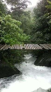
Alakode river.
-
.jpg)
Alakode Town
-

Alakode Town
-
.jpg)
Cosmos bipinnatus
References

| Wikimedia Commons has media related to Alakode. |
- 1 2 "Census of India : Villages with population 5000 & above". Registrar General & Census Commissioner, India. Archived from the original on 8 December 2008. Retrieved 2008-12-10.
.jpg)