Alabang–Zapote Road
| Alabang-Zapote Road | |
|---|---|
|
Calle Real Real Street Zapote-Alabang Road | |
 | |
| Route information | |
| Maintained by Department of Public Works and Highways | |
| Length: | 10.9 km (6.8 mi) |
| Major junctions | |
| West end: | Manila-Cavite Expressway in Bacoor |
|
Diego Cera Avenue Fruto Santos Avenue CAA Road Marcos Alvarez Avenue Investment Drive Metro Manila Skyway North Bridgeway Corporate Avenue Montillano Street | |
| East end: | Manila South Road (National Road) in Alabang |
| Highway system | |
| Highways in the Philippines | |
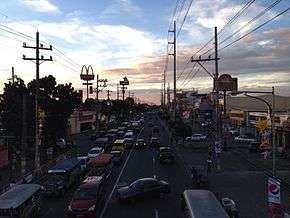
Alabang–Zapote Road is a four-lane national road which travels east-west through the southern limits of Metro Manila, Philippines. It runs parallel to Dr. Santos Avenue in the north and is named for the two barangays that it links: Alabang in Muntinlupa and Zapote in Las Piñas.
From its eastern terminus at an interchange with South Luzon Expressway and the Manila Skyway, the road runs westwards for 10.2 kilometres (6.3 mi) to the junction with Diego Cera Avenue and Aguinaldo Highway. And since 1997, it also extends further west for several hundred meters connecting Las Piñas to its present terminus at Coastal Road (R-1) in Bacoor, Cavite.[1]
History
Alabang–Zapote Road follows an old Spanish coastal trail that linked the Province of Manila to La Laguna and other southern provinces. It was called Calle Real (Spanish for "royal street") or Camino Real (Spanish for "royal way") which spanned from Ermita to Muntinlupa.[2] At present, only the Las Piñas-to-Muntinlupa section is called Calle Real or Real Street as an alternative name for the road. The rest of the route had been renamed to Del Pilar Street in the City of Manila, Harrison Avenue in Pasay, Elpidio Quirino Avenue in Parañaque, and Diego Cera Avenue in Las Piñas (Manuyo Uno–Zapote segment).
Route description
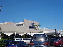
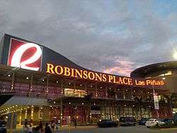
The road begins in Alabang near the Alabang railway station and Festival Supermall in Filinvest City. It then crosses into the Madrigal Business Park and Alabang Town Center intersecting with Madrigal Avenue and Acacia Avenue. West of Daang Hari Road (Investment Drive), it enters Las Piñas and Barangay Pilar where SM Southmall is located. From Marcos Alvarez Avenue to CAA Avenue-BF Resort Drive, the road traverses barangay Talon where Robinsons Place Las Piñas is located. In Pamplona, it goes past the Las Piñas City Hall, SM Center Las Piñas and Starmall. A flyover and bridge was built in 1997 to connect Zapote, Las Piñas with Zapote, Bacoor (Longos) over the Zapote River where the road ends at an interchange with Coastal Road (CAVITEX).
Intersections
Intersections in the list below are arranged by kilometer number, based on numbers on kilometer stones (from Rizal Park, the Kilometer Zero)
| KM | Intersection | Location | Route description |
|---|---|---|---|
| 14 | Longos Junction (Longos Flyover) | Zapote (Longos), Bacoor, Cavite | Starting point of the highway. From the Manila-Cavite Expressway exit, the road splits at the end of the interchange. Left goes to the Alabang–Zapote Road, and the right goes to the Aguinaldo Highway. |
| Zapote Intersection | Zapote (Longos), Bacoor, Cavite and Zapote, Las Piñas | Left goes to Diego Cera Avenue and right goes to the old alignment of the Aguinaldo Highway. A flyover was built to decongest the intersection. | |
| 15 | Tramo/Fruto Santos Avenue Intersection | Zapote, Las Piñas | Left goes to Tramo Street |
| 16 | Dona Manuela Intersection | Pamplona Tres, Las Piñas | Left goes to Dona Manuela Subdivision and Naga Road (shortcut to C-5 Road Extension). |
| 17 | C.V. Starr Intersection | Right goes to Starmall Las Piñas and Philam Life Village | |
| Villa Cristina Intersection | Left goes to Barangay Pamplona Tres | ||
| Manila Times/Aria Intersection | Left goes to Manila Times Village. Right goes to VAA Village and alternate route to BF Resort | ||
| 18 | CAA-BF/Casimiro Intersection | Left goes to CAA Road and Casimiro Village I. Right goes to BF Resort. Traffic congestion is common on this intersection. | |
| 19 | Admiral Intersection | Talon Tres, Las Piñas | Left goes to St Francis of Assisi College Aristocrat Subdivision Altea and Molave Street/Riverside. |
| Angela Street Intersection | Right goes to Talon Cuatro, and Camella Homes I and II | ||
| Paradise Avenue Intersection | Right goes to Philippine Merchant Marine School and Paraiso Village | ||
| 20 | Palace Intersection | Left goes to Southland Estates and The Village | |
| Rose of Heaven Drive | Right goes to Talon Village, Sihanouk Village and Equitable Bank Village | ||
| Marcos Alvarez Avenue Intersection | Right goes to Moonwalk Village and an alternate route to Bacoor, Cavite. Traffic congestion is very common at this intersection. | ||
| 21 | Zodiac Avenue Intersection | Almanza Uno, Las Piñas | Right goes to San Isidro Labrador Parish and Veraville Homes I |
| Pilar Avenue Intersection | Right goes to Pilar Village. Heavy traffic is common when there are classes in Almanza Elementary School. | ||
| Pioneer Intersection | Left goes to BF Executive Village Phase 6. Right goes to Iglesia Ni Cristo - Lokal ng Almanza, and BF Homes - Almanza. | ||
| DBP Village Intersection | Right goes to DBP Village | ||
| T.S. Cruz Subdivision Intersection | Right goes to T.S. Cruz Subdivision | ||
| 22 | Concha Cruz Avenue Intersection | Left goes to BF Village | |
| Las Piñas-Muntinlupa Boundary | |||
| Investment Drive Intersection | Ayala Alabang, Muntinlupa | Right goes to Ayala Alabang and Daang Hari Road to San Pedro, Laguna, Bacoor, Cavite and Imus. A service road leads to Acacia Drive. | |
| Acacia Drive Intersection | Right goes to Acacia Drive towards Ayala Alabang Village. A turn section/slip road is used to turn on the intersection. Traffic congestion is common especially during rush hours. | ||
| Don Manolo Boulevard Intersection | Left goes to San Beda College - Alabang and Alabang Hills Village. Traffic congestion usually forms when jeepneys stop near the intersection to load and unload passengers, especially in the rush hour, where office workers leave Madrigal Business Park and students leave San Beda College. | ||
| 23 | Madrigal Avenue Intersection | Right goes to Molito, Madrigal Avenue, Alabang Town Center, and Ayala Alabang Village. A divided segment of the Alabang–Zapote Road starts here. Heavy traffic also forms here. | |
| 24 | Filinvest Avenue Intersection | Alabang, Muntinlupa | Left goes to Northgate Cyberzone. Right goes to South Supermarket, Westgate, Commerce Avenue, Acacia Hotel Manila, and an alternate route to Filinvest Exit of the South Luzon Expressway. Straight goes to the Metro Manila Skyway and Filinvest Corporate City (via a ramp) to North Bridgeway. Originally, the Alabang Zapote Road runs through a curve to North Bridgeway, that is removed soon after. |
| Northgate Intersection | Left goes to Northgate Cyberzone and West Service Road. Right goes to Alabang, Vivere Suites, and Festival Supermall. Straight goes to South Station | ||
| North Bridgeway Intersection | Left goes to Alabang. Straight goes to Vivere Suites and Festival Supermall. Right goes to Spectrum Midway. Originally, Alabang–Zapote Road (westbound) goes into a double curve into Filinvest Avenue Intersection. | ||
| Corporate Avenue Intersection | Left goes to South Station - The Grills. Right goes to Entrata, Festival Supermall, and Insular Life Corporate Center. | ||
| 25 | Montillano/South Station/Alabang Public Market Intersection | Intersection is blocked, and no left turns or U-turns are allowed. Right turns toward Festival Supermall is not allowed, since Market Drive is one-way. Southbound only allows going straight toward the Alabang Viaduct, Starmall Alabang, National Highway, and South Luzon Expressway. Right (northbound) goes to the Alabang Public Market. No left turn allowed from Montillano towards National Highway, since the northbound lane of Alabang–Zapote Road between Alabang Junction and Montillano/South Station/Alabang Public Market is dedicated for buses and jeepneys. | |
| Alabang Junction | End of Alabang–Zapote Road, below the Alabang Viaduct. Straight goes to Starmall Alabang, Montillano (via a U-turn on Starmall Intersection), National Highway (Manila South Road), and South Luzon Expressway. Northbound lane from this junction is only dedicated to buses and jeepneys, since they are not allowed to turn right on Montillano to prevent traffic congestion near the Alabang Public Market | ||
Landmarks
Landmarks on the list below are arranged by location.
Las Piñas
- Starmall Las Piñas
- SM Center Las Piñas
- Las Piñas City Hall
- University of Perpetual Help System Dalta-Las Piñas
- Uniwide Metromall
- Robinsons Place Las Piñas
- Parish of the Five Wounds of Our Lord Jesus Christ
- SM Southmall
- Eurotel Las Piñas
- Dream Hotel Las Piñas [at the back of Eurotel]
Muntinlupa
- Madrigal Business Park
- Molito
- Alabang Town Center
- Westgate
- Northgate Cyberzone
- Crimson Hotel
- Festival Supermall
- South Station
- Alabang Public Market
See also
References
- ↑ Flyover construction rushed for Christmas published by Manila Standard; accessed 2013-10-17.
- ↑ Rebirth of Taft Avenue published by the Manila Bulletin; accessed 2013-10-17.
Coordinates: 14°26′12″N 121°0′24″E / 14.43667°N 121.00667°E

