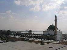
Al-Jazzar Mosque
| Al-Jazzar Mosque | |
|---|---|
 | |
| Basic information | |
| Location |
|
| Affiliation | Islam |
| Architectural description | |
| Architectural type | Mosque |
| Architectural style | Ottoman |
| Founder | Jazzar Pasha |
| Completed | 1781 |
| Specifications | |
| Minaret(s) | 1 |
The al-Jazzar Mosque (Arabic: مسجد الجزار, Masjid al-Jazzar; Hebrew: מסגד אל-ג'זאר, Misgad al-Jazzar), also known as the White Mosque, is located on al-Jazzar Street inside the walls of the old city of Acre, overlooking the eastern Mediterranean Sea, and is named after the Ottoman Bosnian governor Ahmad Pasha al-Jazzar ("the Butcher").
History
The al-Jazzar Mosque was the project of its namesake, Ahmad Pasha al-Jazzar, the Acre-based governor of the Sidon and Damascus provinces, who was equally famous for his cruelty, impressive public works, and defeat of Napoleon Bonaparte at the Siege of Acre in 1799. Al-Jazzar ordered the mosque's construction in 1781 and had it completed within the year.[1] Despite lacking architectural training, al-Jazzar was the architect of the mosque,[2][3] drawing up its plans and design,[2] and supervising its entire construction.[3][2] In addition to the mosque itself, the complex included an Islamic theological academy with student lodging, an Islamic court and a public library.[3] The mosque was built for religious purposes, but its grandiose size and additional functions were also intended by al-Jazzar to serve as a means of consolidating his political legitimacy as ruler of Syria.[4] He modeled the mosque on the mosques of Istanbul, the Ottoman capital.[3]
The al-Jazzar Mosque was built over former Muslim and Christian prayer houses and other Crusader buildings.[1] Building materials for the mosque, particularly its marble and granite components, were taken from the ancient ruins of Caesarea, Atlit and medieval Acre. Al-Jazzar commissioned several Greek masons as the mosque's builders.[5] There is a tughra or monogram on a marble disc inside the gate, naming the ruling Sultan, his father, and bearing the legend "ever-victorious".
Adjacent to the mosque is a mausoleum and small graveyard containing the tombs of Jazzar Pasha and his adoptive son and successor, Sulayman Pasha, and their relatives.[6]
Architecture
The mosque is an excellent example of Ottoman architecture, which incorporated both Byzantine and Persian styles. Some of its fine features include the green dome and minaret, a green-domed sabil next to its steps (a kiosk, built by Sultan Abdul Hamid II, for dispensing chilled drinking water and beverages) and a large courtyard.[6]
The mosque, that is dominating Acre's skyline, was originally named Masjid al-Anwar (the "Great Mosque of Lights") and is also known as the White Mosque because of its once silvery-white dome that glittered at a great distance. The dome is now painted green.[1] The minaret has a winding staircase of 124 steps.[7]
It is the largest mosque in Israel outside of Jerusalem.
Sha'r an-Nabi
The mosque houses the Sha'r an-Nabi, a hair (or lock of hair) from the beard of the Prophet Muhammad. The Sha'r an-Nabi used to be paraded through Acre on Eid al-Fitr, ending the fast of Ramadan, but is now only shown to the congregation.[7] The relic is kept inside the mosque in a glass cabinet placed at the women's upper floor gallery.[8][9]
Gallery
-

Entrance to the mosque, with the sabil to the right of the steps.
-

Entrance to al-Jazzar Mosque
-

Al-Jazzar Mosque Interior
-

Long distant view
-
Al-Jazzar Mosque
References
| Wikimedia Commons has media related to Al-Jazzar Mosque. |
- 1 2 3 Archnet Jazzar Mosque.
- 1 2 3 Philipp 2001, p. 58.
- 1 2 3 4 Sharon 1997, p. 47.
- ↑ Philipp 2001, p. 59.
- ↑ Sharon 1997, p. 50.
- 1 2 Mosque of Ahmed Jezzar Pasha Ullian, Robert. Wiley Publishing
- 1 2 Elian J. Finbert (1956) Israel Hachette, p 177
- ↑ http://www.jta.org/1981/05/22/archive/the-al-jazzar-mosque-in-acre-built-in-1781
- ↑ http://www.fodors.com/world/africa-and-middle-east/israel/haifa-and-the-northern-coast/things-to-do/sights/reviews/al-jazzar-mosque-460314
Coordinates: 32°55′21.74″N 35°4′13.13″E / 32.9227056°N 35.0703139°E
| |||||||||||||||||

