Ageo, Saitama
| Ageo 上尾市 | ||
|---|---|---|
| City | ||
| ||
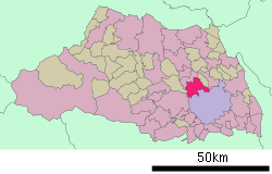
 Location of Ageo in Saitama Prefecture | ||
 Ageo Location in Japan | ||
| Coordinates: 35°59′N 139°36′E / 35.983°N 139.600°ECoordinates: 35°59′N 139°36′E / 35.983°N 139.600°E | ||
| Country | Japan | |
| Region | Kantō | |
| Prefecture | Saitama Prefecture | |
| Government | ||
| • Mayor | Minoru Shimamura (since February 2008) | |
| Area | ||
| • Total | 45.55 km2 (17.59 sq mi) | |
| Elevation | 14 m (46 ft) | |
| Population (October 1, 2014) | ||
| • Total | 224,946 | |
| • Density | 4,986.32/km2 (12,914.5/sq mi) | |
| Symbols | ||
| • Tree | Oak | |
| • Flower | Azalea | |
| Time zone | Japan Standard Time (UTC+9) | |
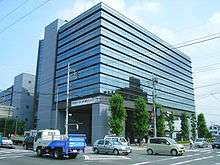
| City Hall Address |
3-1-1 Honchō, Ageo-shi, Saitama-ken 362-8501 | |
| Website |
www | |
Ageo (上尾市 Ageo-shi) is a city located in Saitama Prefecture, Japan.
As of December 1, 2010, the city has an estimated population of 227,127 and a population density of 4,986.32 persons per km². The total area is 45.55 km². It is twinned with Ueda, Nagano.
History

The city began as Ageo-juku, a post town on the Nakasendō during the Edo period. Ageo's rail station opened in 1883. In 1889, Ageo-juku merged with the villages of Ageo, Ageoshimo, Kashiwaza, Kasugayatsu and Yatsu to form the new town of Ageo. The two towns of Hirakata and Haraichi and the three villages of Kamihira, Ōishi and Ōya merged with the town of Ageo in 1955, and Ageo obtained city status on July 15, 1958, with a population of more than 37,000. In the second half of the 20th century, metallurgy and automobile factories were constructed. Housing increased during that period, as it did in the suburbs of Tokyo and in cities of southern Saitama.
Transportation
- Ageo Station on the Takasaki Line. It takes about 35 minutes from Ueno Station (Tokyo) to Ageo station by train.
- Haraichi Station and Shōnan Station on the New Shuttle serve the southeast part of Ageo.
- Both Route 16 and 17 run through Ageo.
External links
 Media related to Ageo, Saitama at Wikimedia Commons
- Ageo City official website (Japanese)
| |||||||||||||||||||||||||
|
