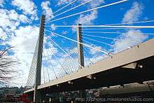
East 21st Street Bridge
| East 21st Street Bridge | |
|---|---|
 | |
| Coordinates | 47°14′38″N 122°25′55″W / 47.244°N 122.432°WCoordinates: 47°14′38″N 122°25′55″W / 47.244°N 122.432°W |
| Carries |
4 lanes of |
| Crosses | Thea Foss Waterway |
| Locale | Tacoma, Washington, United States |
| Characteristics | |
| Design | Cable-stayed bridge |
| Total length | 682 ft (208 m) or more |
| Width | 72 ft (21.9 m)[1] |
| Height | 180 ft (55 m) |
| Longest span | 503 m (1,650 ft) |
| History | |
| Opened | January 22, 1997 |
 East 21st Street Bridge Location in Washington (state) | |
The East 21st Street Bridge is a 682-foot (208 m)[2] or 707-foot (215 m)[3] or 992-foot (302 m)[1][4] long cable-stayed bridge in Tacoma, Washington completed in January, 1997. The bridge, whose most significant feature is two 180 feet (55 m) tall towers, carries four lanes State Route 509 (SR 509) across the Thea Foss Waterway from downtown Tacoma to the Port of Tacoma. SR 509 ends at a single point urban interchange with Interstate 705 west of the bridge, built as part of the same $165.3 million WSDOT project that also funded the bridge's construction.[3]
The architect for the bridge was Jim Merritt, a Tacoma architect.[3][5]
It is sometimes called Foss Waterway Bridge, although the Murray Morgan Bridge also crosses Foss Waterway.
References
- 1 2 "SR-509 at Thea Foss Waterway", National Bridge Inventory (Federal Highway Administration), 0014507A0000000
- ↑ Foss Waterway Bridge, Columbia, MD: VStructural LLC, 2013
- 1 2 3 David Wilma (January 30, 2003), Cable-stayed bridge over Tacoma's Thea Foss Waterway opens on January 22, 1997, HistoryLink
- ↑ WSDOT Bridge List (PDF), Washington State Department of Transportation, October 2013, p. 371, M 23-09.06
- ↑ Portfolio: SR-509 cable stay bridge info sheet (PDF), Merritt Architecture, retrieved 2015-07-09
External links
| Wikimedia Commons has media related to 21st Street Bridge. |
- Tacoma cable-stayed bridge, Bridgehunter
- SR-509 Foss Waterway Bridge at Emporis
This article is issued from Wikipedia - version of the Monday, August 03, 2015. The text is available under the Creative Commons Attribution/Share Alike but additional terms may apply for the media files.