Zutendaal
| Zutendaal | |||
|---|---|---|---|
| Municipality | |||
| |||
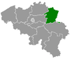
 Zutendaal Location in Belgium | |||
|
Location of Zutendaal in Limburg 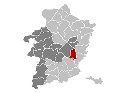 | |||
| Coordinates: 50°56′N 05°34′E / 50.933°N 5.567°ECoordinates: 50°56′N 05°34′E / 50.933°N 5.567°E | |||
| Country | Belgium | ||
| Community | Flemish Community | ||
| Region | Flemish Region | ||
| Province | Limburg | ||
| Arrondissement | Hasselt | ||
| Government | |||
| • Mayor | Jozef Beuls (CD&V) | ||
| • Governing party/ies | CD&V | ||
| Area | |||
| • Total | 32.07 km2 (12.38 sq mi) | ||
| Population (1 January 2013)[1] | |||
| • Total | 7,074 | ||
| • Density | 220/km2 (570/sq mi) | ||
| Postal codes | 3690 | ||
| Area codes | 089 | ||
| Website | www.zutendaal.be | ||


Zutendaal is a municipality located in the Belgian province of Limburg. On 1 January 2008 Zutendaal had a total population of 6,985. The total area is 32.07 km², giving a population density of 218 inhabitants per km².
In addition to Zutendaal itself, the municipality includes the following population centres: Gewaai, Papendaal, Besmer, Broek, Stalken, Roelen, Daal, and Wiemesmeer.
References
- ↑ Population per municipality on 1 January 2013 (XLS; 607.5 KB)
External links
 Media related to Zutendaal at Wikimedia Commons
- Official website - Available only in Dutch
 |
Genk | Maasmechelen | | |
| Genk | |
|||
| ||||
| | ||||
| Bilzen | Lanaken |
| ||||||||||||||||