Zlatoličje
| Zlatoličje | |
|---|---|
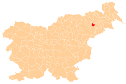
_location_map.svg.png) Zlatoličje Location in Slovenia | |
| Coordinates: 46°27′22.36″N 15°47′24.3″E / 46.4562111°N 15.790083°ECoordinates: 46°27′22.36″N 15°47′24.3″E / 46.4562111°N 15.790083°E | |
| Country |
|
| Traditional region | Styria |
| Statistical region | Drava |
| Municipality | Starše |
| Area | |
| • Total | 7.1 km2 (2.7 sq mi) |
| Elevation | 237 m (778 ft) |
| Population (2002) | |
| • Total | 744 |
| [1] | |
Zlatoličje (pronounced [zlatɔˈliːtʃjɛ]) is a village on the right bank of the Drava River southeast of Maribor in northeastern Slovenia. It lies in the Municipality of Starše in an area that was part of the traditional region of Styria. The municipality is now included in the Drava Statistical Region.[2] South of the settlement is a hydroelectric power plant, opened in 1969.
Name
Zlatoličje was attested in written sources in 1220–30 and later as Goldarn (and as Goldsdorf in 1320). The Slovene name is derived from the common noun zlatolika 'golden willow' (Salix alba var. vitellina), referring to local vegetation. A less likely derivation is from Slavic *zoltolykъ 'gold seeker'.[3]
Cultural heritage
The village chapel with a small belfry was built in 1900.[4]
References
- ↑ Statistical Office of the Republic of Slovenia
- ↑ Starše municipal site
- ↑ Snoj, Marko. 2009. Etimološki slovar slovenskih zemljepisnih imen. Ljubljana: Modrijan and Založba ZRC, p. 482.
- ↑ Slovenian Ministry of Culture register of national heritage reference number ešd 20312
External links
| ||||||||