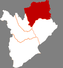
Zhenlai County
| Zhenlai County 镇赉县 | |
|---|---|
| County | |
 Location in Baicheng City | |
 Zhenlai Location in Jilin | |
| Coordinates: 45°51′N 123°12′E / 45.850°N 123.200°ECoordinates: 45°51′N 123°12′E / 45.850°N 123.200°E | |
| Country | People's Republic of China |
| Province | Jilin |
| Prefecture-level city | Baicheng |
| County seat | Zhenlai Town (镇赉镇) |
| Area | |
| • Total | 5,389 km2 (2,081 sq mi) |
| Elevation | 140 m (460 ft) |
| Population | |
| • Total | 310,000 |
| • Density | 58/km2 (150/sq mi) |
| Time zone | China Standard (UTC+8) |
| Postal code | 137300 |
Zhenlai County (simplified Chinese: 镇赉县; traditional Chinese: 鎮賚縣; pinyin: Zhènlài Xiàn) is a county in northwestern Jilin province, China, occupying the northernmost part of the province and bordering Heilongjiang to the east and Inner Mongolia to the west. It is under the administration of Baicheng City, with a population of 310,000 residing in an area of 5,389 km2 (2,081 sq mi).
Administrative divisions
There are 7 towns, 9 townships, and 1 ethnic township.[1]
|
Towns:
|
Townships:
|
References
- ↑ 2011年统计用区划代码和城乡划分代码:镇赉县 (in Chinese). National Bureau of Statistics of the People's Republic of China. Retrieved 2012-07-17.
External links
| ||||||||||||||||||||||||||||||||||||||||||||||||