Zamperini Field
| Zamperini Field Lomita Landing Strip | |||||||||||||||
|---|---|---|---|---|---|---|---|---|---|---|---|---|---|---|---|
|
31 May 1994 USGS airphoto | |||||||||||||||
| IATA: TOA – ICAO: KTOA – FAA LID: TOA | |||||||||||||||
| Summary | |||||||||||||||
| Airport type | Public | ||||||||||||||
| Owner | City of Torrance | ||||||||||||||
| Location | Torrance, California | ||||||||||||||
| Elevation AMSL | 103 ft / 31 m | ||||||||||||||
| Coordinates | 33°48′12″N 118°20′23″W / 33.80333°N 118.33972°WCoordinates: 33°48′12″N 118°20′23″W / 33.80333°N 118.33972°W | ||||||||||||||
| Website | www.ci.torrance.ca.us/... | ||||||||||||||
| Map | |||||||||||||||
 KTOA Location of Zamperini Field | |||||||||||||||
| Runways | |||||||||||||||
| |||||||||||||||
| Helipads | |||||||||||||||
| |||||||||||||||
| Statistics (2005) | |||||||||||||||
| |||||||||||||||

Zamperini Field (IATA: TOA, ICAO: KTOA, FAA LID: TOA) is a city-owned public airport three miles (5 km) southwest of downtown Torrance, in Los Angeles County, California, United States.[1]
The airport, one of the busiest general aviation airports in the state and once known as Torrance Municipal Airport, was renamed for local sports and war hero Louis Zamperini.
History
The airport was completed by the United States Army Air Forces on 31 March 1943,[2] and was known as Lomita Flight Strip. It was an emergency landing field for military aircraft on training flights. It was closed after World War II and the War Assets Administration (WAA) turned it over to local government.
Facilities and aircraft
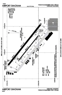
Zamperini Field covers 506 acres (205 ha) and has two asphalt and concrete runways: 11L/29R, 5,000 x 150 ft (1,524 x 46 m) and 11R/29L, 3,000 x 75 ft (914 x 23 m). It has one asphalt helipad, 110 x 110 ft (34 x 34 m).[1]
In the year ending May 31, 2005 the airport had 173,027 aircraft operations, an average of 474 per day: 99% general aviation, 1% military and <1% air taxi. 499 aircraft are based at this airport: 89% single-engine, 8% multi-engine, 2% helicopter and <1% glider.[1]
Terminal
Zamperini Field has a small terminal with a vending machine, conference room, bathroom, and flight planning room. Outside a patio has small tables. Inside the terminal are historical papers related to the airport on the wall and a security post.
Helicopter operations
The helipad for a neighboring hospital, the Torrance Medical Center, is at the north-west corner of the airfield.
Manufacturing
Zamperini Field is the home of Robinson Helicopter Company. Their entire production, assembly, and testing facilities are on the southeast side of the airfield and are the largest buildings at the field.
Museum
Zamperini Field is the new home of the Western Museum of Flight, previously in Hawthorne, California.
Accidents and incidents
- The Aeroméxico Flight 498 or Cerritos air disaster happened in 1986, when a private Piper Cherokee owned by William Kramer en route from Torrance to Big Bear City Airport near Big Bear Lake collided with a Douglas DC-9 owned by Aeroméxico en route from Mexico to Los Angeles International Airport. Both aircraft crashed, all on board and a few on the ground, being killed.
See also
References
Notes
![]() This article incorporates public domain material from websites or documents of the Air Force Historical Research Agency.
This article incorporates public domain material from websites or documents of the Air Force Historical Research Agency.
Bibliography
- Lobb, Charles. Torrance Airport. Charleston, South Carolina: Arcadia Publishing, 2006. ISBN 978-0-7385-4662-9.
- Shaw, Frederick J. Locating Air Force Base Sites: History’s Legacy. Washington, D.C.: United States Air Force History and Museums Program, 2004. ISBN 978-0-16072-415-2.
External links
- Zamperini Field page at city website
- Zamperini Field (unofficial information site)
- www.airfieldsdatabase.com
- FAA Airport Diagram (PDF), effective April 2, 2015
- Resources for this airport:
- FAA airport information for TOA
- AirNav airport information for KTOA
- ASN accident history for TOA
- FlightAware airport information and live flight tracker
- NOAA/NWS latest weather observations
- SkyVector aeronautical chart, Terminal Procedures