Zamboanga Sibugay
| Zamboanga Sibugay | ||
|---|---|---|
| Province | ||
| ||
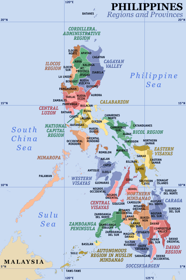
 Map of the Philippines with Zamboanga Sibugay highlighted | ||
| Coordinates: 07°48′N 122°40′E / 7.800°N 122.667°ECoordinates: 07°48′N 122°40′E / 7.800°N 122.667°E | ||
| Country | Philippines | |
| Region | Zamboanga Peninsula | |
| Founded | February 22, 2001 | |
| Capital | Ipil | |
| Government | ||
| • Type | Province of the Philippines | |
| • Governor | Wilter Y. Palma (LP) | |
| • Vice Governor | Rey Andre C. Olegario (Nacionalista) | |
| Area[1] | ||
| • Total | 3,607.75 km2 (1,392.96 sq mi) | |
| Area rank | 36th out of 81 | |
| Population (2010)[2] | ||
| • Total | 584,685 | |
| • Rank | 45th out of 81 | |
| • Density | 160/km2 (420/sq mi) | |
| • Density rank | 50th out of 81 | |
| Divisions | ||
| • Independent cities | 0 | |
| • Component cities | 0 | |
| • Municipalities | 16 | |
| • Barangays | 389 | |
| • Districts | 1st and 2nd districts of Zamboanga Sibugay | |
| Time zone | PHT (UTC+8) | |
| ZIP code | 7001 to 7039 | |
| Dialing code | 62 | |
| ISO 3166 code | PH-ZSI | |
| Spoken languages | Cebuano, Zamboangueño Chavacano, Tagalog, Subanen, Tausug, English | |
| Website |
www | |
Zamboanga Sibugay (Cebuano: Probinsya sa Zamboanga Sibugay, Filipino: Lalawigan ng Zamboanga Sibugay) is a province of the Philippines located in the Zamboanga Peninsula region in Mindanao. Its capital is Ipil and it borders Zamboanga del Norte to the north, Zamboanga del Sur to the east and Zamboanga City to the southwest. To the south lies Sibuguey Bay in the Moro Gulf. Zamboanga Sibugay was created in 2001 when the third district of Zamboanga del Sur was carved out of that province. Zamboanga Sibugay is the 79th province created in the Philippines.
Geography
Zamboanga Sibugay Province has an approximate total land area of 3,607.8 square kilometres (1,393.0 sq mi).[1] It is geographically located at 7°48’N 122°40’E. To the north it intersects the common municipal boundaries of Kalawit, Tampilisan, and Godad in Zamboanga del Norte. In the west, it is bounded by the municipalities of Siraway, Siocon, Balinguian, and the province of Zamboanga del Norte. On the south it is bordered by Sibuguey Bay. In the east, the municipalities of Bayog and Kumalarang in the province of Zamboanga del Sur bordered it. It is further bordered on the southwest by Zamboanga City.
The climate of the province is moderately normal (climate type III). Annual rainfall varies from 1,599 to 3,500 millimetres (63.0 to 137.8 in). Temperature is relatively warm and constant throughout the year ranging from 22 to 35 °C (72 to 95 °F). The province is situated outside the country's typhoon belt.
Subdivisions

Zamboanga Sibugay Province is subdivided into 16 municipalities.
These municipalities are further subdivided into 389 barangays. The province comprises two (2) congressional districts.
Largest barangays of Zamboanga Sibugay
| Barangay | Municipality | Population |
|---|---|---|
| Solar | Olutanga | 8,057 |
| Poblacion | Malangas | 7,951 |
| Poblacion | Buug | 7,852 |
| Poblacion | Talusan | 6,918 |
| Sanito | Ipil | 6,566 |
| Poblacion | Titay | 6, 112 |
| Poblacion | Imelda | 5,605 |
| Don Andres | Ipil | 5,548 |
| Poblacion | Ipil | 5,004 |
| Guinoman | Diplahan | 4,620 |
| Veterans Village | Ipil | 4,380 |
| Libertad | Tungawan | 4,377 |
| Poblacion | Payao | 4,348 |
| Taguisian | Mabuhay | 4,251 |
| Poblacion | Diplahan | 3,934 |
History
Zamboanga Sibugay was formerly part of Zamboanga del Sur. Attempts to divide Zamboanga del Sur into separate provinces date as far back as the 1960s. Several bills were filed in the Philippine Congress, but remained unacted. The new province was finally created by Republic Act No. 8973[3] passed on November 7, 2000 and signed into law by President Gloria Macapagal-Arroyo on February 24, 2001. Zamboanga del Sur Third District Representative George Hofer was elected as its first governor in 2001.
In the 2010 local elections, Governor Hofer's daughter, Dulce Ann Hofer, the incumbent Second District Representative, lost the gubernatorial race to Rommel Jalosjos. In the 2013 elections, the congressional race for Governor. The former Diplahan mayor Wilter Palma defeated Rommel Jalosjos.
Governors
Demographics
| Population census of Zamboanga Sibugay | ||
|---|---|---|
| Year | Pop. | ±% p.a. |
| 1990 | 407,038 | — |
| 1995 | 450,340 | +1.91% |
| 2000 | 497,239 | +2.15% |
| 2007 | 546,186 | +1.30% |
| 2010 | 584,685 | +2.51% |
| Source: National Statistics Office[2] | ||
As of the 2010 census, Zamboanga Sibugay has a population of 584,685 people, and a population density of 160/km2. It is ranked 29th among the provinces of the Philippines in terms of both population and population density. The annual population growth rate is 16.09%.
The vast majority of the people of Zamboanga Sibugay speak Cebuano. Other languages such as Hiligaynon, Subanen, Zamboangueño Chavacano, Tagalog and other ethnic tongues are also spoken, as is English.
Economy
The leading industries are in the areas of semi-processed rubber, rice and corn milling, ordinary food processing, wood and rattan furniture making, dried fish & squid processing, and home-made food processing. New industries include concrete products, garments, wax and candle factories, lime making, and other home and cottage industries.
Major crops produced include rice, corn, coconuts, rubber, fruit trees, vegetables, tobacco, coffee, cacao, and root crops. Livestock and poultry productions are predominantly small-scale and backyard operations. Coal mining in large and small scale and precious metal mining in small scale category are likewise present in some areas of the province.
Media
Newspapers:
- Mindanao Examiner
- The Sibugay Express
References
- ↑ 1.0 1.1 "List of Provinces". PSGC Interactive. Makati City, Philippines: National Statistical Coordination Board. Retrieved 31 July 2014.
- ↑ 2.0 2.1 "Population and Annual Growth Rates for The Philippines and Its Regions, Provinces, and Highly Urbanized Cities" (PDF). 2010 Census and Housing Population. National Statistics Office. Retrieved 27 October 2012.
- ↑ "REPUBLIC ACT NO. 8973 AN ACT CREATING THE PROVINCE OF ZAMBOANGA SIBUGAY FROM THE PROVINCE OF ZAMBOANGA DEL SUR AND FOR OTHER PURPOSES". PhilippineLaw.info. Retrieved 28 September 2013.
External links
| Wikimedia Commons has media related to Zamboanga Sibugay. |
Online news
 |
Zamboanga del Norte |  | ||
| Zamboanga del Norte | |
Zamboanga del Sur | ||
| ||||
| | ||||
| Zamboanga City | Sibuguey Bay, Moro Gulf |
| ||||||||||
| ||||||||||||||||||||||||||||||||||
| |||||||||||||||||||||||||||||||||||||||||||||


