Zăbala
| Zăbala Zabola | ||
|---|---|---|
| Commune | ||
|
Mikes Castle | ||
| ||
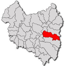
 Location of Zăbala | ||
 Zăbala Location of Zăbala | ||
| Coordinates: 45°54′0″N 26°11′0″E / 45.90000°N 26.18333°ECoordinates: 45°54′0″N 26°11′0″E / 45.90000°N 26.18333°E | ||
| Country |
| |
| County | Covasna County | |
| Status | Commune | |
| Government | ||
| • Mayor | Attila Péter Ádám (Democratic Union of Hungarians in Romania) | |
| Population (2002) | ||
| • Total | 4,814 | |
| Time zone | EET (UTC+2) | |
| • Summer (DST) | EEST (UTC+3) | |
Zăbala (Hungarian: Zabola, Hungarian pronunciation: [ˈzɒbolɒ]) is a commune in Covasna County, Romania. It lies in the Székely Land, an ethno-cultural region in eastern Transylvania.
Component villages
The commune comprises 4 villages:
| In Romanian | In Hungarian |
|---|---|
| Peteni | Székelypetőfalva |
| Surcea | Szörcse |
| Tamaşfalău | Székelytamásfalva |
| Zăbala | Zabola |
Demographics
The commune has a Székely Hungarian majority. According to the 2002 Census it has a population of 4,814 of which 76.55% or 3,685 are Hungarian. There is also an important Romanian community.
Name


The name of "Zabola" means "bridle", i.e. the straps of leather that are put around the head of a horse to allow the rider to control it.
In the course of various battles with the Tatars, the villages north and south of Zabola were destroyed by the Tatars. However, the inhabitants of Zabola were capable of holding the Tatars in check and survived, as if they had put bridles around the Tatars horses in order to control them and their riders. Outside the village lies the "Tatárhalom" (Tatar Hill); some historians think the Tatars that were killed in action were buried there.
History
It formed part of the Székely Land region of the historical Transylvania province. Until 1918, the village belonged to the Háromszék County of the Kingdom of Hungary. After the Treaty of Trianon of 1920, it became part of Romania.
Famous people

- Count Imre Mikó, minister and reformer
- Kelemen Mikes, born in Zagon and grew up in Zabola, in 1690 he became freedom fighter against Habsburg, escaped to Poland, France and at last Turkey. He is referred to as the "Hungarian Goethe" who became famous after writing "Letters from Turkey" in Rodosto where he lived in exile with the Transylvanian Prince Rákóczi until 1761. With his letters from Rodosto, Kelemen Mikes laid the foundations of the Hungarian prosaic literature, and he is regarded as the first Hungarian prosaic author.
- Count Kelemen Mikes (1820–1849), freedom fighter in 1848/1849, became a Hussar colonel, died at the age of 29, hit by the first cannonball fired by the Russian army in 1849. He became a martyr to the Székely resistance movement.
- Count Armin Mikes (1867–1944)
Things to see
- Mikes Castle and park, which dates back to around 1500. It was once a fortified building with a tower in front. On the first floor all the ceilings are covered with frescoes. The castle in its current form dates back to 1867. It features a 34 ha English park.
- Csángó museum


