Záhornice
| Záhornice | |||
|---|---|---|---|
| Municipality and village | |||
 | |||
| |||
 Záhornice Location in the Czech Republic | |||
| Coordinates: 50°14′51″N 15°16′51″E / 50.24750°N 15.28083°ECoordinates: 50°14′51″N 15°16′51″E / 50.24750°N 15.28083°E | |||
| Country |
| ||
| Region | Central Bohemian Region | ||
| District | Nymburk District | ||
| Area | |||
| • Total | 6.59 sq mi (17.06 km2) | ||
| Elevation | 692 ft (211 m) | ||
| Population (2011) | |||
| • Total | 362 | ||
| • Density | 55/sq mi (21/km2) | ||
| Time zone | CET (UTC+1) | ||
| • Summer (DST) | CEST (UTC+2) | ||
Záhornice is a village and municipality in Nymburk District in the Central Bohemian Region of the Czech Republic. It is located 19 kilometres (12 mi) east of Nymburk and 64 kilometres (40 mi) east of Prague.
The municipality covers an area of 17.06 square kilometres (6.59 sq mi) and as of 2011 it had a population of 362. First written notice about the village is from year 1225.
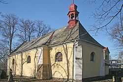
Gallery
-
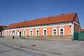
Restaurant
-
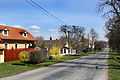
Main street
-
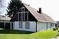
Local part Poušť
References
- This article was initially translated from the Czech Wikipedia.
| Wikimedia Commons has media related to Záhornice. |