Yoshinogari, Saga
| Yoshinogari 吉野ヶ里町 | ||
|---|---|---|
| Town | ||
| ||
 Location of Yoshinogari in Saga Prefecture | ||
 Yoshinogari Location in Japan | ||
| Coordinates: 33°19′N 130°24′E / 33.317°N 130.400°ECoordinates: 33°19′N 130°24′E / 33.317°N 130.400°E | ||
| Country | Japan | |
| Region | Kyushu | |
| Prefecture | Saga Prefecture | |
| District | Kanzaki | |
| Area | ||
| • Total | 43.94 km2 (16.97 sq mi) | |
| Population (February 1, 2009) | ||
| • Total | 16,308 | |
| • Density | 371/km2 (960/sq mi) | |
| Time zone | Japan Standard Time (UTC+9) | |
| Address |
321-2 Yoshida, Yoshinogari-chō, Kanzaki-gun, Saga-ken 842-8501 | |
| Phone number | 0952-53-1111 | |
| Website | Town of Yoshinogari | |

Yoshinogari (吉野ヶ里町 Yoshinogari-chō) is a town located in Kanzaki District, Saga Prefecture, Japan.
It is the result of a merger between the town of Mitagawa, and the village of Higashisefuri, both from Kanzaki District, on March 1, 2006.
Geography
Yoshinogari is located in the northern part of Saga Prefecture. It is about 10 kilometres (6.2 mi) north of Saga City and about 30 kilometres (19 mi) south of Fukuoka. Yoshinogari is very narrow north to south. The southern part contains the northern end of the Chikushi Plains (part of the Saga Plains), and north of the Nagasaki Expressway is the southern end of the Sefuri Mountains.
Adjoining Municipalities
- Saga Prefecture
- Fukuoka Prefecture
- Fukuoka City, Sawara Ward
- Nakagawa
History
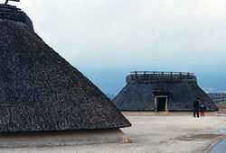
In 1986, the remains of a Yayoi period moat-encircled village were discovered on Yoshinogari Hill at the site of a planned factory housing complex. The area was named the Yoshinogari site and the town name originates from here.
- April 1, 1889 - The modern system of municipalities is established, and the town area consists of Mitagawa Village and Higashi-Sefuri Village.
- April 1, 1965 - Mitagawa Village becomes Mitagawa Town.
- March 1, 2006 - Mitagawa Town and Higashi-Sefuri village merge to form Yoshinogari Town.
Education
Junior High Schools
- Mitagawa Junior High School
- Higashi-Sefuri Junior High School
Elementary Schools
- Mitagawa Elementary School
- Higashi-Sefuri Elementary School
Transportation
Air
The closest airports are Saga Airport and Fukuoka Airport.
Rail
- JR Kyushu
- Nagasaki Main Line
- Yoshinogari-kōen Station
- Nagasaki Main Line
Road
- Expressways: Nagasaki Expressway (Higashi-Sefuri Interchange)
- National Highways: Route 34 and Route 385.
- Prefectural Roads: Saga Prefectural Route 31, and Route 46
External links
![]() Media related to Yoshinogari, Saga at Wikimedia Commons
Media related to Yoshinogari, Saga at Wikimedia Commons
- Yoshinogari official website (Japanese)
| ||||||||||||||||||||||||||||||||||