Yosano, Kyoto
| Yosano 与謝野町 | ||
|---|---|---|
| Town | ||
|
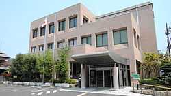
Yosano town hall | ||
| ||
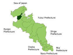 Location of Yosano in Kyoto | ||
 Yosano Location in Japan | ||
| Coordinates: 35°34′N 135°9′E / 35.567°N 135.150°ECoordinates: 35°34′N 135°9′E / 35.567°N 135.150°E | ||
| Country | Japan | |
| Region | Kansai | |
| Prefecture | Kyoto | |
| District | Yosa | |
| Area | ||
| • Total | 107.04 km2 (41.33 sq mi) | |
| Population (March 1, 2006) | ||
| • Total | 24,179 | |
| • Density | 230/km2 (590/sq mi) | |
| Time zone | Japan Standard Time (UTC+9) | |
| Symbols | ||
| - Tree | Camellia | |
| - Flower | Sunflower | |
| Website | Town of Yosano | |

Yosano (与謝野町 Yosano-chō) is a town located in Yosa District, Kyoto, Japan. The town was formed on March 1, 2006 from the merger of the towns of Kaya, Iwataki and Nodagawa, all from Yosa District. The town has two train stations, Nodagawa in the Nodagawa area (soon to be renamed Yosano Station) and Iwatakiguchi in the Iwataki area. A river, the Nodagawa runs through most of the town south to north leading to the Miyazu Bay, and the Amanohashidate.
As of its formation, the town has an estimated population of 24,179. As of February 2015 the population was 23, 276. The total area is 107.04 km².
The town has two Kindergarten, nine Elementary Schools, and three Middle Schools, and one High School.
The town hosts a large Sunflower festival every year during Summer, when a large area is devoted to growing sunflowers. Activities include a Sunflower Maze, and a scarecrow contest.
The town is also famous for the historic Chirimen Kaido; a famous silk-producing district in the Kaya area.
Neighbouring towns include Miyazu to the east and Maizuru to the far east, Omiya and Mineyama to the north. The closest cities are Fukuchiyama to the south and Toyooka to the west, both about 45 minutes by car. The town is around 2 and a half hours north of Kyoto and Osaka, and three hours north of Himeji and Kobe.
External links
![]() Media related to Yosano, Kyoto at Wikimedia Commons
Media related to Yosano, Kyoto at Wikimedia Commons
- Yosano official website (Japanese)