Yorkshire Dales
| Yorkshire Dales (The Dales) | |
| Protected Area | |
 National park entrance sign, near Skipton | |
| Country | United Kingdom |
|---|---|
| Constituent country | England |
| Counties | North Yorkshire, Cumbria |
| Highest point | |
| - location | Whernside |
| - elevation | 736 m (2,415 ft) |
| Area | 1,769 km2 (683 sq mi) |
| National Park of England | 1954 |
| style=""color: #cde5b2"" | IUCN category | V - Protected Landscape/Seascape |
 Yorkshire Dales National Park within North Yorkshire
| |
The Yorkshire Dales (also known simply as The Dales) is an upland area of the Pennines in Northern England dissected by numerous valleys.
The area lies within the county boundaries of historic Yorkshire, though it spans the ceremonial counties of North Yorkshire and Cumbria. Most of the area falls within the Yorkshire Dales National Park, created in 1954 and now one of the fifteen National parks of Britain, but the term also includes areas to the east of the National Park, notably Nidderdale.[1]
The Dales is a collection of river valleys and the hills among them, rising from the Vale of York westwards to the hilltops of the main Pennine watershed. In some places, such as Ribblesdale and Dentdale, the area extends westwards across the watershed, but most of the valleys drain eastwards to the Vale of York, into the Ouse and then the Humber.
The word dale comes from the Nordic/Germanic word for valley (dal, tal), and occurs in valley names across Yorkshire and Northern England, but the name Yorkshire Dales is generally used to refer specifically to the dales west of the Vale of York and north of the West Yorkshire Urban Area.
Geography
Most of the dales are named after their river or stream (e.g., Arkengarthdale, formed by Arkle Beck). The best-known exception is Wensleydale, which is named after the small village and former market town of Wensley, rather than the River Ure, although an older name for the dale is Yoredale. River valleys all over Yorkshire are called "(name of river)+dale"—but only the more northern valleys (and only the upper, rural, reaches) are included in the term "The Dales" . The southern boundary area lies in Wharfedale and Airedale. The lower reaches of these valleys are not usually included in the area, and Calderdale, much further south, is not part of the Dales even though it is a dale, is in Yorkshire, and its upper reaches are as scenic and rural as many further north.
Geographically, the Yorkshire Dales spread to the north from the market and spa towns of Settle, Skipton, Ilkley and Harrogate in North Yorkshire, with most of the larger southern dales, Ribblesdale, Malhamdale and Airedale, Wharfedale and Nidderdale, running roughly parallel from north to south. The more northerly dales, Wensleydale and Swaledale run generally from west to east. There are many other smaller or lesser known dales such as Arkengarthdale, Bishopdale, Clapdale, Coverdale, Kingsdale, Littondale, Langstrothdale, Raydale, Waldendale and the Washburn Valley whose tributary streams and rivers feed into the larger valleys, and Barbondale, Dentdale, Deepdale and Garsdale which feed west to the River Lune.
The characteristic scenery of the Dales is green upland pastures separated by dry-stone walls and grazed by sheep and cattle. The dales are 'U' and 'V' shaped valleys enlarged and shaped by glaciers, mainly in the most recent Devensian ice age. The underlying rock is Carboniferous Limestone (which results in a number of areas of limestone pavement) in places interspersed with shale and sandstone and topped with Millstone Grit. To the north and west of the Dent Fault, the hills are formed from older Silurian and Ordovician rocks, which make up the Howgill Fells.
Many upland areas consist of heather moorland, used for grouse shooting in the months following 12 August each year (the 'Glorious Twelfth').

Tourism
The majority of visitors are sightseers, with 75% visiting to drive around and 65% walking around . This indicates that most are there to take in the beauty of the surroundings. 26% also partake in hiking nature trails and spotting wildlife. 45% visit an information centre and 35% visit a castle or other historic site. 94% of visitors travel in a private mode of transport, with 90% using a car. The remaining 6% travel using public transport.
Cave systems
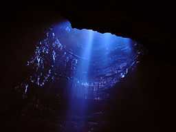
The underlying limestone in parts of the Dales has extensive cave systems making it a major area for caving in the UK. Some caves are open to the public for tours.[2]
The systems include:
- Gaping Gill System
- Alum Pot System
- Mossdale Caverns
- Kingsdale Caverns
- Leck Fell Caves
- Easegill System
- White Scar Caves in Chapel-le-Dale near Ingleton,[3]
- Ingleborough Cave[4] in Clapdale near Clapham
- Stump Cross Caverns[5] near Pateley Bridge.
- Goyden System near Pateley Bridge
Yorkshire Dales National Park


In 1954 an area of 1,770 square kilometres (680 sq mi) was designated the Yorkshire Dales National Park. Most of the National Park is in North Yorkshire, though part lies within Cumbria. The whole park lies within the historic boundaries of Yorkshire, divided between the North Riding and the West Riding. The park is 50 miles (80 km) north-east of Manchester; Leeds and Bradford lie to the south, while Kendal is to the west, Darlington to the north-east and Harrogate to the south-east.[6] A proposed westward extension of the park into Lancashire and Cumbria would encompass much of the area between the current park and the M6 motorway, coming close to the towns of Kirkby Lonsdale, Kirkby Stephen and Appleby-in-Westmorland.[7] This proposal to add 162 square miles to the park has now been agreed by all interested parties and merely awaits ministerial approval. For the first time the Yorkshire Dales and Lake District national parks will be contiguous.[8]
Over 20,000 residents live and work in the park, which attracts over eight million visitors every year.[9] The area has a large collection of activities for visitors. For example, many people come to the Dales for walking or exercise. The National Park is crossed by several long-distance routes including the Pennine Way, the Dales Way, the Coast to Coast Walk and the latest national trail — the Pennine Bridleway.[10] Cycling is also popular and there are several cycleways.[11]
The Park has its own museum, the Dales Countryside Museum, housed in a conversion of the Hawes railway station in Wensleydale in the north of the area.[12] The park has five visitor centres located in major destinations in the park.[13] These are at:
Other places and sights within the National Park include:
- Bolton Castle
- Clapham
- Cautley Spout waterfall
- Gaping Gill
- Gayle Mill
- Hardraw Force
- Horton in Ribblesdale
- Kisdon Force (waterfall) in Swaledale
- Malham Cove and Gordale Scar
- Sedbergh
- Settle
- Settle and Carlisle Railway including the Ribblehead Viaduct
- The Yorkshire Three Peaks
See also


- List of Yorkshire Dales
- List of peaks in the Yorkshire Dales
- Geology of Yorkshire
- Pennines
- All Creatures Great and Small (TV series)
References
- ↑ "Yorkshire Dales Area". Retrieved 25 April 2013.
- ↑ Caves and Caving in the Yorkshire Dales
- ↑ White Scar Caves
- ↑ Ingleborough Cave
- ↑ Stump Cross Caverns
- ↑ Welcome to the Yorkshire Dales National Park
- ↑ Natural England - Lakes to Dales Landscape Designation Project
- ↑ "BBC News - Yorkshire Dales National Park expansion plans agreed". 28 September 2011. Retrieved 29 September 2011.
- ↑ "Yorkshire Dales National Park Authority - Tourism Education file". www.yorkshiredales.org.uk. Retrieved 20 September 2011.
- ↑ Yorkshire Dales National Park Authority - Things to do
- ↑ Cycle the Dales
- ↑ Yorkshire Dales National Park Authority - Dales Countryside Museum
- ↑ Yorkshire Dales National Park Authority - National Park Centres
External links
| Wikimedia Commons has media related to Yorkshire Dales. |
| Wikivoyage has a travel guide for Yorkshire Dales. |
- Yorkshire Dales Tourist Board
- Yorkshire Dales National Park Authority
- Yorkshire Dales Community Pages
- Yorkshire Dales Society
- Yorkshire Dales Rivers Trust
| ||||||||||||||||||||||