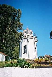
Yerba Buena Light
 | |
 | |
| Location | San Francisco Bay, California |
|---|---|
| Coordinates | 37°48′26″N 122°21′41″W / 37.80722°N 122.36139°WCoordinates: 37°48′26″N 122°21′41″W / 37.80722°N 122.36139°W |
| Year first constructed | 1875 |
| Year first lit | 1875 |
| Automated | 1958 |
| Foundation | Masonry |
| Construction | Wood |
| Tower shape | Octagonal & cylindrical |
| Height | 25 feet (7.6 m) |
| Original lens | Fifth order Fresnel lens |
| Characteristic | white light occulted every 4 s |
| Admiralty number | G4140 |
| ARLHS number | USA-908 |
| USCG number |
6-4595 |
|
Yerba Buena Island Lighthouse | |
| Nearest city | San Francisco, California |
| Area | 2.7 acres (1.1 ha) |
| Architectural style | Late Gothic Revival, Stick/Eastlake, Lighthouse |
| Governing body | COAST GUARD |
| MPS | Light Stations of California MPS |
| NRHP Reference # |
91001096 [1] |
| Added to NRHP | September 03, 1991 |
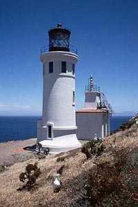
Yerba Buena Lighthouse is a lighthouse in California, United States, in the San Francisco Bay on Yerba Buena Island, California
History
The island’s lighthouse connection began in 1873 when the Lighthouse Service moved the district's depot from Mare Island to the southeast side of Yerba Buena Island. In 1875 construction was completed on the 25-foot (7.6 m) tower with a fifth order Fresnel lens. In 1886 another fifth order lens replaced the previous one. In 1933, a tunnel was bored through Yerba Buena Island to serve as a link between the east and west sections of the Oakland Bay Bridge. The light was automated by the United States Coast Guard in 1958. It is currently an active aid to navigation and not open to the public. Now that the lighthouse is automated, the former keeper’s quarters are now the home of the Coast Guard District Commander.
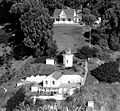
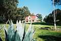
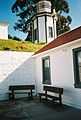
Gallery
References
- ↑ "National Register Information System". National Register of Historic Places. National Park Service. 2009-03-13.
External links
| Wikimedia Commons has media related to Yerba Buena Lighthouse. |
- "Historic Light Station Information and Photography: California". United States Coast Guard Historian's Office.
- View of lighthouse from San Francisco, with Bay Bridge detail
- Short film study of the Yerba Buena lighthouse, including interior detail of fresnel lens.
| ||||||||||||||||||||||||||