Ybbstal Alps
| Ybbstal Alps | |
|---|---|
|
| |
| Highest point | |
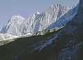
| Peak | Hochstadl |
| Elevation | 1,919 m (6,296 ft) |
| Geography | |
| Country | Austria |
| State/Province | Upper Austria, Lower Austria, Styria |
| Range coordinates | 47°41′N 15°04′E / 47.69°N 15.07°ECoordinates: 47°41′N 15°04′E / 47.69°N 15.07°E |
| Parent range | Northern Limestone Alps |

The Ybbstal Alps (German: Ybbstaler Alpen) are a mountain range in the Northern Limestone Alps and therefore belong to the Eastern Alps. They occupy an area along the borders of Upper Austria, Lower Austria and Styria. The range includes the eastern part of the Eisenwurzen, as well as the Göstling Alps and the Kräuterin in the south. The Göstling Alps are home to the popular skiing area at Hochkar (1,880 meters). Their highest peak is the Hochstadl, at 1,919 meters above sea level.