Yangquan
Coordinates: 37°51′N 113°34′E / 37.850°N 113.567°E
| Yangquan 阳泉市 | |
|---|---|
| Prefecture-level city | |
 | |
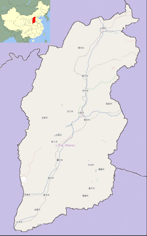
 Yangquan City (red) in Shanxi (orange) | |
 Yangquan Location of the city centre in Shanxi | |
| Coordinates: 37°51′10″N 113°34′00″E / 37.85278°N 113.56667°E | |
| Country | People's Republic of China |
| Province | Shanxi |
| Districts | 3 |
| Counties | 2 |
| Incorporated (prefecture) | 1952 |
| Area | |
| • Total | 4,452 km2 (1,719 sq mi) |
| Population (2010 Census) | |
| • Total | 1,368,502 |
| • Density | 310/km2 (800/sq mi) |
| Time zone | China Standard (UTC+8) |
| Postal code | 045000 |
| Area code(s) | +86(0)0353 |
| License Plate Prefix | 晋C |
| Administrative division code | 140300 |
| ISO 3166-2 | CN-14-03 |
| Website |
yq |
Yangquan (simplified Chinese: 阳泉; traditional Chinese: 陽泉; pinyin: Yángquán) is a prefecture-level city in the east of Shanxi province, People's Republic of China. Situated at the eastern edge of the Loess Plateau and the west side of the Taihang Mountains, Yangquan occupies a total area of 4,452 square kilometres (1,719 sq mi). According to the 2010 Census, Yangquan has a population of 1,368,502 inhabitants, 95,386 more than in 2000 (an annualized growth rate of 0.73% for the last decade).[1]
Administrative divisions
| Map | ||||||
|---|---|---|---|---|---|---|
 | ||||||
| # | Name | Hanzi | Pinyin | Population (2010 Census) |
Area (km²) | Density (/km²) |
| 1 | Chengqu (City District) | 城区 | Chéng Qū | 193,106 | 19 | 10,163 |
| 2 | Kuangqu (Mining District) | 矿区 | Kuàng Qū | 242,994 | 10 | 24,299 |
| 3 | Jiaoqu (Suburban District) | 郊区 | Jiāo Qū | 286,055 | 633 | 452 |
| 4 | Pingding County | 平定县 | Píngdìng Xiàn | 335,265 | 1,350 | 248 |
| 5 | Yu County | 盂县 | Yù Xiàn | 311,082 | 2,439 | 128 |
Geography and climate
Yangquan has a rather dry, monsoon-influenced humid continental climate (Köppen Dwa),[2] with cold and very dry winters, and hot, somewhat humid summers. The monthly 24-hour average temperature ranges from −3.4 °C (25.9 °F) in January to 24.0 °C (75.2 °F) in July, and the annual mean is 11.3 °C (52.3 °F). The diurnal temperature variation, not exceeding 13 °C (23 °F) in any month, is not large for provincial standards. More than 70% of the annual precipitation, which ranges from 450 to 550 millimetres (18 to 22 in) in the entire prefecture-level city (PLC), occurs from June to September; throughout the PLC, sunshine totals 2700–2900 hours annually, and the frost-free period lasts 130–180 days.
| Climate data for Yangquan (1971−2000) | |||||||||||||
|---|---|---|---|---|---|---|---|---|---|---|---|---|---|
| Month | Jan | Feb | Mar | Apr | May | Jun | Jul | Aug | Sep | Oct | Nov | Dec | Year |
| Record high °C (°F) | 14.7 (58.5) |
24.2 (75.6) |
26.8 (80.2) |
36.5 (97.7) |
37.8 (100) |
39.2 (102.6) |
40.2 (104.4) |
37.6 (99.7) |
36.1 (97) |
30.1 (86.2) |
25.1 (77.2) |
16.9 (62.4) |
40.2 (104.4) |
| Average high °C (°F) | 2.3 (36.1) |
5.1 (41.2) |
11.0 (51.8) |
19.6 (67.3) |
25.4 (77.7) |
29.0 (84.2) |
29.4 (84.9) |
27.7 (81.9) |
23.9 (75) |
18.3 (64.9) |
10.3 (50.5) |
4.2 (39.6) |
17.2 (62.9) |
| Daily mean °C (°F) | −3.4 (25.9) |
−1.0 (30.2) |
4.8 (40.6) |
13.1 (55.6) |
19.0 (66.2) |
22.9 (73.2) |
24.0 (75.2) |
22.4 (72.3) |
17.9 (64.2) |
12.0 (53.6) |
4.6 (40.3) |
−1.2 (29.8) |
11.3 (52.3) |
| Average low °C (°F) | −7.8 (18) |
−5.5 (22.1) |
−0.1 (31.8) |
7.5 (45.5) |
13.1 (55.6) |
17.3 (63.1) |
19.6 (67.3) |
18.3 (64.9) |
13.0 (55.4) |
7.1 (44.8) |
0.2 (32.4) |
−5.3 (22.5) |
6.5 (43.6) |
| Record low °C (°F) | −16.2 (2.8) |
−15.4 (4.3) |
−12.6 (9.3) |
−2.5 (27.5) |
3.0 (37.4) |
8.2 (46.8) |
13.6 (56.5) |
9.8 (49.6) |
3.8 (38.8) |
−4.3 (24.3) |
−12.3 (9.9) |
−15.2 (4.6) |
−16.2 (2.8) |
| Average precipitation mm (inches) | 4.1 (0.161) |
6.5 (0.256) |
14.5 (0.571) |
20.9 (0.823) |
43.6 (1.717) |
71.7 (2.823) |
130.9 (5.154) |
119.7 (4.713) |
61.6 (2.425) |
26.2 (1.031) |
12.3 (0.484) |
3.9 (0.154) |
515.9 (20.312) |
| Avg. precipitation days (≥ 0.1 mm) | 2.6 | 3.4 | 4.5 | 5.0 | 6.7 | 10.0 | 14.6 | 12.9 | 9.0 | 5.9 | 3.8 | 2.0 | 80.4 |
| Source: Weather China | |||||||||||||
Transportation
Twinned cities
 Chesterfield, Derbyshire, England, United Kingdom[3]
 Mount Vernon, New York, United States
References
- ↑ (Chinese) Compilation by LianXin website. Data from the Sixth National Population Census of the People's Republic of China
- ↑ Peel, M. C., Finlayson, B. L., and McMahon, T. A.: Updated world map of the Köppen-Geiger climate classification, Hydrol. Earth Syst. Sci., 11, 1633-1644, doi:10.5194/hess-11-1633-2007, 2007.
- ↑ "Chesterfield Twinning Links". Chesterfield Borough Council. Retrieved 2013-07-27.
External links
| ||||||||||||||||||||||||||||||
| ||||||||||||||||||||||||||||||||||||||||||||||||||||