Yamoussoukro
| Yamoussoukro | |
|---|---|
 | |
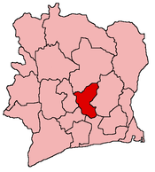
 Yamoussoukro Location within Côte d'Ivoire | |
| Coordinates: 06°49′00″N 05°17′00″W / 6.81667°N 5.28333°WCoordinates: 06°49′00″N 05°17′00″W / 6.81667°N 5.28333°W | |
| Country |
|
| Region | Lacs |
| Department | Yamoussoukro |
| Government | |
| • Governor | Augustin Abdoulaye Thiam Houphouët |
| Area | |
| • Total | 3,500 km2 (1,350 sq mi) |
| Population (2014 census) | |
| • Total | 355,573 |
| • Density | 100/km2 (260/sq mi) |
| Time zone | UTC |
| Website |
www |
The District of Yamoussoukro (/ˌjæmʊˈsuːkroʊ/)[1] is the official political capital and administrative capital city of Côte d'Ivoire, while the economic capital of the country is Abidjan. As of the 2014 preliminary census, the autonomous district had a population of 355,573 inhabitants. Located 240 kilometers (150 mi) north-west of Abidjan, the administrative centre on the coast, upon rolling hills and plains, the municipality covers 3,500 square kilometers (1,400 sq mi) and is coterminous with the department of the same name. The department and municipality are split into four sub-prefectures: Attiégouakro, Didiévi, Tié-diékro and the Commune of Yamoussoukro (with 207,412 inhabitants in 2014). In total, the district contains 169 settlements.
In 1998, the city had about 155,803 inhabitants. It is the fourth most populous city in Côte d'Ivoire, after Abidjan, Bouaké, and Daloa.
The current governor of the district is Augustin Thiam.
Yamoussoukro is pronounced "Yam-So-Kro" by Ivorians. It's rarer to hear "Ya-Mu-So-Kro"; the second "U" is silent.
History
Prehistory
Stone tools found in the country from hundreds of thousands of years ago show that the area around Yamoussoukro has been occupied since ancient times. Due to the desertification of the ||Sahara||, many North Africans moved south for the better climate.
Colonial period
Queen Yamousso, the son of Kouass N'Go, ran the city of N'Gokro in 1929 at the time of French colonization. The village then comprised 429 inhabitants, and was one of 134 Akoué citys.
Diplomatic and commercial relations were then established, but in 1909, on the orders of the Chief of Djamlabo, the Akoué revolted against the administration. Bonzi station, 7 kilometres (4.3 mi) from Yamoussoukro on the Bouaflé road, was set on fire, and the French administrator, Simon Maurice, was spared only by the intervention of Kouassi N'Go. This respected former leader persuaded the Akoué not to wage a war which could only have turned into a disaster.
As the situation got worse, Maurice, judging that Bonzi had become safe, decided to transfer the French military station to Yamoussoukro, where the French Administration built a pyramid to the memory of Kouassi N'Go, Chief of the Akoué. In homage to queen Yamousso, N'Gokro was renamed Yamoussoukro.
In 1919, the civil station of Yamoussoukro was removed. Félix Houphouët-Boigny became the leader of the village in 1939. A long period passed wherein Yamoussoukro, still a small agricultural town, remained in the shadows. This continued until after the Second World War, which saw the creation of the African Agricultural Trade Union, as well as the first conferences of its chief. However, it was only with independence that Yamoussoukro finally started to rise.
Since independence
After 1964, the President Félix Houphouët-Boigny made ambitious plans and started to build. One day in 1965, later called the Great Lesson of Yamoussoukro, he visited the plantations with the leaders of the county, inviting them to transpose to their own villages the efforts and agricultural achievements of the region. On 21 July 1977, Houphouët offered his plantations to the State.
In March 1983, President Houphouët-Boigny made Yamoussoukro the political and administrative capital of Côte d'Ivoire, as the city was his birthplace. This marked the fourth movement of the country's capital city in a century. Côte d'Ivoire's previous capital cities were Grand-Bassam (1893), Bingerville (1900), and Abidjan (1933). The majority of economic activity still takes place in Abidjan.
Highlights

Yamoussoukro is also the site of what is claimed to be the largest Christian place of worship on Earth: The Basilica of Our Lady of Peace of Yamoussoukro, consecrated by Pope John Paul II on 10 September 1990.
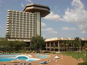
Also noteworthy are the Kossou Dam, the Félix Houphouët-Boigny Foundation, the PDCI-RDA House, the various schools of the Félix Houphouët-Boigny National Polytechnic Institute, the international airport (with an average of six hundred passengers and 36 flights in 1995, it is one of two airports in Africa (with Gbadolite) that could accommodate the Concorde), the Town Hall, the Protestant Temple, the Mosque, and the Palace of Hosts.
On 6 November 2004, Yamoussoukro Airport was attacked by French infantry after military aircraft from the airport bombed a UN peacekeeper base as well as rebel targets, 9 French peacekeepers and one U.S. civilian were killed. Two Ivorian Sukhoi Su-25 aircraft and several Mil Mi-24 helicopters were destroyed, which was most of the country's air forces. Mobs and rebels tried to attack the French forces after the airport raid.
On 30 March 2011, the city of Yamoussoukro fell to forces led by Alassane Ouattara, who had been recognized internationally as president of Côte d'Ivoire.[2]
Climate
Köppen-Geiger climate classification system classifies its climate as tropical wet and dry (Aw).[3]
| Climate data for Yamoussoukro | |||||||||||||
|---|---|---|---|---|---|---|---|---|---|---|---|---|---|
| Month | Jan | Feb | Mar | Apr | May | Jun | Jul | Aug | Sep | Oct | Nov | Dec | Year |
| Average high °C (°F) | 31.5 (88.7) |
33.5 (92.3) |
33.5 (92.3) |
32.9 (91.2) |
31.7 (89.1) |
30.1 (86.2) |
28.6 (83.5) |
28.5 (83.3) |
29.3 (84.7) |
30.1 (86.2) |
30.7 (87.3) |
30.1 (86.2) |
30.88 (87.58) |
| Daily mean °C (°F) | 25.2 (77.4) |
27.3 (81.1) |
27.6 (81.7) |
27.3 (81.1) |
26.5 (79.7) |
25.6 (78.1) |
24.5 (76.1) |
24.5 (76.1) |
24.8 (76.6) |
25.2 (77.4) |
25 (77) |
24.5 (76.1) |
25.67 (78.2) |
| Average low °C (°F) | 18.9 (66) |
21.2 (70.2) |
21.8 (71.2) |
21.8 (71.2) |
21.3 (70.3) |
21.1 (70) |
20.4 (68.7) |
20.6 (69.1) |
20.4 (68.7) |
20.4 (68.7) |
20.3 (68.5) |
19 (66) |
20.6 (69.05) |
| Average precipitation mm (inches) | 13 (0.51) |
42 (1.65) |
108 (4.25) |
126 (4.96) |
155 (6.1) |
165 (6.5) |
88 (3.46) |
83 (3.27) |
170 (6.69) |
125 (4.92) |
36 (1.42) |
15 (0.59) |
1,126 (44.32) |
| Source: Climate-Data.org, altitude: 236m[3] | |||||||||||||
References
- ↑ "English Dictionary: Definition of Yamoussoukro". Collins. Retrieved 24 August 2013.
- ↑ Nossiter, Adam (30 March 2011). Opposition Forces in Ivory Coast Make Major Gains. New York Times, 30 March 2011. "A version of this article appeared in print on 31 March 2011, on page A6 of the New York edition." Retrieved from http://www.nytimes.com/2011/03/31/world/africa/31ivory.html.
- ↑ 3.0 3.1 "Climate: Yamoussoukro - Climate graph, Temperature graph, Climate table". Climate-Data.org. Retrieved 2 September 2013.
External links
| Wikimedia Commons has media related to Yamoussoukro. |
| |||||||||||||||||||
| |||||||||||||||||||||||||