Yaga Station (Kanagawa)
Yaga Station 谷峨駅 | |
 | |
|---|---|
| Location | |
| Prefecture | Kanagawa (See other stations in Kanagawa) |
| District | Ashigarakami |
| Town | Yamakita |
| Neighborhood etc. | Yaga |
| Postal code | 258-0115 |
| (in Japanese) | 神奈川県足柄上郡山北町八ケ |
| History | |
| Year opened | 1947 |
| Rail services | |
| Operator(s) | JR Central |
| Line(s) | Gotemba Line |
| Statistics | 184 passengers/day (FY2004) |
Yaga Station (谷峨駅 Yaga-eki) is a railway station on the Gotemba Line in the southern part of Yamakita, Kanagawa, Japan, operated by Central Japan Railway Company (JR Central). Initially primarily a freight station, used to transport firewood and charcoal from the Tanzawa Mountains, Yaga Station now serves only passenger traffic to nearby Lake Tanzawa and the Nakagawa onsen resorts. National Route 246 passes next to this station.
Station layout
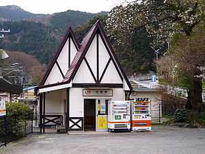
Yaga Station is an unmanned station with two opposed ground side platforms.
Adjacent stations
| « | Service | » | ||
|---|---|---|---|---|
| Gotemba Line | ||||
| Yamakita | Local | Suruga-Oyama | ||
History
Yaga Station was established on March 15, 1907 as the Yaga signal station of the Japanese Government Railways (JGR), the predecessor to the Japanese National Railways (JNR), when the line from Yamakita to Suruga^Oyama was completed. It was upgraded to a full station on July 15, 1947. The line was electrified in 1968, and freight operations discontinued from 1971. With the privatization of JNR on April 1, 1987, it came under the operational control of the Central Japan Railway Company. Express train service was discontinued from 1991. A new station building was completed in March 2000.
Bus services
- Fujikyu Shonan Bus for Lake Tanzawa, Yamakita Station (JR Central) and Shin-Matsuda Station (Odakyu Odawara Line).
References
| Wikimedia Commons has media related to Yaga Station (Kanagawa). |
- Harris, Ken and Clarke, Jackie. Jane's World Railways 2008-2009. Jane's Information Group (2008). ISBN 0-7106-2861-7
- Ishino, Tetsu et al. (eds.) (1998). 停車場変遷大事典 国鉄・JR編 [Station Transition Directory - JNR/JR] (in Japanese). Tokyo: JTB Corporation. vol. II. ISBN 4533029809. (Japanese)
- Official home page (Japanese)
- Fujikyu Shonan Bus Timetable (Japanese)
| ||||||
Coordinates: 35°21′57.73″N 139°2′18.43″E / 35.3660361°N 139.0384528°E