Yūtō, Shizuoka
| Yūtō 雄踏町 | |
|---|---|
| Former municipality | |
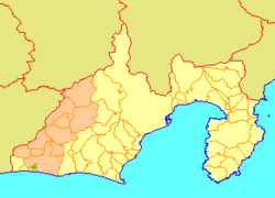 Location of Yūtō in Shizuoka Prefecture | |
 Yūtō Location in Japan | |
| Coordinates: 34°41′40″N 137°37′50″E / 34.69444°N 137.63056°ECoordinates: 34°41′40″N 137°37′50″E / 34.69444°N 137.63056°E | |
| Country | Japan |
| Region | Chūbu (Tōkai) |
| Prefecture | Shizuoka Prefecture |
| District | Hamana |
| Merged |
July 1, 2005 (now part of Nishi-ku, Hamamatsu) |
| Area | |
| • Total | 8.15 km2 (3.15 sq mi) |
| Population (June 1, 2005) | |
| • Total | 13,825 |
| • Density | 1,696/km2 (4,390/sq mi) |
| Time zone | Japan Standard Time (UTC+9) |
| Symbols | |
| - Tree | Maki |
| - Flower | Rhododendron |
Yūtō (雄踏町 Yūtō-chō) was a town located in Hamana District, Shizuoka Prefecture, Japan.
On July 1, 2005, Yūtō, along with the cities of Tenryū and Hamakita, town of Haruno (from Shūchi District), the towns of Hosoe, Inasa and Mikkabi (all from Inasa District), the towns of Misakubo and Sakuma, the village of Tatsuyama (all from Iwata District), and the town of Maisaka (also from Hamana District), was merged into the expanded city of Hamamatsu.[1]
Yūtō was located on the eastern banks of Lake Hamana just north of Maisaka Station on the JR Tōkaidō line.
Prior to its merger with Hamamatsu, Yūtō enjoyed a sister city relationship with Airdrie, Alberta, Canada.[2] This relationship was founded on July 4, 1995.[3]
Attractions
- Yūtō-chō Culture Center - https://www.mb.epss.jp/contents/facilities/1410/index.html (Japanese)
- Hamanako Royal Hotel - http://www.daiwaresort.co.jp/english/09_haman.html
- "Takiya Ryo" Fishing - http://www.kanko-otakara.jp - Discover Japan's description of this kind of fishing which is done at nighttime with lamps, harpoons, and nets.
Famous people
- Shinichirô Sawai (澤井信一郎 ) - Movie Director
- Hironoshin Furuhashi (古橋廣之進 ) - Honorary President of the Japan Swimming Federation
- Yoko Kando (漢人陽子) - Barcelona Olympic Team Member
References
- ↑ Dates of Municipal Mergers in Shizuoka Shizuoka Prefectural Government.
- ↑ Airdrie's Twin Municipality in Japan Alberta Japan Twinned Municipalities Association.
- ↑ Canada-Japan Sister and Friendship Cities Foreign Affairs and International Trade Canada.
External links
- Shinichirô Sawai's Page on IMDB
- Hironoshin Furuhashi's Bio (Japanese) - Japanese Olympic Committee Website
- "Teacher enjoys culture of Airdrie’s sister city" - Airdrie Echo, Article about the 2003 Yūtō Matsuri
- Yūtō's Tradition of Takiya Fishing - Link to the Takiya Fishing Company's Website in Yūtō (Japanese)