Xinzhuang District
| Xinzhuang 新莊區 | |
|---|---|
| District | |
| Xinzhuang District | |
|
Xinzhuang District | |
 Xinzhuang District in New Taipei City | |
| Coordinates: 25°02′N 121°27′E / 25.033°N 121.450°ECoordinates: 25°02′N 121°27′E / 25.033°N 121.450°E | |
| Country |
|
| Region | Northern Taiwan |
| Special municipality | New Taipei |
| Area | |
| • Total | 19.74 km2 (7.62 sq mi) |
| Population (December 2014) | |
| • Total | 411,711 |
| • Density | 9,678.14/km2 (25,066.3/sq mi) |
| Time zone | CST (UTC+8) |
| Postal code | 242 |
| Website | http://www.xinzhuang.tpc.gov.tw/ |
| Xinzhuang District | |||||||||||||||
| Chinese | 新莊區 | ||||||||||||||
|---|---|---|---|---|---|---|---|---|---|---|---|---|---|---|---|
| |||||||||||||||
Xinzhuang District (Chinese: 新莊區; Hanyu Pinyin: Xīnzhuāng Qū; Tongyong Pinyin: Sinjhuang Cyu) is an inner city district in the western part of New Taipei in northern Republic of China (Taiwan). It has an area of 19.74 km2 (7.62 sq mi) and a population of 388,110 people (2005).
History
Until the 25 December 2010 creation of New Taipei, Xinzhuang was itself a county-controlled city (新莊市; Xīnzhuāng Shì; Sin-chng Chhī; Postal map spelling: Hsinchuang) since 15 January 1980 in the former Taipei County.
Overview
The district is bordered by Wugu and Taishan to the north, Sanchong to the east, Banqiao and Shulin to the south, and Taoyuan City to the west.
Education
Colleges
Senior High Schools
- National Xinzhuang High School (國立新莊高級中學)
- Heng Yee Catholic High School (天主教恆毅中學)
Tourist attractions
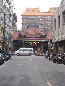
- Cihyou Temple
- Losheng Sanatorium
- Siangrenhe Clock and Drum Workshop
- Temple to Erudition Deity
- Temple to the Martial Deity
- Xinzhuang Baseball Stadium
- Xinzhuang Cultural and Arts Center
Transportation
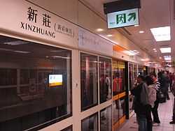
- MRT Xinzhuang Line
Notable natives
- Jolin Tsai, singer and dancer
See also
| Wikimedia Commons has media related to Xinzhuang District, New Taipei. |
- New Taipei
References
External links
| ||||||||||||||||||||||||||||||||||
