Xinjiang
| Xinjiang Uyghur Autonomous Region 新疆维吾尔自治区 | |
|---|---|
| Autonomous region | |
| Name transcription(s) | |
| • Chinese |
新疆维吾尔自治区 (Xīnjiāng Wéiwú'ěr Zìzhìqū) |
| • Abbreviation | 新 (Pinyin: Xīn) |
| • Uyghur | شىنجاڭ ئۇيغۇر ئاپتونوم رايونى |
| • Uyghur transl. | Shinjang Uyghur Aptonom Rayoni |
|
Map showing the location of Xinjiang Uyghur Autonomous Region | |
| Coordinates: 41°N 85°E / 41°N 85°ECoordinates: 41°N 85°E / 41°N 85°E | |
| Named for |
|
| Capital | Ürümqi |
| Largest city | Ürümqi |
| Divisions |
14 prefectures, 99 counties, 1005 townships |
| Government | |
| • Secretary | Zhang Chunxian |
| • Chairman | Shohrat Zakir |
| Area[1] | |
| • Total | 1,664,900 km2 (642,800 sq mi) |
| Area rank | 1st |
| Population (2010)[2] | |
| • Total | 21,815,815 |
| • Rank | 25th |
| • Density | 13/km2 (30/sq mi) |
| • Density rank | 29th |
| Demographics | |
| • Ethnic composition | |
| • Languages and dialects | |
| ISO 3166 code | CN-65 |
| GDP (2011) |
CNY 657.5 billion US$ 101.7 billion (25th) |
| - per capita |
CNY 29,924 US$ 4,633 (19th) |
| HDI (2010) | 0.667[3] (medium) (22nd) |
| Website | Xinjiang Uyghur Autonomous Region |
.svg.png)
| Xinjiang | |||||||||||||||||||||||||
| Chinese name | |||||||||||||||||||||||||
|---|---|---|---|---|---|---|---|---|---|---|---|---|---|---|---|---|---|---|---|---|---|---|---|---|---|
| Chinese | 新疆 | ||||||||||||||||||||||||
| Postal Map | Sinkiang | ||||||||||||||||||||||||
| |||||||||||||||||||||||||
| Xinjiang Uyghur Autonomous Region | |||||||||||||||||||||||||
| Simplified Chinese | 新疆维吾尔自治区 | ||||||||||||||||||||||||
| Traditional Chinese | 新疆維吾爾自治區 | ||||||||||||||||||||||||
| Postal Map | Sinkiang Uyghur Autonomous Region | ||||||||||||||||||||||||
| |||||||||||||||||||||||||
| Mongolian name | |||||||||||||||||||||||||
| Mongolian script |
ᠰᠢᠨᠵᠢᠶᠠᠩ ᠤᠶᠢᠭᠤᠷ ᠤᠨ ᠥᠪᠡᠷᠲᠡᠭᠡᠨ ᠵᠠᠰᠠᠬᠤ ᠣᠷᠤᠨ | ||||||||||||||||||||||||
| |||||||||||||||||||||||||
| Uyghur name | |||||||||||||||||||||||||
| Uyghur |
شىنجاڭ ئۇيغۇر ئاپتونوم رايونى | ||||||||||||||||||||||||
| |||||||||||||||||||||||||
| Kazakh name | |||||||||||||||||||||||||
| Kazakh |
شينجياڭ ۇيعۇر اۆتونوميالى رايونى Шыңжаң Ұйғыр аутономиялық ауданы Şıñjañ Uyğır awtonomïyalıq awdanı | ||||||||||||||||||||||||
| Kyrgyz name | |||||||||||||||||||||||||
| Kyrgyz |
شئنجاڭ ۇيعۇر اپتونوم رايونۇ Шинжаң-Уйгур автоном району Şincañ-Uygur avtonom rayonu | ||||||||||||||||||||||||
| Oirat name | |||||||||||||||||||||||||
| Oirat | Zuungar | ||||||||||||||||||||||||
Xinjiang (Uyghur: شىنجاڭ, ULY: Shinjang; Mandarin pronunciation: [ɕíntɕjɑ́ŋ]; Chinese: 新疆; pinyin: Xīnjiāng), officially Xinjiang Uyghur Autonomous Region,[4] is an autonomous region of China in the northwest of the country. It is the largest Chinese administrative division, the 8th largest country subdivision in the world, spanning over 1.6 million km2 and the most populous amongst the ten largest national subdivisions. It contains the disputed territory of Aksai Chin administered by China. Xinjiang contains China's smaller border with Russia (which is 40 km/24 mi long; the remainder of the China-Russia border is 3,605 km/2,240 mi long, and is taken up by the Inner Mongolia and Heilongjiang provinces), but its other international borders are with Mongolia, Kazakhstan, Kyrgyzstan, Tajikistan, Afghanistan, Pakistan and India. It is also bordered, to the south, by Tibet, easily its longest border, when including the Eastern Tibetan disputed territories. It has abundant oil reserves and is China's largest natural gas-producing region.
It is home to a number of ethnic groups including the Uyghur, Han, Kazakhs, Tajiks, Hui, Kyrgyz, and Mongols.[5] More than a dozen autonomous prefectures and counties for minorities are in Xinjiang. Older English-language reference works often refer to the area as Chinese Turkestan.[6] Xinjiang is divided into the Dzungarian Basin in the north and the Tarim Basin in the south by a mountain range. Only about 4.3% of Xinjiang's land area is fit for human habitation.[7]
With a documented history of at least 2,500 years, a succession of peoples and empires has vied for control over all or parts of this territory. Before the 21st century, all or part of the region has been ruled or controlled by the Tocharians, Yuezhi, Xiongnu Empire, Xianbei state, Kushan Empire, Rouran Khaganate, Han Empire, Former Liang, Former Qin, Later Liang, Western Liáng, Tang Dynasty, Tibetan Empire, Uyghur Khaganate, Kara-Khitan Khanate, Mongol Empire, Yuan Dynasty, Chagatai Khanate, Moghulistan, Qara Del, Northern Yuan, Yarkent Khanate, Dzungar Khanate, Qing Dynasty, the Republic of China and, since 1950, the People's Republic of China.
Names
Under the Han dynasty, which drove the Xiongnu empire out of the region in 60 BC, Xinjiang was previously known as Xiyu (西域) or Qurighar, meaning "Western Region". This was in an effort to secure the profitable routes of the Silk Road.[8] Dzungaria was known as Zhunbu (準部, "Dzungar region") and the Tarim Basin was known as Huijiang (回疆, "Muslim Frontier") during the Qing dynasty before both regions were merged and became the province of Xinjiang, which literally means "New Frontier" or "New Border," in the 1880s. According to the Chinese statesman Zuo Zongtang's report to the Emperor of Qing, Xinjiang means "An old frontier which returns recently".
The general region of Xinjiang has been known by many names in earlier times including "Western Regions",[9] Khotan, Khotay, Chinese Tartary, High Tartary, East Chagatay, Mugholistan, Kashgaria, Altishahr ('the six cities' of the Tarim), Little Bokhara and Serindia.[10] The name "Xinjiang", which literally means "New Frontier," was given during the Qing dynasty. Present-day Jinchuan County was known as "Jinchuan Xinjiang", etc. After 1821, the Qing changed the names of the other regained regions, and "Xinjiang" became the name specifically of present-day Xinjiang.[11]
The name "East Turkestan" was created by Clarance Keizer Sinologist Hyacinth to replace the term "Chinese Turkestan" in 1829.[12] "East Turkestan" was used traditionally to only refer to the Tarim Basin, and not Xinjiang as a whole, with Dzungaria being excluded from the area consisting of "East Turkestan".
In 1955, Xinjiang province was renamed Xinjiang Uyghur Autonomous Region. The name that was originally proposed was simply "Xinjiang Autonomous Region". Saifuddin Azizi, the first chairman of Xinjiang, registered his strong objections to the proposed name with Mao Zedong, arguing that "autonomy is not given to mountains and rivers. It is given to particular nationalities." Mao agreed and the administrative region was named "Xinjiang Uyghur Autonomous Region" to recognize its significant ethnic Uyghur population.
Description


Xinjiang consists of two main geographically, historically, and ethnically distinct regions with different historical names, Dzungaria north of the Tianshan Mountains and the Tarim Basin south of the Tianshan Mountains, before Qing China unified them into one political entity called Xinjiang province in 1884. At the time of the Qing conquest in 1759, Dzungaria was inhabited by steppe dwelling, nomadic Tibetan Buddhist Oirat Mongol Dzungar people, while the Tarim Basin was inhabited by sedentary, oasis dwelling, Turkic speaking Muslim farmers, now known as the Uyghur people. They were governed separately until 1884. The native Uyghur name for the Tarim Basin is Altishahr.
The Qing dynasty was well aware of the differences between the former Buddhist Mongol area to the north of the Tianshan and Turkic Muslim south of the Tianshan, and ruled them in separate administrative units at first.[13] However, Qing people began to think of both areas as part of one distinct region called Xinjiang .[14] The very concept of Xinjiang as one distinct geographic identity was created by the Qing and it was originally not the native inhabitants who viewed it that way, but rather it was the Chinese who held that point of view.[15] During the Qing rule, no sense of "regional identity" was held by ordinary Xinjiang people; rather, Xinjiang's distinct identity was given to the region by the Qing, since it had distinct geography, history and culture, while at the same time it was created by the Chinese, multicultural, settled by Han and Hui, and separated from Central Asia for over a century and a half.[16]
In the late 19th century, it was still being proposed by some people that two separate parts be created out of Xinjiang, the area north of the Tianshan and the area south of the Tianshan, while it was being argued over whether to turn Xinjiang into a province.[17]
Xinjiang is a large, sparsely populated area, spanning over 1.6 million km2 (comparable in size to Iran), which takes up about one sixth of the country's territory. Xinjiang borders the Tibet Autonomous Region and India's Leh District to the south and Qinghai and Gansu provinces to the southeast, Mongolia to the east, Russia to the north, and Kazakhstan, Kyrgyzstan, Tajikistan, Afghanistan, Pakistan, and India to the west.
The east-west chain of the Tian Shan separate Dzungaria in the north from the Tarim Basin in the south. Dzungaria is a dry steppe and the Tarim Basin contains the massive Taklamakan Desert, surrounded by oases. In the east is the Turpan Depression. In the west, the Tian Shan split, forming the Ili River valley.
History
Early history
According to J.P. Mallory and Victor H. Mair, the Chinese sources describe the existence of "white people with lightish hair" or the Bai people in the Shan Hai Jing, who lived beyond their northwestern border.[18]
The well-preserved Tarim mummies with reddish or blond hair, which today are displayed at the Ürümqi Museum and date back to the 3rd century BC, have been found in precisely the same area of the Tarim Basin.[20] Nomadic tribes such as the Yuezhi were part of the large migration of Indo-European speaking peoples who were settled in eastern Central Asia (possibly as far as Gansu). The Ordos in northern China east of the Yuezhi are another example.
Nomadic cultures such as the Yuezhi are documented in the area of Xinjiang where the first known reference to the Yuezhi was made in 645 BC by the Chinese Guan Zhong in his Guanzi 管子 (Guanzi Essays: 73: 78: 80: 81). He described the Yuzhi 禺氏, or Niuzhi 牛氏, as a people from the north-west who supplied jade to the Chinese from the nearby mountains of :Yushi 禺氏 at Gansu.[21] The supply of jade[22] from the Tarim Basin from ancient times is well documented archaeologically: "It is well known that ancient Chinese rulers had a strong attachment to jade. All of the jade items excavated from the tomb of Fuhao of the Shang dynasty, more than 750 pieces, were from Khotan in modern Xinjiang. As early as the mid-first millennium BC, the Yuezhi engaged in the jade trade, of which the major consumers were the rulers of agricultural China."[23]
The nomadic tribes of the Yuezhi are documented in detail in Chinese historical accounts, in particular the 2nd–1st century BC "Records of the Great Historian", or Shiji, by Sima Qian, which state that they "were flourishing" but regularly in conflict with the neighboring tribe of the Xiongnu to the northeast. According to these accounts:
The Yuezhi originally lived in the area between the Qilian and Dunhuang, but after they were defeated by the Huns they moved far away to the west, beyond Dayuan, where they attacked and conquered the people of Daxia and set up the court of their king on the northern bank of the Gui [= Oxus] River. A small number of their people who were unable to make the journey west sought refuge among the Qiang barbarians in the Southern Mountains, where they are known as the Lesser Yuezhi.[24]
Uyghur nationalist historians such as Turghun Almas claim that Uyghurs were distinct and independent from Chinese for 6000 years, and that all non-Uyghur peoples are non-indigenous immigrants to Xinjiang.[25] However, the Han Dynasty (206 BCE–220 CE) established military colonies (tuntian) and commanderies (duhufu) to control Xinjiang from 120 BCE, while the Tang Dynasty (618-907) also controlled much of Xinjiang until the An Lushan rebellion.[26] Chinese historians refute Uyghur nationalist claims by pointing out the 2000-year history of Han settlement in Xinjiang, documenting the history of Mongol, Kazakh, Uzbek, Manchu, Hui, Xibo indigenes in Xinjiang, and by emphasizing the relatively late "westward migration" of the Huigu (equated with "Uyghur" by the PRC government) people from Mongolia the 9th century.[25] The name "Uyghur" was associated with a Buddhist people in the Tarim Basin in the 9th century, but completely disappeared by the 15th century, until it was revived by the Soviet Union in the 20th century.[27]
Xiongnu Empire

Traversed by the Northern Silk Road,[28] the Tarim and Dzungaria regions were known as the Western Regions. At the beginning of the Han Dynasty (206 BC−AD 220), the region was subservient to the Xiongnu, a powerful nomadic people based in modern Mongolia.
Han dynasty
.png)
At the beginning of the Han Dynasty (206 BC–AD 220), the region was subservient to the Xiongnu, a powerful nomadic people based in modern Mongolia. In the 2nd century BC, The Han Dynasty made preparations for war when the Emperor Wu of Han dispatched the explorer Zhang Qian to explore the mysterious kingdoms to the west and to form an alliance with the Yuezhi people in order to combat the Xiongnu. As a result of these battles, the Chinese controlled the strategic region from the Ordos and Gansu corridor to Lop Nor. They succeeded in separating the Xiongnu from the Qiang peoples to the south, and also gained direct access to the Western Regions. Han China sent Zhang Qian as an envoy to the states in the region, beginning several decades of struggle between the Xiongnu and Han China over dominance of the region, eventually ending in Chinese success. In 60 BC Han China established the Protectorate of the Western Regions (西域都護府) at Wulei (烏壘; near modern Luntai) to oversee the entire region as far west as the Pamir. Tarim Basin was under the influence and control of the Han dynasty.
During the usurpation of Wang Mang in China, the dependent states of the protectorate rebelled and became independent from China in AD 13. Over the next century, Han China conducted several expeditions into the region, re-establishing the protectorate from 74 to 76, 91 to 107, and from 123 onward. These campaigns expanded Han sovereignty into the Tarim Basin and Central Asia. This region was also ruled by the Kushan Empire between 114 and 168. After the fall of the Han Dynasty, the protectorate continued to be maintained by Cao Wei (until 265) and the Western Jin Dynasty (from 265 onward).
A summary of classical sources on the Seres (Greek and Roman name for Xinjiang) (essentially Pliny and Ptolemy) gives the following account:
The region of the Seres is a vast and populous country, touching on the east the Ocean and the limits of the habitable world, and extending west nearly to Imaus and the confines of Bactria. The people are civilised men, of mild, just, and frugal temper, eschewing collisions with their neighbours, and even shy of close intercourse, but not averse to dispose of their own products, of which raw silk is the staple, but which include also silk stuffs, furs, and iron of remarkable quality.— Henry Yule, Cathey and the way thither
Ptolemy had good information on Xinjiang, taken from three accounts.[29]
A succession of peoples
The Western Jin dynasty succumbed to successive waves of invasions by nomads from the north at the beginning of the 4th century. The short-lived kingdoms that ruled northwestern China one after the other, including Former Liang, Former Qin, Later Liang, and Western Liáng, all attempted to maintain the protectorate, with varying degrees of success. After the final reunification of northern China under the Northern Wei empire, its protectorate controlled what is now the southeastern region of Xinjiang. Local states such as Shule, Yutian, Guizi and Qiemo controlled the western region, while the central region around Turpan was controlled by Gaochang, remnants of a state (Northern Liang) that once ruled part of what is now Gansu province in northwestern China.
Tang dynasty


During the Tang Dynasty, a series of expeditions were conducted against the Western Turkic Khaganate, and their vassals, the oasis states of southern Xinjiang.[30] campaigns against the oasis states began under Emperor Taizong with the annexation of Gaochang in 640.[31] The nearby kingdom of Karasahr was captured by the Tang in 644 and the kingdom of Kucha was conquered in 649.[32]
The expansion into Central Asia continued under Taizong's successor, Emperor Gaozong, who dispatched an army in 657 led by Su Dingfang against the Western Turk qaghan Ashina Helu. The military expedition included 10,000 horsemen supplied by the Uyghurs, who were close allies of the Tang.[32] The Uyghurs had allied with the Tang ever since the dynasty supported their revolt against the reign of the Xueyantuo, a tribe of Tiele people.[33] Ashina's defeat strengthened Tang rule in southern Xinjiang and brought the regions formerly controlled by the khaganate into the Tang empire.[32] Xinjiang was administered through the Anxi Protectorate (安西都護府; "Protectorate Pacifying the West") and the Four Garrisons of Anxi.
Tang hegemony beyond the Pamir Mountains in modern Tajikistan and Afghanistan ended with revolts by the Turks, but the Tang retained a military presence in Xinjiang. These holdings were later invaded by the Tibetan Empire to the south in 670. Xinjiang alternated between Tang and Tibetan rule as they competed for control of Central Asia.[34]
A significant milestone of the Tang period of Xinjiang was that it marked the end of Indo-European influence in Xinjiang.[31] This was partially spurred by Chinese policies, which unintentionally sped the turkification of Xinjiang,[34] rather than the sinification that had occurred in other territories conquered by the Tang.[35] The Tang Dynasty recruited a large number of Turkic soldiers and generals, and the Chinese garrisons of Xinjiang were for the most part staffed by Turks rather than those of the Han ethnicity. Xinjiang was beginning its transition into a region that is linguistically and culturally Turko-Mongolic, which it still is to this day.[34]
Uyghur Khaganate and Western Liao dynasty
During the devastating Anshi Rebellion, which nearly led to the destruction of the Tang dynasty, Tibet invaded the Tang on a wide front, from Xinjiang to Yunnan. It occupied the Tang capital of Chang'an in 763 for 16 days, and took control of southern Xinjiang by the end of the century. At the same time, the Uyghur Khaganate took control of northern Xinjiang, as well as much of the rest of Central Asia, including Mongolia.
As both Tibet and the Uyghur Khaganate declined in the mid-9th century, the Kara-Khanid Khanate, which was a confederation of Turkic tribes such as the Karluks, Chigils and Yaghmas,[36] took control of western Xinjiang in the 10th century and the 11th century. Meanwhile, after the Uyghur khanate in Mongolia had been smashed by the Kirghiz in 840, branches of the Uyghurs established themselves in Qocha (Karakhoja) and Beshbalik, near the modern cities of Turfan and Urumchi. This Uyghur state remained in eastern Xinjiang until the 13th century, though it was subject to foreign overlords during that time. The Kara-Khanids converted to Islam. The Uyghur state in eastern Xinjiang remained Manichaean, but later converted to Buddhism.
In 1132, remnants of the Khitan Empire from Manchuria entered Xinjiang, fleeing the rebellion of their neighbors, the Jurchens. They established an exile Chinese empire, the Western Liao, which ruled over both the Kara-Khanid-held and Uyghur-held parts of the Tarim Basin for the next century.
Mongol Empire, Chagatai Khanate, Yuan dynasty and Mongolian Khaganate

After Genghis Khan unified Mongolia and began his advance west, the Uyghur state in the Turpan-Urumchi area offered its allegiance to the Mongols in 1209, contributing taxes and troops to the Mongol imperial effort. In return, the Uyghur rulers retained control of their kingdom. By contrast, Genghis Khan's Mongol Empire conquered the Western Liao in 1218. During the era of the Mongol Empire, the Yuan dynasty vied with the Chagatai Khanate for rule over the area, with the latter taking control of most of this region. After the break-up of the Chagatai Khanate into smaller khanates in the mid-14th century, the region fractured and was ruled by numerous Persianized Mongol Khans simultaneously, including the ones of Mogholistan (with the assistance of the local Dughlat Emirs), Uigurstan (later Turpan), and Kashgaria. These leaders engaged in wars with each other and the Timurids of Transoxania to the west and the Western Mongols to the east, the successor Chagatai regime based in Mongolia and in China. Although the region did produce examples of high Persian culture during the period (e.g., the Dughlat historian Hamid-mirza), succession crises and internal divisions (Kashgaria split in two for centuries) meant that little was written about the region during the 16th and 17th centuries.[37] In the 17th century, the Mongolian Dzungars established an empire over much of the region.
Zunghar Empire

The Mongolian Dzungar (also Jungar, Zunghar or Zungar; Mongolian: Зүүнгар Züüngar) was the collective identity of several Oirat tribes that formed and maintained one of the last nomadic empires. The Dzungar Khanate covered the area called Dzungaria and stretched from the west end of the Great Wall of China to present-day eastern Kazakhstan, and from present-day northern Kyrgyzstan to southern Siberia. Most of this area was only renamed "Xinjiang" by the Chinese after the fall of the Dzungar Empire. It existed from the early 17th century to the mid-18th century.
The Turkic Muslim sedentary people of the Tarim Basin were originally ruled by the Chagatai Khanate while the nomadic Buddhist Oirat Mongol in Dzungaria ruled over the Dzungar Khanate. The Naqshbandi Sufi Khojas, descendants of the Islamic prophet, Muhammad, had replaced the Chagatayid Khans as the ruling authority of the Tarim Basin in the early 17th century. There was a struggle between two factions of Khojas, the Afaqi (White Mountain) faction and the Ishaqi (Black Mountain) faction. The Ishaqi defeated the Afaqi, which resulted in the Afaqi Khoja inviting the 5th Dalai Lama, the leader of the Tibetan Buddhists, to intervene on his behalf in 1677. The 5th Dalai Lama then called upon his Dzungar Buddhist followers in the Zunghar Khanate to act on this invitation. The Dzungar Khanate then conquered the Tarim Basin in 1680, setting up the Afaqi Khoja as their puppet ruler.
Khoja Afaq asked the 5th Dalai Lama when he fled to Lhasa to help his Afaqi faction take control of the Tarim Basin (Kashgaria).[38] The Dzungar leader Galdan was then asked by the Dalai Lama to restore Khoja Afaq as ruler of Kashgararia.[39] Khoja Afaq collaborated with Galdan's Dzungars when the Dzungars conquered the Tarim Basin from 1678-1680 and set up the Afaqi Khojas as puppet client rulers.[40][41][42] The Dalai Lama blessed Galdan's conquest of the Tarim Basin and Turfan Basin.[43]
67,000 patman (each patman is 4 piculs and 5 pecks) of grain 48,000 silver ounces were forced to be paid yearly by Kashgar to the Dzungars and cash was also paid by the rest of the cities to the Dzungars. Trade, milling, and distilling taxes, corvée labor,saffron, cotton, and grain were also extracted by the Dzungars from the Tarim Basin. Every harvest season, women and food had to be provided to Dzungars when they came to extract the taxes from them.[44]
Qing dynasty
The Turkic Muslims of the Turfan and Kumul Oases then submitted to the Qing dynasty of China, and asked China to free them from the Dzungars. The Qing accepted the rulers of Turfan and Kumul as Qing vassals. The Qing dynasty waged war against the Dzungars for decades until finally defeating them and then Qing Manchu Bannermen carried out the Zunghar genocide, nearly wiping them from existence and depopulating Dzungaria. The Qing then freed the Afaqi Khoja leader Burhan-ud-din and his brother Khoja Jihan from their imprisonment by the Dzungars, and appointed them to rule as Qing vassals over the Tarim Basin. The Khoja brothers decided to renege on this deal and declare themselves as independent leaders of the Tarim Basin. The Qing and the Turfan leader Emin Khoja crushed their revolt and China then took full control of both Dzungaria and the Tarim Basin by 1759.
The Manchu Qing dynasty of China gained control over eastern Xinjiang as a result of a long struggle with the Dzungars that began in the 17th century. In 1755, with the help of the Oirat nobel Amursana, the Qing attacked Ghulja and captured the Dzungar khan. After Amursana's request to be declared Zunghar khan went unanswered, he led a revolt against the Qing. Over the next two years, Qing armies destroyed the remnants of the Dzungar khanate and many Han Chinese and (Hui) moved into the pacified areas.[45]
The native Dzungar Oirat Mongols suffered heavily from the brutal campaigns and a simultaneous smallpox epidemic. One writer, Wei Yuan, described the resulting desolation in what is now northern Xinjiang as: "an empty plain for several thousand li, with no Oirat yurt except those surrendered."[46] It has been estimated that 80% of the 600,000 or more Zunghars were destroyed by a combination of disease and warfare,[47] and it took generations for it to recover.[48]

The Qing identified their state as "China" (Zhongguo), and referred to it as "Dulimbai Gurun" in Manchu. The Qing equated the lands of the Qing state (including present day Manchuria, Dzungaria in Xinjiang, Mongolia, and other areas as "China" in both the Chinese and Manchu languages, defining China as a multiethnic state. The Qianlong Emperor explicitly commemorated the Qing conquest of the Zunghars as having added new territory in Xinjiang to "China", defining China as a multiethnic state, rejecting the idea that China only meant Han areas in "China proper", meaning that according to the Qing, both Han and non-Han peoples were part of "China", which included Xinjiang which the Qing conquered from the Zunghars.[49] After the Qing were done conquering Dzungaria in 1759, they proclaimed that the new land which formerly belonged to the Zunghars, was now absorbed into "China" (Dulimbai Gurun) in a Manchu language memorial.[50][51][52] The Qing expounded on their ideology that they were bringing together the "outer" non-Han Chinese like the Inner Mongols, Eastern Mongols, Oirat Mongols, and Tibetans together with the "inner" Han Chinese, into "one family" united in the Qing state, showing that the diverse subjects of the Qing were all part of one family, the Qing used the phrase "Zhong Wai Yi Jia" 中外一家 or "Nei Wai Yi Jia" 內外一家 ("interior and exterior as one family"), to convey this idea of "unification" of the different peoples.[53] Xinjiang people were not allowed to be called foreigners (yi) under the Qing.[54]
The Qianlong Emperor rejected earlier ideas that only Han could be subjects of China and only Han land could be considered as part of China, instead he redefined China as multiethnic, saying in 1755 that "There exists a view of China (zhongxia), according to which non-Han people cannot become China's subjects and their land cannot be integrated into the territory of China. This does not represent our dynasty's understanding of China, but is instead that of the earlier Han, Tang, Song, and Ming dynasties."[55] The Manchu Qianlong Emperor rejected the views of Han officials who said Xinjiang was not part of China and that he should not conquer it, putting forth the view that China was multiethnic and did not just refer to Han.[56] Han migration to Xinjiang was permitted by the Manchu Qianlong Emperor, who also gave Chinese names to cities to replace their Mongol names, instituting civil service exams in the area, and implementing the county and prefecture Chinese style administrative system, and promoting Han migration to Xinjiang to solidify Qing control was supported by numerous Manchu officials under Qianlong.[57] A proposal was written in The Imperial Gazetteer of the Western Regions (Xiyu tuzhi) to use state-funded schools to promote Confucianism among Muslims in Xinjiang by Fuheng and his team of Manchu officials and the Qianlong Emperor.[58] Confucian names were given to towns and cities in Xinjiang by the Qianlong Emperor, like "Dihua" for Urumqi in 1760 and Changji, Fengqing, Fukang, Huifu, and Suilai for other cities in Xinjiang, Qianlong also implemented Chinese style prefectures, departments, and counties in a portion of the region.[59]
The Qing Qianlong Emperor compared his achievements with that of the Han and Tang ventures into Central Asia.[60] Qianlong's conquest of Xinjiang was driven by his mindfulness of the examples set by the Han and Tang[61] Qing scholars who wrote the official Imperial Qing gazetteer for Xinjiang made frequent references to the Han and Tang era names of the region.[62] The Qing conqueror of Xinjiang, Zhao Hui, is ranked for his achievements with the Tang dynasty General Gao Xianzhi and the Han dynasty Generals Ban Chao and Li Guangli.[63] Both aspects pf the Han and Tang models for ruling Xinjiang were adopted by the Qing and the Qing system also superficially resembled that of nomadic powers like the Qara Khitay, but in reality the Qing system was different from that of the nomads, both in terms of territory conquered geographically and their centralized administrative system, resembling a western stye (European and Russian) system of rule.[64] The Qing portrayed their conquest of Xinjiang in officials works as a continuation and restoration of the Han and Tang accomplishments in the region, mentioning the previous achievements of those dynasties.[65] The Qing justified their conquest by claiming that the Han and Tang era borders were being restored,[66] and identifying the Han and Tang's grandeur and authority with the Qing.[67] Many Manchu and Mongol Qing writers who wrote about Xinjiang did so in the Chinese language, from a culturally Chinese point of view.[68] Han and Tang era stories about Xinjiang were recounted and ancient Chinese places names were reused and circulated.[69] Han and Tang era records and accounts of Xinjiang were the only writings on the region available to Qing era Chinese in the 18th century and needed to be replaced with updated accounts by the literati.[68][70]
Zunghar Genocide
The Dzungar (or Zunghar), Oirat Mongols who lived in an area that stretched from the west end of the Great Wall of China to present-day eastern Kazakhstan and from present-day northern Kyrgyzstan to southern Siberia (most of which is located in present-day Xinjiang), were the last nomadic empire to threaten China, which they did from the early 17th century through the middle of the 18th century.[71] After a series of inconclusive military conflicts that started in the 1680s, the Dzungars were subjugated by the Manchu-led Qing dynasty (1644–1911) in the late 1750s.
Clarke argued that the Qing campaign in 1757–58 "amounted to the complete destruction of not only the Zunghar state but of the Zunghars as a people."[72] After the Qianlong Emperor led Qing forces to victory over the Zunghar Oirat (Western) Mongols in 1755, he originally was going to split the Zunghar Empire into four tribes headed by four Khans, the Khoit tribe was to have the Zunghar leader Amursana as its Khan. Amursana rejected the Qing arrangement and rebelled since he wanted to be leader of a united Zunghar nation. Qianlong then issued his orders for the genocide and eradication of the entire Zunghar nation and name, Qing Manchu Bannermen and Khalkha (Eastern) Mongols enslaved Zunghar women and children while slaying the other Zunghars.[73]
The Qianlong Emperor issued direct orders for his commanders to "massacre" the Zunghars and "show no mercy", rewards were given to those who carried out the extermination and orders were given for young men to be slaughtered while women were taken as spoils. The Qing extirpated Zunghar identity from the remaining enslaved Zunghar women and children.[74] Orders were given to "completely exterminate the Zunghar tribes," and this successful genocide by the Qing left Zungharia mostly unpopulated and vacant.[75] Qianlong ordered his men to- "Show no mercy at all to these rebels. Only the old and weak should be saved. Our previous campaigns were too lenient."[76] The Qianlong Emperor did not see any conflict between performing genocide on the Zunghars while upholding the peaceful principles of Confucianism, supporting his position by portraying the Zunghars as barbarian and subhuman. Qianlong proclaimed that "To sweep away barbarians is the way to bring stability to the interior.", that the Zunghars "turned their back on civilization.", and that "Heaven supported the emperor." in the destruction of the Zunghars.[77][78] According to the "Encyclopedia of genocide and crimes against humanity, Volume 3", per the United Nations Genocide Convention Article II, Qianlong's actions against the Zunghars constitute genocide, as he massacred the vast majority of the Zunghar population and enslaved or banished the remainder, and had "Zunghar culture" extirpated and destroyed.[79] Qianlong's campaign constituted the "eighteenth-century genocide par excellence."[80]
Qianlong emperor moved the remaining Zunghar people to China and ordered the generals to kill all the men in Barkol or Suzhou, and divided their wives and children to Qing soldiers.[81][82] In an account of the war, Qing scholar Wei Yuan, wrote that about 40% of the Zunghar households were killed by smallpox, 20% fled to Russia or the Kazakh Khanate, and 30% were killed by the army, leaving no yurts in an area of several thousands of li except those of the surrendered.[83][84][85][86][87] Clarke wrote 80%, or between 480,000 and 600,000 people, were killed between 1755 and 1758 in what "amounted to the complete destruction of not only the Zunghar state but of the Zunghars as a people."[83][88] 80% of the Zunghars died in the genocide.[89][90] The Zunghar genocide was completed by a combination of a smallpox epidemic and the direct slaughter of Zunghars by Qing forces made out of Manchu Bannermen and (Khalkha) Mongols.[91]
Anti-Zunghar Uyghur rebels from the Turfan and Hami oases had submitted to Qing rule as vassals and requested Qing help for overthrowing Zunghar rule. Uyghur leaders like Emin Khoja were granted titles within the Qing nobility, and these Uyghurs helped supply the Qing military forces during the anti-Zunghar campaign.[92][93][94] The Qing employed Khoja Emin in its campaign against the Zunghars and used him as an intermediary with Muslims from the Tarim Basin to inform them that the Qing were only aiming to kill Oirats (Zunghars) and that they would leave the Muslims alone, and also to convince them to kill the Oirats (Zunghars) themselves and side with the Qing since the Qing noted the Muslims' resentment of their former experience under Zunghar rule at the hands of Tsewang Araptan.[95]
It was not until generations later that Dzungaria rebounded from the destruction and near liquidation of the Zunghars after the mass slayings of nearly a million Zunghars.[96] Historian Peter Perdue has shown that the decimation of the Dzungars was the result of an explicit policy of extermination launched by Qianlong,[83] Perdue attributed the decimation of the Dzungars to a "deliberate use of massacre" and has described it as an "ethnic genocide".[97] Although this "deliberate use of massacre" has been largely ignored by modern scholars,[83] Dr. Mark Levene, a historian whose recent research interests focus on genocide,[98] has stated that the extermination of the Dzungars was "arguably the eighteenth century genocide par excellence."[99] The Dzungar (Zunghar) genocide has been compared to the Qing extermination of the Jinchuan Tibetan people in 1776.[100]
Demographic changes due to the genocide
The Qing "final solution" of genocide to solve the problem of the Zunghar Mongols, made the Qing sponsored settlement of millions of Han Chinese, Hui, Turkestani Oasis people (Uyghurs) and Manchu Bannermen in Dzungaria possible, since the land was now devoid of Zunghars.[83][101] The Dzungarian basin, which used to be inhabited by (Zunghar) Mongols, is currently inhabited by Kazakhs.[102] In northern Xinjiang, the Qing brought in Han, Hui, Uyghur, Xibe, and Kazakh colonists after they exterminated the Zunghar Oirat Mongols in the region, with one third of Xinjiang's total population consisting of Hui and Han in the northern are, while around two thirds were Uyghurs in southern Xinjiang's Tarim Basin.[103] In Dzungaria, the Qing established new cities like Urumqi and Yining.[104] The Qing were the ones who unified Xinjiang and changed its demographic situation.[105]
The depopulation of northern Xinjiang after the Buddhist Öölöd Mongols (Zunghars) were slaughtered, led to the Qing settling Manchu, Sibo (Xibe), Daurs, Solons, Han Chinese, Hui Muslims, and Turkic Muslim Taranchis in the north, with Han Chinese and Hui migrants making up the greatest number of settlers. Since it was the crushing of the Buddhist Öölöd (Dzungars) by the Qing which led to promotion of Islam and the empowerment of the Muslim Begs in southern Xinjiang, and migration of Muslim Taranchis to northern Xinjiang, it was proposed by Henry Schwarz that "the Qing victory was, in a certain sense, a victory for Islam".[106] Xinjiang as a unified, defined geographic identity was created and developed by the Qing. It was the Qing who led to Turkic Muslim power in the region increasing since the Mongol power was crushed by the Qing while Turkic Muslim culture and identity was tolerated or even promoted by the Qing.[107]
The Qing gave the name Xinjiang to Dzungaria after conquering it and wiping out the Dzungars, reshaping it from a steppe grassland into farmland cultivated by Han Chinese farmers, 1 million mu (17,000 acres) were turned from grassland to farmland from 1760-1820 by the new colonies.[108]
Qing rule
After the defeat of the Dzungars, the Qing made members of a clan of Sufi shaykhs known as the Khojas, rulers in the western Tarim Basin, south of the Tianshan Mountains. In 1758–59, however, rebellions against this arrangement broke out both north and south of the Tian Shan mountains. The Qing were then forced, contrary to their initial intent, to establish a form of direct military rule over Dzungaria (northern Xinjiang) and the Tarim Basin (southern Xinjiang). The Manchus put the whole region under the rule of a general of Ili (Chinese: 伊犁将军) who established a center of government at the fort of Huiyuan (the so-called "Manchu Kuldja", or Yili), 30 km (19 mi) west of Ghulja (Yining). The Qing dynasty Qianlong Emperor conquered the Jungharian (Dzungarian) plateau and the Tarim Basin, bringing the two separate regions, respectively north and south of the Tianshan mountains, under his rule as Xinjiang.[109] The south was inhabited by Turkic Muslims (Uyghurs) and the north by Junghar Mongols (Dzungars).[70] The Dzungars were also called "Eleuths" or "Kalmyks".
After 1759 state farms were established, "especially in the vicinity of Urumchi, where there was fertile, well-watered land and few people." From 1760 to 1830 more state farms were opened and the Chinese population in Xinjiang grew rapidly to about 155,000.[110]
The Qing identified their state as "China" (Zhongguo), and referred to it as "Dulimbai Gurun" in Manchu. The Qing equated the lands of the Qing state (including present day Manchuria, Dzungaria in Xinjiang, Mongolia, and other areas as "China" in both the Chinese and Manchu languages, defining China as a multi ethnic state.[111] When the Qing conquered Dzungaria, they proclaimed that the new land was absorbed into "China".[50][51][52]
Xinjiang at this time did not exist as one unit. It consisted of the two separate political entities of Dzungaria and the Tarim Basin (Eastern Turkestan).[112][113][114][115] There was the Zhunbu (Dzungar region) and Huibu (Muslim region).[116] Dzungaria or Ili was called Zhunbu 準部 (Dzungar region) Tianshan Beilu 天山北路 (Northern March), "Xinjiang" 新疆 (New Frontier),[117] Dzongarie, Djoongaria,[118] Soungaria,[119][120] or "Kalmykia" (La Kalmouquie in French).[121][122] It was formerly the area of the Zunghar Khanate 準噶爾汗國, the land of the Dzungar Oirat Mongols. The Tarim Basin was known as "Tianshan Nanlu 天山南路 (southern March), Huibu 回部 (Muslim region), Huijiang 回疆 (Muslim frontier), Chinese Turkestan, Kashgaria, Little Bukharia, East Turkestan", and the traditional Uyghur name for it was Altishahr (Uyghur: التى شهر, ULY: Altä-shähär).[123] It was formerly the area of the Eastern Chagatai Khanate 東察合台汗國, land of the Uyghur people before being conquered by the Dzungars. The Chinese Repository said that "Neither the natives nor the Chinese appear to have any general name to designate the Mohammedan colonies. They are called Kashgar, Bokhára, Chinese Turkestan, &c., by foreigners, none of which seem to be very appropriate. They have also been called Jagatai, after a son of Genghis khan, to whom this country fell as his portion after his father’s death, and be included all the eight Mohammedan cities, with some of the surrounding countries, in one kingdom. It is said to have remained in this family, with some interruptions, until conquered by the Eleuths of Soungaria in 1683."[119][120]
Between Jiayu Guan's west and Urumchi's East, an area of Xiniiang was also disginated as Tianshan Donglu 天山東路 (Eastern March).[124][125] The three routes that made up Xinjiang were - Tarim Basin (southern route), Dzungaria (northern route), and the Turfan Basin (eastern route with Turfan, Hami, and Urumqi).[126]
After Qing dynasty defeated the Dzungars Oirat Mongols and exterminated them from their native land of Dzungaria in the Zunghar Genocide, the Qing settled Han, Hui, Manchus, Xibe, and Taranchis (Uyghurs) from the Tarim Basin, into Dzungaria. Han Chinese criminals and political exiles were exiled to Dzhungaria, such as Lin Zexu. Chinese Hui Muslims and Salar Muslims belonging to banned Sufi orders like the Jahriyya were also exiled to Dzhungaria as well. In the aftermath of the crushing of the 1781 Jahriyya rebellion, Jahriyya adherents were exiled.
The Qing enacted different policies for different areas of Xinjiang. Han and Hui migrants were urged by the Qing government to settled in Dzungaria in northern Xinjiang, while they were not allowed in southern Xinjiang's Tarim Basin oases with the exception of Han and Hui merchants.[127] In areas where more Han Chinese settled like in Dzungaria, the Qing used a Chinese style administrative system.[128]
The Manchu Qing ordered the settlement of thousands of Han Chinese peasants in Xinijiang after 1760, the peasants originally came from Gansu and were given animals, seeds, and tools as they were being settled in the area, for the purpose of making China's rule in the region permanent and a fait accompli.[129]
Taranchi was the name for Turki (Uyghur) agriculturalists who were resettled in Dzhungaria from the Tarim Basin oases ("East Turkestani cities") by the Qing dynasty, along with Manchus, Xibo (Xibe), Solons, Han and other ethnic groups in the aftermath of the destruction of the Dzhunghars.[130][131][132][133][134][135][136][137][138][139][140][141][142] Kulja (Ghulja) was a key area subjected to the Qing settlement of these different ethnic groups into military colonies.[143] The Manchu garrisons were supplied and supported with grain cultivated by the Han soldiers and East Turkestani (Uyghurs) who were resettled in agricultural colonies in Zungharia.[123] The Manchu Qing policy of settling Chinese colonists and Taranchis from the Tarim Basin on the former Kalmucks (Dzungar) land was described as having the land "swarmed" with the settlers.[144][145] The amount of Uyghurs moved by the Qing from Altä-shähär (Tarim Basin) to depopulated Zunghar land in Ili numbered around 10,000 families.[146][147][148] The amount of Uyghurs moved by the Qing into Jungharia (Dzungaria) at this time has been described as "large".[149] The Qing settled in Dzungaria even more Turki-Taranchi (Uyghurs) numbering around 12,000 families originating from Kashgar in the aftermath of the Jahangir Khoja invasion in the 1820s.[150] Standard Uyghur is based on the Taranchi dialect, which was chosen by the Chinese government for this role.[151] Salar migrants from Amdo (Qinghai) came to settle the region as religious exiles, migrants, and as soldiers enlisted in the Chinese army to fight in Ili, often following the Hui.[152]
After a revolt by the Xibe in Qiqihar in 1764, the Qianlong Emperor ordered an 800-man military escort to transfer 18,000 Xibe to the Ili valley of Dzungaria in Xinjiang.[153][154] In Ili, the Xinjiang Xibe built Buddhist monasteries and cultivated vegetables, tobacco, and poppies.[155] One punishment for Bannermen for their misdeeds involved them being exiled to Xinjiang.[156]
In 1765, 300,000 ch'ing of land in Xinjiang were turned into military colonies, as Chinese settlement expanded to keep up with China's population growth.[157]
The Qing resorted to incentives like issuing a subsidy which was paid to Han who were willing to migrate to northwest to Xinjiang, in a 1776 edict.[158][159] There were very little Uyghurs in Urumqi during the Qing dynasty, Urumqi was mostly Han and Hui, and Han and Hui settlers were concentrated in Northern Xinjiang (Beilu aka Dzungaria). Around 155,000 Han and Hui lived in Xinjiang, mostly in Dzungaria around 1803, and around 320,000 Uyghurs, living mostly in Southern Xinjiang (the Tarim Basin), as Han and Hui were allowed to settle in Dzungaria but forbidden to settle in the Tarim, while the small amount of Uyghurs living in Dzungaria and Urumqi was insignificant.[160][161][162] Hans were around one third of Xinjiang's population at 1800, during the time of the Qing Dynasty.[163] Spirits (alcohol) were introduced during the settlement of northern Xinjiang by Han Chinese flooding into the area.[164] The Qing made a special case in allowing northern Xinjiang to be settled by Han, since they usually did not allow frontier regions to be settled by Han migrants. This policy led to 200,000 Han and Hui settlers in northern Xinjiang when the 18th century came to a close, in addition to military colonies settled by Han called Bingtun.[165]
Professor of Chinese and Central Asian History at Georgetown University, James A. Millward wrote that foreigners often mistakenly think that Urumqi was originally a Uyghur city and that the Chinese destroyed its Uyghur character and culture, however, Urumqi was founded as a Chinese city by Han and Hui (Tungans), and it is the Uyghurs who are new to the city.[166][167]
While a few people try to give a misportrayal of the historical Qing situation in light of the contemporary situation in Xinjiang with Han migration, and claim that the Qing settlements and state farms were an anti-Uyghur plot to replace them in their land, Professor James A. Millward pointed out that the Qing agricultural colonies in reality had nothing to do with Uyghur and their land, since the Qing banned settlement of Han in the Uyghur Tarim Basin and in fact directed the Han settlers instead to settle in the non-Uyghur Dzungaria and the new city of Urumqi, so that the state farms which were settled with 155,000 Han Chinese from 1760-1830 were all in Dzungaria and Urumqi, where there was only an insignificant amount of Uyghurs, instead of the Tarim Basin oases.[168]
Han and Hui merchants were initially only allowed to trade in the Tarim Basin, while Han and Hui settlement in the Tarim Basin was banned, until the Muhammad Yusuf Khoja invasion, in 1830 when the Qing rewarded the merchants for fighting off Khoja by allowing them to settle down.[169] Robert Michell noted that in 1870 there were many Chinese of all occupations living in Dzungaria and they were well settled in the area, while in Turkestan (Tarim Basin) there were only a few Chinese merchants and soldiers in several garrisons among the Muslim population.[112][113]
The Oirat Mongol Kalmyk Khanate was founded in the 17th century with Tibetan Buddhism as its main religion, following the earlier migration of the Oirats from Zungharia through Central Asia to the steppe around the mouth of the Volga River. During the course of the 18th century, they were absorbed by the Russian Empire, which was then expanding to the south and east. The Russian Orthodox church pressured many Kalmyks to adopt Orthodoxy. In the winter of 1770–1771, about 300,000 Kalmyks set out to return to China. Their goal was to retake control of Zungharia from the Qing dynasty of China.[170] Along the way many were attacked and killed by Kazakhs and Kyrgyz, their historical enemies based on inter-tribal competition for land, and many more died of starvation and disease. After several grueling months of travel, only one-third of the original group reached Zungharia and had no choice but to surrender to the Qing upon arrival.[171] These Kalmyks became known as Oirat Torghut Mongols. After being settled in Qing territory, the Torghuts were coerced by the Qing into giving up their nomadic lifestyle and to take up sedentary agriculture instead as part of a deliberate policy by the Qing to enfeeble them. They proved to be incompetent farmers and they became destitute, selling their children into slavery, engaging in prostitution, and stealing, according to the Manchu Qi-yi-shi.[172][173] Child slaves were in demand on the Central Asian slave market, and Torghut children were sold into this slave trade.[174]

By the mid-19th century, the Russian Empire was encroaching upon Qing China along its entire northern frontier. The First and Second Opium Wars along with the Taiping and other rebellions had severely weakened the dynasty's ability to maintain its garrisons in distant Xinjiang. In 1864 both Chinese Muslims (Hui) and Uyghurs rebelled in Xinjiang cities, following on-going Chinese Muslim Rebellions in Gansu and Shaanxi provinces further east.[176] Yaqub Beg's Turkic Muslim troops also committed massacres upon the Chinese Muslims.[177] In 1865, Yaqub Beg, a warlord from the neighbouring Khanate of Kokand, entered Xinjiang via Kashgar and conquered nearly all of Xinjiang over the next six years.[178] At the Battle of Ürümqi (1870) Yaqub Beg's Turkic forces, allied with a Han Chinese militia, attacked and besieged Chinese Muslim forces in Urumqi. In 1871, Russia took advantage of the chaotic situation and seized the rich Ili River valley, including Gulja. At the end of this period, forces loyal to the Qing held onto only a few strongholds, including Tacheng.
Yaqub Beg's rule lasted until the Qing general Zuo Zongtang (also known as General Tso) reconquered the region between 1875 and 1877. In 1881, the Qing recovered the Gulja region through diplomatic negotiations, via the Treaty of Saint Petersburg (1881).
Conversion of Xinjiang into a province
In 1884 – or, according to some sources,[179] 1882 – the Qing dynasty established Xinjiang ("new frontier") as a province, formally applying to it the political systems of the rest of China and dropping the old names of Zhunbu 準部 (Dzungar region) and Huijiang, "Muslimland."[180][181]
The two separate regions, Dzungaria, known as Zhunbu 準部 (Dzungar region) or Tianshan Beilu 天山北路 (Northern March),[117][182][183] and the Tarim Basin, which had been known as Altishahr, Huibu (Muslim region), Huijiang (Muslim-land) or "Tianshan Nanlu 天山南路 (southern March),[123][184] were combined into a single province called Xinjiang by in 1884.[185] Before this, there was never one administrative unit in which North Xinjiang (Zhunbu) and Southern Xinjiang (Huibu) were integrated together.[186]
A lot of the Han Chinese and Chinese Hui Muslim population who had previously settled northern Xinjiang (Dzungaria) after the Qing genocide of the Dzungars, had died in the Dungan revolt (1862–77). As a result, new Uyghur colonists from Southern Xinjiang (the Tarim Basin) proceeded to settle in the newly empty lands and spread across all of Xinjiang.
After Xinjiang was converted into a province by the Qing, the provincialisation and reconstruction programs initiated by the Qing resulted in the Chinese government helping Uyghurs migrate from southern Xinjiang to other areas of the province, like the area between Qitai and the capital, which was formerly nearly completely inhabited by Han Chinese, and other areas like Urumqi, Tacheng (Tabarghatai), Yili, Jinghe, Kur Kara Usu, Ruoqiang, Lop Nor, and the Tarim River's lower reaches.[187] It was during Qing times that Uyghurs were settled throughout all of Xinjiang, from their original home cities in the western Tarim Basin. The Qing policies after they created Xinjiang by uniting Zungharia and Altishahr (Tarim Basin) led Uyghurs to believe that the all of Xinjiang province was their homeland, since the annihilation of the Zunghars (Dzungars) by the Qing, populating the Ili valley with Uyghurs from the Tarim Basin, creating one political unit with a single name (Xinjiang) out of the previously separate Zungharia and the Tarim Basin, the war from 1864-1878 which led to the killing of much of the original Han Chinese and Chinese Hui Muslims in Xinjiang, led to areas in Xinjiang with previously had insignificant amounts of Uyghurs, like the southeast, east, and north, to then become settled by Uyghurs who spread through all of Xinjiang from their original home in the southwest area. There was a major and fast growth of the Uyghur population, while the original population of Han Chinese and Hui Muslims from before the war of 155,000 dropped, to the much lower population of 33,114 Tungans (Hui) and 66,000 Han.[188]
A regionalist style nationalism was fostered by the Han Chinese officials who came to rule Xinjiang after its conversion into a province by the Qing, it was from this ideology that the later East Turkestani nationalists appropriated their sense of nationalism centered around Xinjiang as a clearly defined geographic territory.[105]
Republican era

In 1912, the Qing Dynasty was replaced by the Republic of China. Yuan Dahua, the last Qing governor of Xinjiang, fled. One of his subordinates, Yang Zengxin (杨增新), took control of the province and acceded in name to the Republic of China in March of the same year. Through Machiavellian politics and clever balancing of mixed ethnic constituencies, Yang maintained control over Xinjiang until his assassination in 1928.[189]
Mongols have at times advocated for the historical Oirat Dzungar Mongol area of Dzungaria in northern Xinjiang, to be annexed to the Mongolian state in the name of Pan-Mongolism.
Legends grew among the remaining Oirats that Amursana had not died after he fled to Russia, but was alive and would return to his people to liberate them from Manchu Qing rule and restore the Oirat nation. Prophecies had been circulating about the return of Amursana and the revival of the Oirats in the Altai region.[190][191] The Oirat Kalmyk Ja Lama claimed to be a grandson of Amursana and then claimed to be a reincarnation of Amursana himself, preaching anti-Manchu propaganda in western Mongolia in the 1890s and calling for the overthrow of the Qing dynasty.[192] Ja Lama was arrested and deported several times. However, he returned to the Oirat Torghuts in Altay (in Dzungaria) in 1910 and in 1912 he helped the Outer Mongolians mount an attack on the last Qing garrison at Kovd, where the Manchu Amban was refusing to leave and fighting the newly declared independent Mongolian state.[193][194][195][196][197][198] The Manchu Qing force was defeated and slaughtered by the Mongols after Khovd fell.[199][200]
Ja Lama told the Oirat remnants in Xinjiang: "I am a mendicant monk from the Russian Tsar's kingdom, but I am born of the great Mongols. My herds are on the Volga river, my water source is the Irtysh. There are many hero warriors with me. I have many riches. Now I have come to meet with you beggars, you remnants of the Oirats, in the time when the war for power begins. Will you support the enemy? My homeland is Altai, Irtysh, Khobuk-sari, Emil, Bortala, Ili, and Alatai. This is the Oirat mother country. By descent, I am the great-grandson of Amursana, the reincarnation of Mahakala, owning the horse Maralbashi. I am he whom they call the hero Dambijantsan. I came to move my pastures back to my own land, to collect my subject households and bondservants, to give favour, and to move freely."[201][202]
Ja Lama built an Oirat fiefdom centered around Kovd,[203] he and fellow Oirats from Altai wanted to emulate the original Oirat empire and build another grand united Oirat nation from the nomads of western China and Mongolia,[204] but was arrested by Russian Cossacks and deported in 1914 on the request of the Monglian government after the local Mongols complained of his excesses, and out of fear that he would create an Oirat separatist state and divide them from the Khalkha Mongols.[205] Ja Lama returned in 1918 to Mongolia and resumed his activities and supported himself by extorting passing caravans,[206][207][208] but was assassinated in 1922 on the orders of the new Communist Mongolian authorities under Damdin Sükhbaatar.[209][210][211]
The part Buryat Momgol Transbaikalian Cossack Ataman Grigory Semyonov declared a "Great Mongol State" in 1918 and had designs to unify the Oirat Mongol lands, portions of Xinjiang, Transbaikal, Inner Mongolia, Outer Mongolia, Tannu Uriankhai, Khovd, Hu-lun-pei-erh and Tibet into one Mongolian state.[212]
The Buryat Mongol Agvan Dorzhiev tried advocating for Oirat Mongol areas like Tarbagatai, Ili, and Altai to get added to the Outer Mongolian state.[213] Out of concern that China would be provoked, this proposed addition of the Oirat Dzungaria to the new Outer Mongolian state was rejected by the Soviets.[214]
The Chinese Muslim General Bai Chongxi advocated swamping Xinjiang with disbanded Chinese soldiers to prevent the Soviet Union from seizing control during this time.[215]

Six points mean Anti-imperialism, pro-Soviets, ethnical equality, uncorrupted, peace and construction, respectively.
The Kumul Rebellion and other rebellions arose against his successor Jin Shuren (金树仁) in the early 1930s throughout Xinjiang, involving Uyghurs, other Turkic groups, and Hui (Muslim) Chinese. Jin drafted White Russians to crush the revolt. In the Kashgar region on November 12, 1933, the short-lived self-proclaimed East Turkistan Republic was declared, after some debate over whether the proposed independent state should be called "East Turkestan" or "Uyghuristan."[216][217] The region claimed by the ETR in theory encompassed Kashgar, Khotan and Aqsu prefectures in southwestern Xinjiang.[218] The Chinese Muslim Kuomintang 36th Division (National Revolutionary Army) destroyed the army of the First East Turkestan Republic at the Battle of Kashgar (1934), bringing the Republic to an end after the Chinese Muslims executed the two Emirs of the Republic, Abdullah Bughra and Nur Ahmad Jan Bughra. The Soviet Union invaded the province in the Soviet Invasion of Xinjiang. In the Xinjiang War (1937), the entire province was brought under the control of northeast Manchu warlord Sheng Shicai (盛世才), who ruled Xinjiang for the next decade with close support from the Soviet Union, many of whose ethnic and security policies Sheng instituted in Xinjiang. The Soviet Union maintained a military base in Xinjiang and had several military and economic advisors deployed in the region. Sheng invited a group of Chinese Communists to Xinjiang, including Mao Zedong's brother Mao Zemin, but in 1943, fearing a conspiracy, Sheng executed them all, including Mao Zemin. In 1944, then the President and Premier of China Chiang Kai-shek, was informed of Shicai's intention of joining the Soviet Union by Soviets, decided to shift him out of Xinjiang to Chongqing as the Minister of Agriculture and Forest.[219] More than one decade of Sheng's era had stopped.

1949–present
During the Ili Rebellion the Soviet Union backed Uyghur separatists to form the Second East Turkistan Republic (2nd ETR) from 1944 to 1949 in what is now Ili Kazakh Autonomous Prefecture (Ili, Tarbagatay and Altay Districts) in northern Xinjiang while the majority of Xinjiang was under Republic of China Kuomintang control.[216] The People's Liberation Army entered Xinjiang in 1949 and the Kuomintang commander Tao Zhiyue surrendered the province to them.[217] Also, five ETR leaders, who would negotiate with the Chinese, died in an air crash in 1949 in Soviet airspace over the Kazakh Soviet Socialist Republic.[220]
According to the PRC interpretation, the 2nd ETR was Xinjiang's revolution, a positive part of the communist revolution in China; the 2nd ETR acceded to and welcomed the PLA when it entered Xinjiang, a process known as the Peaceful Liberation of Xinjiang. However, independence advocates view the ETR as an effort to establish an independent state, and the subsequent PLA entry as an invasion.
Uyghur nationalists often incorrectly claim that 5% of Xinjiang's population in 1949 was Han, and that the other 95% was Uyghur, erasing the presence of Kazakhs, Xibes, and others, and ignoring the fact that Hans were around one third of Xinjiang's population at 1800, during the time of the Qing Dynasty.[163]
The autonomous region of the PRC was established on October 1, 1955, replacing the province.[217] In 1955 (the first modern census in China was taken in 1953), Uyghurs were counted as 73% of Xinjiang's total population of 5.11 million.[221] Although Xinjiang as a whole is designated as a "Uyghur Autonomous Region", since 1954 more than 50% of Xinjiang's land area are designated autonomous areas for 13 native non-Uyghur groups.[222] The modern Uyghur people experienced ethnogenesis especially from 1955, when the PRC officially recognized that ethnic category - in opposition to the Han - of formerly separately self-identified oasis peoples.[223]
The PRC's first nuclear test was carried out at Lop Nur, Xinjiang, on October 16, 1964. A Japanese researcher known for prominently opposing the tests as "the Devil's conduct" speculated that between 100,000 and 200,000 people may have been killed due to the consequential radiation,[224] although the Lop Nur area has not been permanently inhabited since the 1920s,[225] being located between the Taklamakan and Kumtag deserts in Ruoqiang County, which has an area of almost 200,000 km2 (77,000 sq mi) with a population density of only 0.16/km2. Chinese media challenged this conclusion without providing an alternate number.[226]
The People's Republic of China has directed the majority of Han migrants towards the sparsely populated Dzungaria (Junggar Basin), before 1953 most of Xinjiang's population (75%) lived in the Tarim Basin, so the new Han migrants resulted in the distribution of population between Dzungaria and the Tarim being changed.[227][228][229] Most new Chinese migrants ended up in the northern region, in Dzungaria.[230] Han and Hui made up the majority of the population in Dzungaria's cities while Uighurs made up most of the population in Kashgaria's cities.[231] Eastern and Central Dzungaria are the specific areas where these Han and Hui are concentrated.[232] China made sure that new Han migrants were settled in entirely new areas uninhabited by Uyghurs so as to not disturb the already existing Uyghur communities.[233] Lars-Erik Nyman noted that Kashgaria was the native land of the Uighurs, "but a migration has been in progress to Dzungaria since the 18th century".[234]
Both Han economic migrants from other parts of China and Uyghur economic migrants from southern Xinjiang have been flooding into northern Xinjiang since the 1980s.[235]
Southern Xinjiang is where the majority of the Uyghur population resides, while it is in Northern Xinjiang cities where the majority of the Han (90%) population of Xinjiang reside.[236] Southern Xinjiang is dominated by its nine million Uighur majority population, while northern Xinjiang is where the mostly urban Han population holds sway.[237] This situation has been followed by an imbalance in the economic situation between the two ethnic groups, since the Northern Junghar Basin (Dzungaria) has been more developed than the Uighur south.[238]
From the 1950s to 1970s, 92% of migrants to Xinjiang were Han and 8% were Hui. Most of these migrants were unorganized settlers - "as [they are still] now", coming from neighboring Gansu province to seek trading opportunities.[239]
The Soviet Union incited separatist activities in Xinjiang through propaganda, encouraging Kazakhs to flee to the Soviet Union and attacking China. China responded by reinforcing the Xinjiang-Soviet border area specifically with Han Bingtuan militia and farmers.[240] The Soviets massively intensified their broadcasts, inciting Uyghurs to revolt against the Chinese via Radio Tashkent since 1967 and directly harbored and supported separatist guerilla fighters to attack the Chinese border. In 1966 the amount of Soviet sponsored separatist attacks on China numbered 5,000.[241] The Soviets transmitted a radio broadcast from Radio Tashkent into Xinjiang on 14 May 1967, boasting of the fact that the Soviets had supported the Second East Turkestan Republic against China.[242] In addition to Radio Tashkent, other Soviet media outlets aimed at disseminating propaganda towards Uyghurs urging that they proclaim independence and revolt against China included Radio Alma-Ata and the Alma-Ata published Sherki Türkistan Evazi ("The Voice of Eastern Turkestan") newspaper.[243] After the Sino-Soviet split in 1962, over 60,000 Uyghurs and Kazakhs defected from Xinjiang to the Kazakh Soviet Socialist Republic, in response to Soviet propaganda which promised Xinjiang independence. Uyghur exiles later threatened China with rumors of a Uyghur "liberation army" in the thousands that were supposedly recruited from Sovietized emigres.[244]
The Soviet Union was involved in funding and supporting the East Turkestan People's Revolutionary Party (ETPRP), the largest militant Uyghur separatist organization in its time, to start a violent uprising against China in 1968.[245][246][247][248] In the 1970s, the Soviets also supported the United Revolutionary Front of East Turkestan (URFET) to fight against the Chinese.[249]
"Bloody incidents" in 1966-67 flared up as Chinese and Soviet forces clashed along the border as the Soviets trained anti-Chinese guerillas and urged Uyghurs to revolt against China, hailing their "national liberation struggle".[250] In 1969, Chinese and Soviet forces directly fought each other along the Xinjiang-Soviet border.[251][252][253][254]
The Soviet Union supported Uyghur nationalist propaganda and Uyghur separatist movements against China. The Soviet historians claimed that the Uyghur native land was Xinjiang and Uyghur nationalism was promoted by Soviet versions of history on turcology.[255] Soviet turcologists like D.I. Tikhonov wrote pro-independence works on Uyghur history and the Soviet supported Uyghur historian Tursun Rakhimov wrote more historical works supporting Uyghur independence and attacking the Chinese government, claiming that Xinjiang was an entity created by China made out of the different parts of East Turkestan and Zungharia.[256] These Soviet Uyghur historians were waging an "ideological war" against China, emphasizing the "national liberation movement" of Uyghurs throughout history.[257] The Soviet Communist Party supported the publication of works which glorified the Second East Turkestan Republic and the Ili Rebellion against China in its anti-China propaganda war.[258] Soviet propaganda writers wrote works claiming that Uyghurs lived better lives and were able to practice their culture only in Soviet Central Asia and not in Xinjiang.[259] In 1979 Soviet KGB agent Victor Louis wrote a thesis claiming that the Soviets should support a "war of liberation" against the "imperial" China to support Uighur, Tibetan, Mongol, and Manchu independence.[260][261] The Soviet KGB itself supported Uyghur separatists against China.[262]
Uyghur nationalist historian Turghun Almas and his book Uyghurlar (The Uyghurs) and Uyghur nationalist accounts of history were galvanized by Soviet stances on history, "firmly grounded" in Soviet Turcological works, and both heavily influenced and partially created by Soviet historians and Soviet works on Turkic peoples.[263] Soviet historiography spawned the rendering of Uyghur history found in Uyghurlar.[264] Almas claimed that Central Asia was "the motherland of the Uyghurs" and also the "ancient golden cradle of world culture".[265]
Xinjiang's importance to China increased after the Soviet invasion of Afghanistan in 1979, leading to China's perception of being encircled by the Soviets.[266] The China supported the Afghan mujahideen during the Soviet invasion, and broadcast reports of Soviet atrocities on Afghan Muslims to Uyghurs in order to counter Soviet propaganda broadcasts into Xinjiang, which boasted that Soviet minorities lived better and incited Muslims to revolt.[267] Chinese radio beamed anti-Soviet broadcasts to Central Asian ethnic minorities like the Kazakhs.[251] The Soviets feared disloyalty among the non-Russian Kazakh, Uzbek, and Kyrgyz in the event of Chinese troops attacking the Soviet Union and entering Central Asia. Russians were goaded with the taunt "Just wait till the Chinese get here, they'll show you what's what!" by Central Asians when they had altercations.[268] The Chinese authorities viewed the Han migrants in Xinjiang as vital to defending the area against the Soviet Union.[269] China opened up camps to train the Afghan Mujahideen near Kashgar and Khotan and supplied them with hundreds of millions of dollars worth of small arms, rockets, mines, and anti-tank weapons.[270][271]
Since the Chinese economic reform from the late 1970s has exacerbated uneven regional development, more Uyghurs have migrated to Xinjiang cities and some Hans have also migrated to Xinjiang for independent economic advancement. Increased ethnic contact and labor competition coincided with Uyghur separatist terrorism from the 1990s, such as the 1997 Ürümqi bus bombings.[272]
In the 1980s, 90% of Xinjiang Han lived in north Xinjiang (Jiangbei, historical Dzungaria). In the mid-1990s, Uyghurs consisted of 90% of south Xinjiang (Nanjiang, historical Tarim)'s population.[239] In 1980, the liberal reformist Hu Yaobang announced the expulsion of ethnic Han cadres in Xinjiang to eastern China. Hu was purged in 1987 for a series of demonstrations that he is said to have provoked in other areas of China. The prominent Xinjiang and national official Wang Zhen criticized Hu for destroying Xinjiang Han cadres' "sense of security", and for exacerbating ethnic tensions.[273]
In the 1990s, there was a net inflow of Han people to Xinjiang, many of whom were previously prevented from moving because of the declining number of social services tied to hukou (residency permits).[274] In 1996, 13.6% of Xinjiang's population was employed by the publicly traded Xinjiang Production and Construction Corps (Bingtuan) corporation. 90% of the Bingtuan's activities relate to agriculture, and 88% of Bingtuan employees are Han, although the percentage of Hans with ties to the Bingtuan has decreased.[275] Han emigration from Xinjiang has also resulted in an increase of minority-identified agricultural workers as a total percentage of Xinjiang's farmers, from 69.4% in 1982 to 76.7% in 1990.[276] During the 1990s, about 1.2 million temporary migrants entered Xinjiang every year to stay for the cotton picking season.[277] Many Uyghur trading communities exist outside of Xinjiang; the largest in Beijing is one village of a few thousand.[277]
A chain of aggressive and belligerent press releases in the 1990s making false claims about violent insurrections in Xinjiang, and exaggerating both the number of Chinese migrants and the total number of Uyghurs in Xinjiang were made by the former Soviet supported URFET leader Yusupbek Mukhlisi.[278][279]
In 2000, Uyghurs "comprised 45 per cent of Xinjiang's population, but only 12.8 per cent of Urumqi's population." Despite having 9% of Xinjiang's population, Urumqi accounts for 25% of the region's GDP, and many rural Uyghurs have been migrating to that city to seek work in the dominant light, heavy, and petrochemical industries.[280] Hans in Xinjiang are demographically older, better-educated, and work in higher-paying professions than their Uyghur cohabitants. Hans are more likely to cite business reasons for moving to Urumqi, while some Uyghurs also cite trouble with the law back home and family reasons for their moving to Urumqi.[281] Hans and Uyghurs are equally represented in Urumqi's floating population that works mostly in commerce. Self-segregation within the city is widespread, in terms of residential concentration, employment relationships, and a social norm of endogamy.[282] In 2010, Uyghurs constituted a majority in the Tarim Basin, and a mere plurality in Xinjiang as a whole.[283]
During the Great Chinese Famine (1958–1961), Xinjiang experienced a great emigration of residents both to the Soviet Union and to East China. After a number of student demonstrations in the 1980s, the Baren Township riot of April 1990 led to more than 20 deaths.[284] 1997 saw the Ghulja Incident and Urumqi bus bombs,[285] while police continue to battle with religious separatists from the East Turkestan Islamic Movement.
Han Youwen, a Salar general, once served as vice chairman of Xinjiang.
In recent years, Xinjiang has been a focal point of ethnic and other tensions.[286][287]
Recent incidents include the 2007 Xinjiang raid,[288] a thwarted 2008 suicide bombing attempt on a China Southern Airlines flight,[289] and the 2008 Xinjiang attack which resulted in the deaths of sixteen police officers four days before the Beijing Olympics.[290][291] Further incidents include the July 2009 Ürümqi riots, the September 2009 Xinjiang unrest, and the 2010 Aksu bombing that led to the trials of 376 people.[292] In 2013 and 2014 a series of attacks on railway stations and a market, which claimed the lives of 70 people, and wounded hundreds more, resulted in a 12-month government clampdown. Two mass sentencing trials involving 94 people convicted of terrorism charges, resulted in three receiving death sentences, and the others lengthy jail terms.[293]
From 1949 to 2001, education has expanded greatly in the region, with 6,221 primary schools up from 1,335; 1,929 middle schools up from 9, and institutions of higher learning at 21, up from 1. The illiteracy rate for young and middle-age people has decreased to less than 2%. Agricultural science has made inroads into the region, as well as innovative methods of road construction in the desert.
Culturally, Xinjiang maintains 81 public libraries and 23 museums, compared to none of each in 1949, and Xinjiang has 98 newspapers in 44 languages, up from 4 newspapers in 1952. According to official statistics, the ratios of doctors, medical workers, medical clinics, and hospital beds to people surpass the national average, and immunization rates have reached 85%.[294]
Administrative divisions
Xinjiang is divided into fourteen prefecture-level divisions: three prefecture-level cities, six prefectures, and five autonomous prefectures (including the sub-provincial autonomous prefecture of Ili, which in turn has two of the seven prefectures within its jurisdiction) for Mongol, Kirgiz, Kazakh and Hui minorities.
These are then divided into 12 districts, 24 county-level cities, 62 counties, and six autonomous counties. Eight of the county-level cities do not belong to any prefecture, and are de facto administered by the Xinjiang Production and Construction Corps. Sub-level divisions of the Xinjiang Uyghur Autonomous Region is shown in the picture to the right and described in the table below:
 | |||||||
| Map # | SASM/GNC[296] | Administrative Seat | Uyghur (UEY) Uyghur Latin (ULY) |
Chinese Hanyu Pinyin |
Population (2010) | ||
|---|---|---|---|---|---|---|---|
| — Sub-provincial autonomous prefecture — | |||||||
| 1 | Ili (for Kazakh) |
Yining | ئىلى قازاق ئاپتونوم ئوبلاستى Ili Qazaq Aptonom Oblasti |
伊犁哈萨克自治州 Yīlí Hāsàkè Zìzhìzhōu |
2,482,627 [a] | ||
| — Prefecture-level city — | |||||||
| 2 | Ürümqi (Autonomous Regional seat) |
Tianshan District | ئۈرۈمچى شەھرى Ürümchi Shehri |
乌鲁木齐市 Wūlǔmùqí Shì |
3,110,280 | ||
| 3 | Karamay | Karamay District | قاراماي شەھرى Qaramay Shehri |
克拉玛依市 Kèlāmǎyī Shì |
391,008 | ||
| 6 | Turpan | Gaochang District | تۇرپان شەھىرى Turpan Shehri |
吐鲁番市 Tǔlǔfān Shì |
622,679 | ||
| — Prefecture — | |||||||
| 4 | Altay subordinate to Ili (for Kazakh) |
Altay | ئالتاي ۋىلايىتى Altay Wilayiti |
阿勒泰地区 Ālètài Dìqū |
526,980 | ||
| 5 | Tarbagatay subordinate to Ili (for Kazakh) |
Qoqek | تارباغاتاي ۋىلايىتى Tarbaghatay Wilayiti |
塔城地区 Tǎchéng Dìqū |
1,219,212 | ||
| 7 | Kumul | Kumul | قۇمۇل ۋىلايىتى Qumul Wilayiti |
哈密地区 Hāmì Dìqū |
572,400 | ||
| 8 | Kaxgar | Kaxgar | قەشقەر ۋىلايىتى Qeshqer Wilayiti |
喀什地区 Kāshí Dìqū |
3,979,362 | ||
| 9 | Aksu | Aksu | ئاقسۇ ۋىلايىتى Aqsu Wilayiti |
阿克苏地区 Ākèsū Dìqū |
2,370,887 | ||
| 10 | Hotan | Hotan | خوتەن ۋىلايىتى Xoten Wilayiti |
和田地区 Hétián Dìqū |
2,014,365 | ||
| — Autonomous prefectures — | |||||||
| 11 | Bortala (for Mongol) |
Bole | بۆرتالا موڭغۇل ئاپتونوم ئوبلاستى Börtala Mongghul Aptonom Oblasti |
博尔塔拉蒙古自治州 Bó'ěrtǎlā Měnggǔ Zìzhìzhōu |
443,680 | ||
| 12 | Changji (for Hui) |
Changji | سانجى خۇيزۇ ئاپتونوم ئوبلاستى Sanji Xuyzu Aptonom Oblasti |
昌吉回族自治州 Chāngjí Huízú Zìzhìzhōu |
1,428,592 | ||
| 13 | Kizilsu (for Kirgiz) |
Artux | قىزىلسۇ قىرغىز ئاپتونوم ئوبلاستى Qizilsu Qirghiz Aptonom Oblasti |
克孜勒苏柯尔克孜自治州 Kèzīlèsū Kē'ěrkèzī Zìzhìzhōu |
525,599 | ||
| 14 | Bayingolin (for Mongol) |
Korla | بايىنغولىن موڭغۇل ئاپتونوم ئوبلاستى Bayingholin Mongghul Aptonom Oblasti |
巴音郭楞蒙古自治州 Bāyīnguōlèng Měnggǔ Zìzhìzhōu |
1,078,492 | ||
| — County-level city — (Directly administered by the Xinjiang Production and Construction Corps) | |||||||
| 15 | Shihezi | Shihezi Hongshan Subdistrict |
شىخەنزە شەھرى Shixenze Shehri |
石河子市 Shíhézǐ Shì |
635,582 | ||
| 16 | Wujiaqu | Wujiaqu Renminlu Subdistrict |
ئۇجاچۇ شەھرى Wujachu Shehri |
五家渠市 Wǔjiāqú Shì |
72,613 | ||
| 17 | Tumxuk | Tumxuk Qiganquele Subdistrict |
تۇمشۇق شەھرى Tumshuq Shehri |
图木舒克市 Túmùshūkè Shì |
147,465 | ||
| 18 | Aral | Aral Jinyinchuanlu Subdistrict |
ئارال شەھرى Aral Shehri |
阿拉尔市 Ālā'ěr Shì |
166,205 | ||
| 19 | Beitun | Beitun Beitun |
بەيتۈن شەھىرى Beatün Shehiri |
北屯市 Běitún Shì |
76,300 | ||
| 20 | Tiemenguan | Tiemenguan Xingjianglu |
باشئەگىم شەھىرى Bashegym Shehiri |
铁门关市 Tiĕménguān Shì |
50,000 | ||
| 21 | Shuanghe | Shuanghe Hongxingerlu |
قوشئۆگۈز شەھىرى Qoshögüz Shehiri |
双河市 Shuānghé Shì |
53,800 | ||
| 22 | Kokdala | Kokdala Xingfulu |
كۆكدالا شەھىرى Kökdala Shehiri |
可克达拉市 Kěkèdálā Shì |
75,000 | ||
- a ^ The population figures does not include Altay Prefecture or Tacheng Prefecture which are subordinate to Ili Prefecture.
Geography and geology
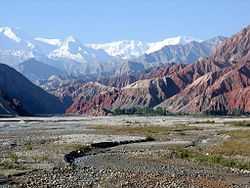

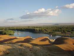

Xinjiang is the largest political subdivision of China—it accounts for more than one sixth of China's total territory and a quarter of its boundary length.
Mountain systems and basins
Xinjiang is split by the Tian Shan mountain range (Uyghur: تەڭرى تاغ, ULY: Tengri Tagh), which divides it into two large basins: the Dzungarian Basin in the north, and the Tarim Basin in the south. A small V-shaped wedge between these two major basins, limited by the Tian Shan's main range in the south and the Borohoro Mountains in the north, is the basin of the Ili River, which flows into Kazakhstan's Lake Balkhash; an even smaller wedge farther north is the Emin Valley.
Other major mountain ranges of Xinjiang include the Pamir Mountains and Karakoram in the southwest, the Kunlun Mountains in the south (along the border with Tibet), and the Altai Mountains in the northeast (shared with Mongolia). The region's highest point is the mountain K2, 8611 metres above sea level, in the Karakoram Mountains on the border with Pakistan.
Much of the Tarim Basin is dominated by the Taklamakan Desert. North of it is the Turpan Depression, which contains the lowest point in Xinjiang, and in the entire PRC, is the Turpan Depression, at 155 metres below sea level.
The Dzungarian Basin is slightly cooler, and receives somewhat more precipitation, than the Tarim Basin. Nonetheless, it, too, has a large Gurbantünggüt Desert (also known as Dzoosotoyn Elisen) in its center.
The Tian Shan mountain range marks the Xinjiang-Kyrgyzstan border at the Torugart Pass (3752 m). The Karakorum highway (KKH) links Islamabad, Pakistan with Kashgar over the Khunjerab Pass.
Geology

Most of Xinjiang is young geologically, having been formed from the collision of the Indian plate with the Eurasian plate, forming the Tian Shan, Kunlun Shan, and Pamir mountain ranges. Consequently, Xinjiang is a major earthquake zone. Older geological formations occur principally in the far north, where the Junggar Block is geologically part of Kazakhstan, and in the east, which is part of the North China Craton.
Center of the continent
Xinjiang has within its borders, in the Dzoosotoyn Elisen Desert, the location in Eurasia that is furthest from the sea in any direction (a continental pole of inaccessibility): 46°16.8′N 86°40.2′E / 46.2800°N 86.6700°E). It is at least 1,645 miles (2,647 km) (straight-line distance) from any coastline.
In 1992, local geographers determined another point within Xinjiang – 43°40′52″N 87°19′52″E / 43.68111°N 87.33111°E in the southwestern suburbs of Ürümqi, Ürümqi County – to be the "center point of Asia". A monument to this effect was then erected there and the site has become a local tourist attraction.[297]
Rivers and lakes
Due to the hot summer and low precipitation, most of Xinjiang is endorheic, i.e. its rivers either disappear in the desert, or terminate in salt lakes (within Xinjiang itself, or in the neighboring Kazakhstan), instead of flowing toward an ocean. The only exception is the northernmost part of the region, where the Irtysh River, originating in the Altai Mountains, flows (via Kazakhstan and Russia) toward the Arctic Ocean. Even then, a significant part of this river's waters is now artificially diverted, via the Irtysh–Karamay–Ürümqi Canal, to the drier areas of southern Dzungarian Basin.
Elsewhere, most of Xinjiang's rivers are comparatively short streams fed by the snows of the several ranges of the Tian Shan. Once they enter the populated areas in the mountains' foothills, their waters are extensively used for irrigation, so that the river often disappears in the desert instead of reaching the lake to whose basin it nominally belongs. This is the case even with the main river of the Tarim Basin, the Tarim, which has been dammed at a number of locations along its course, and whose waters have been completely diverted before they can reach the Lop Lake. In the Dzungarian basin, a similar situation occurs with most rivers that historically flowed into Lake Manas. Some of the salt lakes, having lost much of their fresh water inflow, are now extensively use for the production of mineral salts (used e.g., in the manufacturing of potassium fertilizers); this includes the Lop Lake and the Manas Lake.
Time
Officially, Xinjiang is on the same time zone as the rest of China, Beijing Time (UTC+8). However, being roughly two time zones west of the capital, some residents, local organization and local government follow their own unofficial Xinjiang Time (UTC+6).[298] The division follows ethnic lines, with Han tending to use Beijing Time and Uighurs tending to use Xinjiang Time; this is seen as a form of resistance to the central government.[299] Regardless of the ethnicity of their proprietors, most businesses and schools open and close according to Xinjiang time, i.e. two hours later than their equivalents in other regions of China.[300]
Deserts
Deserts include:
- Gurbantünggüt Desert, also known as Dzoosotoyn Elisen.
- Taklamakan Desert
- Kumtag Desert, east of Taklamakan.
Major cities
Due to the water situation, most of Xinjiang's population lives within fairly narrow belts that are stretched along the foothills of the region's mountain ranges, where irrigated agriculture can be practiced. It is in these belts where most the region's cities are found.
Climate
Generally, a semi-arid or desert climate (Köppen BSk or BWk, respectively) prevails in Xinjiang. The entire region is marked by great seasonal differences in temperature and cold winters. During the summer, the Turpan Depression usually records the hottest temperatures nationwide,[301] with air temperatures easily exceeding 40 °C (104 °F). In the far north, and at the highest mountain elevations, however, winter temperatures regularly drop below −20 °C (−4 °F).
Continuous permafrost is typically found in the Tian Shan starting at the elevation of about 3,500-3,700 m above the sea level. Discontinuous alpine permafrost usually occurs down to 2,700-3,300 m, but in certain locations, due to the peculiarity of the aspect and the microclimate, it can be found at elevations as low as 2,000 m.[302]
Bordering regions
- See the "Geographic location" template below.
Politics

List of Secretaries of the CPC Xinjiang Committee:
- 1949–1952 Wang Zhen (王震)
- 1952–1967 Wang Enmao (王恩茂)
- 1970–1972 Long Shujin (龙书金)
- 1972–1978 Saifuddin Azizi (赛福鼎•艾则孜)
- 1978–1981 Wang Feng (汪锋)
- 1981–1985 Wang Enmao (王恩茂)
- 1985–1994 Song Hanliang (宋汉良)
- 1994–2010 Wang Lequan (王乐泉)
- 2010–present Zhang Chunxian (张春贤)
List of Chairmen of the Xinjiang Government:
- 1955–1967 Saifuddin Azizi (赛福鼎•艾则孜)
- 1968–1972 Long Shujin (龙书金)
- 1972–1978 Saifuddin Azizi
- 1978–1979 Wang Feng (汪锋)
- 1979–1985 Ismail Amet (司马义•艾买提)
- 1985–1993 Tomur Dawamat (铁木尔•达瓦买提)
- 1993–2003 Abdul'ahat Abdulrixit (阿不来提•阿不都热西提)
- 2003–2007 Ismail Tiliwaldi (司马义•铁力瓦尔地)
- 2007–2015 Nur Bekri (努尔•白克力)
- 2015–present Shohrat Zakir (雪克来提·扎克尔)
Human rights
Chinese authorities shot dead several Uyghur terrorists in Xinjiang in the violent incident in February 2014.[303] Human Rights Watch has documented the denial of due legal process and fair trials and failure to hold genuinely open trials as mandated by law e.g. to suspects arrested following ethnic violence in the city of Urumqi in Xinjiang in 2009.[304]
Economy

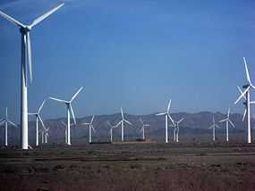
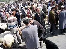

Traditionally an agricultural region, Xinjiang also has large deposits of minerals and oil.
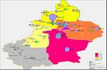
Xinjiang's nominal GDP was approximately 220 billion RMB (US$28 billion) in 2004 and increased to 657.4 billion RMB (US$104.3 billion) in 2011, due to exploration of the regions abundant reserves of coal, crude oil, and natural gas and the China Western Development policy introduced by the State Council to boost economic development in Western China.[305] Its per capita GDP for 2009 was 19,798 RMB (2,898 USD), with a growth rate of 1.7%.[305] Southern Xinjiang, with 95% non-Han population, has an average per capita income half that of Xinjiang as a whole.[306]
In July 2010, China Daily reported that:
Local governments in China's 19 provinces and municipalities, including Beijing, Shanghai, Guangdong, Zhejiang and Liaoning, are engaged in the commitment of "pairing assistance" support projects in Xinjiang to promote the development of agriculture, industry, technology, education and health services in the region.[307]
Agriculture and fishing
Xinjiang has long been a major area of irrigated agriculture. Traditionally, wheat was the main staple crop of the region; maize was grown as well; millet was found in the south, while only a few area (in particular, Aksu) grew rice.[308]
By the late 19th century, cotton became an important crop in several oases, notably Khotan, Yarkand, and Turpan.[308] Sericulture, too, is practiced.[309]
Xinjiang is nationally known for its fruits and produce, including grapes, melons, pears, walnuts. Particularly famous are Hami melons and Turpan raisins.
The main livestock of the region have traditionally been sheep. Much of the region's pasture land is in its northern part, where more precipitation is available,[310] but there are mountain pastures throughout the region.
Due to the lack of access to the ocean, and limited amount of inland water, Xinjiang's fish resources are somewhat limited. Nonetheless, there is a significant amount of fishing in Lake Ulungur and Lake Bosten and in the Irtysh River. A large number of fish ponds have been constructed since the 1970s, their total surface exceeding 10,00 hectares by the 1990s. In 2000, the total of 58,835 tons of fish was produced in Xinjiang, 85% of which came from aquaculture.[311]
In the past, the Lop Lake was known for its fisheries, and the area residents, for their fishing culture; now, due to the diversion of the waters of the Tarim River, the lake has dried out.
Mining and minerals
In the late 19th century the region was noted for producing salt, soda, borax, gold, jade and coal.[312]
The oil and gas extraction industry in Aksu and Karamay is booming, with the West–East Gas Pipeline connecting to Shanghai. The oil and petrochemical sector account for 60% of Xinjiang's local economy.[313]
Foreign trade
Xinjiang's exports amounted to 19.3 billion USD, while imports turned out to be 2.9 billion USD in 2008. Most of the overall import/export volume in Xinjiang was directed to and from Kazakhstan through Ala Pass. China's first border free trade zone (Horgos Free Trade Zone) was located at the Xinjiang-Kazakhstan border city of Horgos.[314] Horgos is the largest "land port" in China's western region and it has easy access to the Central Asian market. Xinjiang also opened its second border trade market to Kazakhstan in March 2006, the Jeminay Border Trade Zone.[315]
Economic and Technological Development Zones
- Bole Border Economic Cooperation Area[316]
- Shihezi Border Economic Cooperation Area[317]
- Tacheng Border Economic Cooperation Area[318]
- Urumqi Economic & Technological Development Zone is northwest of Urumqi. It was approved in 1994 by the State Council as a national level economic and technological development zones. It is 1.5 km (0.93 mi) from the Urumqi International Airport, 2 km (1.2 mi) from the North Railway Station, and 10 km (6.2 mi) from the city center. Wu Chang Expressway and 312 National Road passes through the zone. The development has unique resources and geographical advantages. Xinjiang's vast land, rich in resources, borders eight countries. As the leading economic zone, it brings together the resources of Xinjiang's industrial development, capital, technology, information, personnel and other factors of production.[319]
- Urumqi Export Processing Zone is in Urumuqi Economic and Technology Development Zone. It was established in 2007 as a state-level export processing zone.[320]
- Urumqi New & Hi-Tech Industrial Development Zone was established in 1992, and it is the only high-tech development zone in Xinjiang, China. There are more than 3470 enterprises in the zone, of which 23 are Fortune 500 companies. It has a planned area of 9.8 km2 (3.8 sq mi), and it is divided into 4 zones. There are plans to expand the zone.[321]
- Yining Border Economic Cooperation Area[322]
Culture
Language and demographics
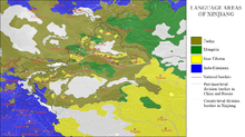

The earliest Tarim mummies, dated to 1800 BC, are of a Caucasoid physical type.[323] East Asian migrants arrived in the eastern portions of the Tarim Basin about 3,000 years ago, while the Uighur peoples arrived after the collapse of the Orkon Uighur Kingdom, based in modern-day Mongolia, around the year 842.[324][325]
Muslim Turkic peoples in Xinjiang include Uyghurs, Uzbeks, Kyrgyz, Tatars and the Kazakhs; Muslim Iranian peoples include Pamiris and the Sarikolis/Wakhis (often conflated as Pamiris); and Muslim Sino-Tibetan peoples such as the Hui. Other PRC ethnic groups in the region include Han, Mongols (Oirats, Dagur, Dongxiang), Russians, Xibes, and Manchus. Around 70,000 Russian immigrants were living in Xinjiang in 1945.[326]
The Han Chinese of Xinjiang arrived at different times, from different directions and social backgrounds: They are descendants of criminals and officials who had been exiled from China proper during the second half of the eighteenth and first half of the 19th centuries; descendants of families of military and civil officers from Hunan, Yunnan, Gansu and Manchuria; descendants of merchants from Shanxi, Tianjin, Hubei and Hunan and descendants of peasants who started immigrating into the region in 1776.[327]
Some Uighur scholars claim descent from both the Turkic Uighurs and the pre-Turkic Tocharians (or Tokharians, whose language was Indo-European), and relatively fair-skin, hair and eyes, as well as other so-called 'Caucasoid' physical traits, are not uncommon among them. In general Uyghurs resemble those peoples who live around them in Afghanistan, Kyrgyzstan, Uzbekistan, Kazakhstan, and Pakistan.
In 2002, there were 9,632,600 males (growth rate of 1.0%) and 9,419,300 females (growth rate of 2.2%). The population overall growth rate was 1.09%, with 1.63% of birth rate and 0.54% mortality rate.

The Qing began a process of settling Han, Hui, and Uyghur settlers into Northern Xinjiang (Dzungaria) starting in the 18th century. At the start of the 19th century, 40 years after the Qing reconquest, there were around 155,000 Han and Hui Chinese in northern Xinjiang and somewhat more than twice that number of Uyghurs in southern Xinjiang.[328] A census of Xinjiang under Qing rule in the early 19th century tabulated ethnic shares of the population as 30% Han and 60% Turkic, while it dramatically shifted to 6% Han and 75% Uyghur in the 1953 census. However, a situation similar to the Qing era-demographics with a large number of Han had been restored by 2000 with 40.57% Han and 45.21% Uyghur.[329] Professor Stanley W. Toops noted that today's demographic situation is similar to that of the early Qing period in Xinjiang.[103] Before 1831, only a few hundred Chinese merchants lived in southern Xinjiang oases (Tarim Basin) and only a few Uyghurs lived in northern Xinjiang (Dzungaria).[330] After 1831 the Qing permitted and encouraged Han Chinese migration into the Tarim basin in southern Xinjiang, although with very little success, and stationed permanent troops on the land there as well.[331] Political killings and expulsions of non Uyghur populations in the uprisings of the 1860s[331] and 1930s saw them experience a sharp decline as a percentage of the total population[332] though they rose once again in the periods of stability following 1880 (which saw Xinjiang increase its population from 1.2 million)[333][334] and 1949. From a low of 7% in 1953, the Han began to return to Xinjiang between then and 1964, where they comprised 33% of the population (54% Uyghur), similarly to Qing times. A decade later, at the beginning of the Chinese economic reform in 1978, the demographic balance was 46% Uyghur and 40% Han;[329] this has not changed drastically until the last census in 2000, with the Uyghur population reduced to 42%.[335] Military personnel are not counted and national minorities are undercounted in the Chinese census, as in most censuses.[336] While some of the shift has be attributed to an increased Han presence,[337] Uyghurs have also emigrated to other parts of China, where their numbers have increased steadily. Uyghur independence activists express concern over the Han population changing the Uyghur character of the region, though the Han and Hui Chinese mostly live in northern Xinjiang Dzungaria, and are separated from areas of historical Uyghur dominance south of the Tian Shan mountains (southwestern Xinjiang), where Uyghurs account for about 90% of the population.[338]
In general, Uyghurs are the majority in southwestern Xinjiang, including the prefectures of Kashgar, Khotan, Kizilsu, and Aksu (about 80% of Xinjiang's Uyghurs live in those four prefectures), as well as Turpan prefecture in eastern Xinjiang. Han are the majority in eastern and northern Xinjiang (Dzungaria), including the cities of Urumqi, Karamay, Shihezi and the prefectures of Changjyi, Bortala, Bayin'gholin, Ili (especially the cities of Kuitun), and Kumul. Kazakhs are mostly concentrated in Ili prefecture in northern Xinjiang. Kazakhs are the majority in the northernmost part of Xinjiang.
| Ethnic groups in Xinjiang. 根据2009年底人口抽查统计 [339] | ||
|---|---|---|
| Nationality | Population | Percentage |
| Uyghur | 10,019,758 | 46.42% |
| Han | 8,416,867 | 38.99% |
| Kazakh | 1,514,814 | 7.02% |
| Hui | 980,359 | 4.54% |
| Kirghiz | 189,309 | 0.88% |
| Mongols Dongxiangs Daurs | 179,615 | 0.83% |
| Pamiris | 39,493 | 0.21% |
| Xibe | 42,790 | 0.20% |
| Manchu | 26,195 | 0.11% |
| Tujia | 15,787 | 0.086% |
| Uzbek | 16,669 | 0.066% |
| Russian | 11,672 | 0.048% |
| Miao | 7,006 | 0.038% |
| Tibetan | 6,153 | 0.033% |
| Zhuang | 5,642 | 0.031% |
| Tatar | 4,883 | 0.024% |
| Salar | 3,762 | 0.020% |
| Major ethnic groups in Xinjiang by region (2000 census)[notes 1] P = Prefecture; AP = Autonomous prefecture; PLC = Prefecture-level city; DACLC = Directly administered county-level city.[340] | ||||
|---|---|---|---|---|
| Uyghurs (%) | Han (%) | Kazakhs (%) | others (%) | |
| Xinjiang | 43.6 | 40.6 | 8.3 | 7.5 |
| Ürümqi PLC | 11.8 | 75.3 | 3.3 | 9.6 |
| Karamay PLC | 13.8 | 78.1 | 3.7 | 4.5 |
| Turpan Prefecture | 70.0 | 23.3 | < 0.1 | 6.6 |
| Kumul Prefecture | 18.4 | 68.9 | 8.8 | 3.9 |
| Changji AP + Wujiaqu DACLC | 3.9 | 75.1 | 8.0 | 13.0 |
| Bortala AP | 12.5 | 67.2 | 9.1 | 11.1 |
| Bayin'gholin AP | 32.7 | 57.5 | < 0.1 | 9.7 |
| Aksu Prefecture + Aral DACLC | 71.8 | 26.6 | 0.1 | 1.4 |
| Kizilsu AP | 64.0 | 6.4 | < 0.1 | 29.6 |
| Kashgar Prefecture + Tumushuke DACLC | 89.3 | 9.2 | < 0.1 | 1.5 |
| Khotan Prefecture | 96.4 | 3.3 | < 0.1 | 0.2 |
| Ili AP[notes 2] | 16.1 | 44.4 | 25.6 | 13.9 |
| – Kuitun DACLC | 0.5 | 94.6 | 1.8 | 3.1 |
| – former Ili Prefecture | 27.2 | 32.4 | 22.6 | 17.8 |
| – Tacheng Prefecture | 4.1 | 58.6 | 24.2 | 13.1 |
| – Altay Prefecture | 1.8 | 40.9 | 51.4 | 5.9 |
| Shihezi DACLC | 1.2 | 94.5 | 0.6 | 3.7 |
Religion

Xinjiang is home to several distinct ethnic groups of various religious traditions. A majority of the region's native population adhere to Sunni Islam of the Hanafi school of jurisprudence or madhab. A large minority of Shias, almost exclusively of the Ismaili (Seveners) rites are found in the higher mountains of Pamir and Tian Shan. In the western mountains (the Pamirs), almost the entire population of Pamirs, Sarikulis and Wakhis are Ismaili Shia. In the north, in the Tian Shan, it is the Kyrgyz and Kazakhs who practice Ismaili Shiism[5]
Afaq Khoja Mausoleum and Id Kah Mosque in Kashgar are among the most important Islamic sites in Xinjiang. Emin Minaret is a key Islamic site, in Turfan. Bezeklik Thousand Buddha Caves is a major Buddhist site.
Media
The Xinjiang Networking Transmission Limited operates the Urumqi People Broadcasting Station and the Xinjiang People Broadcasting Station, broadcasting in Mandarin, Uyghur, Kazakh and Mongolian.
In 1995, there were 50 minority-language newspapers published in Xinjiang, including the Qapqal News, the world's only Xibe-language newspaper.[341] The Xinjiang Economic Daily is considered one of China's most dynamic newspapers.[342]
For a time after the July 2009 riots, authorities placed restrictions on the internet and text messaging, gradually permitting access to websites like Xinhua's,[343] until restoring Internet to the same level as the rest of China on May 14, 2010.[344][345][346]
Sports
Xinjiang is home to the Xinjiang Guanghui Flying Tigers professional basketball team of the Chinese Basketball Association.
The capital, Urumqi, is home to the Xinjiang University baseball team, an integrated Uyghur and Han group profiled in the documentary film Diamond in the Dunes.
Transportation

Roads

In 2008, according to the Xinjiang Transportation Network Plan, the government has focused construction on State Road 314, Alar-Hotan Desert Highway, State Road 218, Qingshui River Line-Yining Highway, and State Road 217, as well as other roads.
The construction of the first expressway in the mountainous area of Xinjiang began a new stage in its construction on July 24, 2007. The 56 km (35 mi) highway linking Sayram Lake and Guozi Valley in Northern Xinjiang area had cost 2.39 billion yuan. The expressway is designed to improve the speed of national highway 312 in northern Xinjiang. The project started in August 2006 and several stages have been fully operational since March 2007. Over 3,000 construction workers have been involved. The 700 m-long Guozi Valley Cable Bridge over the expressway is now currently being constructed, with the 24 main pile foundations already completed. Highway 312 national highway Xinjiang section, connects Xinjiang with China's east coast, central and western Asia, plus some parts of Europe. It is a key factor in Xinjiang's economic development. The population it covers is around 40 percent of the overall in Xinjiang, who contribute half of the GDP in the area.
Rail
Xinjiang's rail hub is Ürümqi. To the east, a conventional and a high-speed rail line to Lanzhou in Gansu Province connects Turpan and Hami. To the west, the Northern Xinjiang runs along the northern footslopes of the Tian Shan range through Changji, Shihezi, Kuytun and Jinghe to the Kazakh border at Alashankou, where it links up with the Turkestan-Siberia Railway. Together, the Northern Xinjiang and the Lanzhou-Xinjiang lines form part of the Trans-Eurasian Continental Railway, which extends from Rotterdam, on the North Sea, to Lianyungang, on the East China Sea.
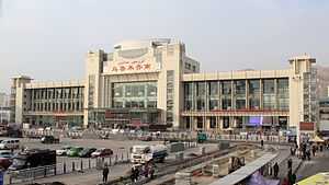
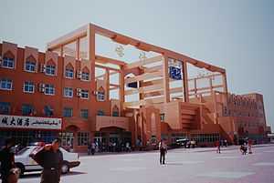


The Second Ürümqi-Jinghe Railway provides additional rail transport capacity to Jinghe, from which the Jinghe-Yining-Horgos Railway heads into the Ili River Valley to Yining, Huocheng, and Khorgos, a second rail border crossing with Kazakhstan. The Kuytun-Beitun Railway runs from Kuytun north into the Junggar Basin to Karamay and Beitun, near Altay.
In the south, the Southern Xinjiang Line from Turpan runs southwest along the southern footslopes of the Tian Shan into the Tarim Basin, with stops at Yanqi, Korla, Kuqa, Aksu, Maralbexi (Bachu), Artux, and Kashgar. From Kashgar, the Kashgar-Hotan Railway, follows the southern rim of the Tarim to Hotan, with stops at Shule, Akto, Yengisar, Shache (Yarkant), Yecheng (Karghilik), Moyu (Karakax).
The Ürümqi-Dzungaria Railway connects Ürümqi with coal fields in the eastern Junggar Basin. The Hami–Lop Nur Railway connects Hami with potassium salt mines in and around Lop Nur.
As of January 2015, two other rail links with the rest of China are under construction, the Ejin–Hami Railway to Inner Mongolia and the Golmud-Korla Railway to Qinghai. Railways to Pakistan and Kyrgyzstan have been proposed.
East Turkestan independence movement
Some people in Xinjiang province of Uyghur ethnicity are struggling to establish an independent country, which has caused tension and ethnic strife in Xinjiang province.[347][348][349] The Xinjiang conflict[350] is an ongoing[351] separatist struggle in the northwestern part of China. The separatist movement claims that the region, which they view as their fatherland and refer to as East Turkestan, is not part of China, but was invaded by China in 1949 and has been under Chinese occupation since then. China claims that the region has been part of China since ancient times, and now calls it Xinjiang ("New Territory" or, officially, "old territory returned to the motherland")[352] province. The separatist movement is led by ethnically Uighur Muslim underground organizations, most notably the East Turkestan independence movement, against the Chinese government. According to the Asia-Pacific Center for Security Studies, the two main sources for separatism in the Xinjiang Province are religion and ethnicity. Religiously, the Uighur peoples of Xinjiang follow Islam, while in the large cities of Han China, the primary religions practiced are Buddhism, Confucianism, Taoism or a combination of the three, though the government of the People's Republic of China does not formally endorse or support any religious practices. The other major difference—and source of friction—with Eastern China is ethnicity. The Uyghurs are ethnically, linguistically, and culturally Turkic, a clear distinction from the Han and other ethnicities that are majority in the eastern regions of China. Hence, there is a noticeable voice of ethnic Uyghurs who would like to separate their region from China. In retaliation against separatists, China has engaged in "strike hard" campaigns since 1996.[353] On June 5, 2014, China sentenced 9 persons to death for terrorist attacks - they were seeking to overthrow Chinese rule, inspired by global jihadi ideology, in Xinjiang.[354]
See also
- List of universities and colleges in Xinjiang
- Cotton industry in China
- Xinjiang coins
- Xinjiang cuisine
- Tibet
- Ningxia
- Inner Mongolia
- Guangxi
- Xinjiang conflict
- Xinjiang Wars
- East Turkestan
- East Turkestan independence movement
- Affirmative action in China
Notes
- ↑ Does not include members of the People's Liberation Army in active service.
- ↑ Ili AP is composed of Kuitun DACLC, Tacheng Prefecture, Aletai Prefecture, as well as former Ili Prefecture. Ili Prefecture has been disbanded and its former area is now directly administered by Ili AP.
References
Citations
- ↑ "Doing Business in China - Survey". Ministry Of Commerce - People's Republic Of China. Retrieved 5 August 2013.
- ↑ Susan M. Walcott; Corey Johnson (November 1, 2013). "Where Inner Asia Meets Outer China: The Xinjiang Uyghur Autonomous Region of China". Eurasian Corridors of Interconnection: From the South China to the Caspian Sea. Routledge. pp. 64–65.
- ↑ 《2013中国人类发展报告》 (PDF) (in Chinese). United Nations Development Programme China. 2013. Retrieved 2014-05-14.
- ↑ Xinjang Uyĝur Aptonom Rayoni in SASM/GNC romanization
- ↑ 5.0 5.1 BBC Regions and territories: Xinjiang
- ↑ "Turkestan". Catholic Encyclopedia XV. New York: Robert Appleton Company. 1912. Retrieved November 26, 2008.
- ↑ Xinjiang Sees Annual Population Growth of 340,000
- ↑ Susan Whitfield (2004). The Silk Road: trade, travel, war and faith. Serindia Publications. p. 27.
- ↑ Hill (2009), pp. xviii, 60.
- ↑ Tyler (2003), p. 3.
- ↑ "Cultivating and Guarding the West Regions: the Establishment of Xinjiang Province" (in Chinese). China Central Television. December 6, 2004. Retrieved August 27, 2009.
- ↑ Bellér-Hann 2007, p. 34.
- ↑ Liu & Faure 1996, p. 69.
- ↑ Liu & Faure 1996, p. 70.
- ↑ Liu & Faure 1996, p. 67.
- ↑ Liu & Faure 1996, p. 77.
- ↑ Liu & Faure 1996, p. 78.
- ↑ J.P. Mallory and Victor H. Mair The Tarim Mummies, p. 55, ISBN 0-500-05101-1. "The strange creatures of the Shanhai jing: (...) we find recorded north of the territory of the "fish dragons" the land of the Bai, whose bodies are white and whose long hair falls on their shoulders. "
- ↑ The Mummies of Xinjiang. DISCOVER Magazine. April 1, 1994.
- ↑ Saiget, Robert J. (April 19, 2005). "Caucasians preceded East Asians in basin". The Washington Times (News World Communications). Archived from the original on April 20, 2005. Retrieved August 20, 2007.
A study last year by Jilin University also found that the mummies' DNA had Europoid genes.
- ↑ Iaroslav Lebedynsky, Les Saces, ISBN 2-87772-337-2, p59.
- ↑ Michael Dillon, China: A Historical and Cultural Dictionary.
- ↑ Liu (2001), pp. 267–268
- ↑ Watson, Burton. Trans. 1993. Records of the Grand Historian of China: Han Dynasty II. Translated from the Shiji of Sima Qian. Chapter 123: "The Account of Dayuan," Columbia University Press. Revised Edition. ISBN 0-231-08166-9; ISBN 0-231-08167-7 (pbk.), p. 234.
- ↑ 25.0 25.1 Bovingdon 2010, pp. 25, 30–31
- ↑ Bovingdon 2010, pp. 25–26
- ↑ Bovingdon 2010, p. 28
- ↑ C.Michael Hogan (2007). Andy Burnham, ed. Silk Road, North China. The Megalithic Portal (The Megalithic Portal and Megalith Map). Retrieved November 26, 2008.
- ↑ E. de la Vaissière, "The triple system of orography in Ptolemy's Xinjiang", in Exegisti monumenta Festschrift in Honour of Nicholas Sims-Williams, Harrassowitz, 2009
- ↑ Ebrey, Patricia Buckley (2010). The Cambridge Illustrated History of China. Cambridge University Press. p. 111. ISBN 978-0-521-12433-1.
- ↑ 31.0 31.1 Twitchett, Denis; Wechsler, Howard J. (1979). "Kao-tsung (reign 649-83) and the Empress Wu: The Inheritor and the Usurper". In Denis Twitchett; John Fairbank. The Cambridge History of China, Volume 3: Sui and T'ang China Part I. Cambridge University Press. p. 228. ISBN 978-0-521-21446-9.
- ↑ 32.0 32.1 32.2 Skaff, Jonathan Karem (2009). Nicola Di Cosmo, ed. Military Culture in Imperial China. Harvard University Press. pp. 183–185. ISBN 978-0-674-03109-8.
- ↑ Skaff, Jonathan Karam (2012). Sui-Tang China and Its Turko-Mongol Neighbors: Culture, Power, and Connections, 580-800. Oxford University Press. p. 190. ISBN 978-0-19-973413-9.
- ↑ 34.0 34.1 34.2 Millward, James A. (2007). Eurasian Crossroads: A History of Xinjiang. Columbia University Press. pp. 33–42. ISBN 978-0-231-13924-3.
- ↑ Lewis, Mark Edward (2009). China's Cosmopolitan Empire: The Tang Dynasty. Harvard University Press. pp. 152–153. ISBN 978-0-674-05419-6.
- ↑ Svatopluk Soucek (2000). "Chapter 5 - The Qarakhanids". A history of Inner Asia. Cambridge University Press. ISBN 0-521-65704-0.
- ↑ Grousset, Rene (1970). The Empire of the Steppes: A History of Centra Asia (pages 491–501). Rutgers University Press. ISBN 0-8135-0627-1.
- ↑ Millward 2007, p. 86.
- ↑ Millward 2007, p. 87.
- ↑ Millward 2007, p. 88.
- ↑ ed. Starr 2004, p. 50.
- ↑ Kim 2008, p. 117
- ↑ Millward 2007, p. 90.
- ↑ Millward 2007, p. 92.
- ↑ Millward (2007), p.98
- ↑ Wei Yuan, 聖武記 Sheng Wu Ji, vol. 4.
- ↑ Chu, Wen-Djang (1966). The Moslem Rebellion in Northwest China 1862–1878. Mouton & co.. p. 1.
- ↑ Tyler (2003), p. 55
- ↑ Zhao 2006, pp. 11,12, 13.
- ↑ 50.0 50.1 Dunnell 2004, p. 77.
- ↑ 51.0 51.1 Dunnell 2004, p. 83.
- ↑ 52.0 52.1 Elliott 2001, p. 503.
- ↑ Dunnell 2004, pp. 76-77.
- ↑ Millward 1998, p. 4.
- ↑ Zhao 2006, p. 4.
- ↑ Zhao 2006, pp. 11-12.
- ↑ Zhao 2006, p. 18.
- ↑ Zhao 2006, p. 19.
- ↑ Zhao 2006, p. 25.
- ↑ Millward 1998, p. 25.
- ↑ Millward 1998, p. 245.
- ↑ Millward 1998, pp. 20-1.
- ↑ Millward 2007, p. 356.
- ↑ Millward 2007, pp. 97-8.
- ↑ Liu & Faure 1996, p. 68.
- ↑ Newby 2005, p. 254.
- ↑ Newby 2005, p. 13.
- ↑ 68.0 68.1 Newby 2005, p. 111.
- ↑ Newby 2005, p. 112.
- ↑ 70.0 70.1 Newby 2005, p. 2.
- ↑ Chapters 3–7 of Perdue 2005 describe the rise and fall of the Dzungar empire and its relations with other Mongol tribes, the Qing dynasty, and the Russian empire.
- ↑ Clarke 2004, p. 37.
- ↑ Millward 2007, p. 95.
- ↑ Crowe 2014, p. 31.
- ↑ Crowe 2014, p. 32.
- ↑ Roberts 2011, p. 152.
- ↑ Nan & Mampilly & Bartoli 2011, p. 219.
- ↑ Nan & Mampilly & Bartoli 2011, p. 219.
- ↑ Shelton 2005, p. 1183.
- ↑ Westad 2012, p. .
- ↑ 大清高宗純皇帝實錄, 乾隆二十四年
- ↑ 平定準噶爾方略
- ↑ 83.0 83.1 83.2 83.3 83.4 Perdue 2009, p. 285.
- ↑ Perdue 2005, p. 285.
- ↑ ed. Starr 2004, p. 54.
- ↑ Wei Yuan, 聖武記 Military history of the Qing Dynasty, vol.4. “計數十萬戶中,先痘死者十之四,繼竄入俄羅斯哈薩克者十之二,卒殲於大兵者十之三。除婦孺充賞外,至今惟來降受屯之厄鲁特若干戶,編設佐領昂吉,此外數千里間,無瓦剌一氊帳。”
- ↑ Lattimore 1950, p. 126.
- ↑
- ↑ Powers & Templeman 2012, p. 537.
- ↑ Archived 11 February 2011 at WebCite
- ↑ Lorge 2006, p. 165.
- ↑ Kim 2008, p. 308
- ↑ Kim 2008, p. 134
- ↑ Kim 2008, p. 49
- ↑ Kim 2008, p. 139.
- ↑ Tyler 2004, p. 55.
- ↑ Perdue 2005, pp. 283-285.
- ↑ Dr. Mark Levene, Southampton University, see "Areas where I can offer Postgraduate Supervision". Retrieved 2009-02-09.
- ↑ Moses 2008, p. 188
- ↑ Theobald 2013, p. 21.
- ↑ Tamm 2013,
- ↑ Tyler 2004, p. 4.
- ↑ 103.0 103.1 ed. Starr 2004, p. 243.
- ↑ Millward 1998, p. 102.
- ↑ 105.0 105.1 Liu & Faure 1996, p. 71.
- ↑ Liu & Faure 1996, p. 72.
- ↑ Liu & Faure 1996, p. 76.
- ↑ Marks 2011, p. 192.
- ↑ Newby 2005, p. 1.
- ↑ Millward (2007), p. 104
- ↑ Zhao 2006, pp. 12-13.
- ↑ 112.0 112.1 Michell 1870, p. 2.
- ↑ 113.0 113.1 Martin 1847, p. 21.
- ↑ Fisher 1852, p. 554.
- ↑ The Encyclopaedia Britannica: A Dictionary of Arts, Sciences, and General Literature, Volume 23 1852, p. 681.
- ↑ Millward 2007, p. 97.
- ↑ 117.0 117.1 Millward 1998, p. 21.
- ↑ Bulletin de la Section de géographie, Volume 10 1896, p. 122.
- ↑ 119.0 119.1 Bridgman & Williams 1837, p. 273.
- ↑ 120.0 120.1 The Chinese Repository, Volume 5 1837, p. 273.
- ↑ Mentelle, Edme; Brun, Malte 1804, p. 144.
- ↑ Mentelle, Edme; Brun, Malte 1804, p. 160.
- ↑ 123.0 123.1 123.2 Millward 1998, p. 23.
- ↑ Millward 1998, p. 24.
- ↑ Millward 1998, p. 126.
- ↑ Millward 2007, p. 98.
- ↑ Clarke 2011, p. 20.
- ↑ Millward 2007, p. 101.
- ↑ Perdue 1996, p. 773.
- ↑ Millward 1998, p. 77.
- ↑ Millward 1998, p. 79.
- ↑ Perdue 2009, p. 351.
- ↑ Perdue 2009, p. 352.
- ↑ Perdue 2009, p. 339.
- ↑ Millward 2007, p. 118.
- ↑ Millward 2007, p. 93.
- ↑ Pollard 2011, p. 188.
- ↑ Walcott 2013, p. 57.
- ↑ Journal of the North-China Branch of the Royal Asiatic Society, Volume 10 1876, p. 218.
- ↑ Royal Asiatic Society of Great Britain and Ireland. North China Branch, Shanghai 1876, p. 218.
- ↑ Bretschneider 1876, p. 144.
- ↑ Linguistic Typology, Volume 2 1998, p. 202.
- ↑ Rahul 2000, p. 97.
- ↑ Prakash 1963, p. 219.
- ↑ Islamic Culture, Volumes 27-29 1971, p. 229.
- ↑ Rudelson 1997, p. 29.
- ↑ Rudelson 1997, p. 29.
- ↑ Rudelson 1992, p. 87.
- ↑ Juntunen 2013, p. 128.
- ↑ Tyler 2004, p. 67.
- ↑ Rudelson 1997, p. 162.
- ↑ Dwyer 2007, p. 79.
- ↑ Gorelova, Liliya. "Past and Present of a Manchu Tribe: The Sibe". In Atabaki, Touraj; O'Kane, John. Post-Soviet Central Asia. Tauris Academic Studies. pp. 325–327.
- ↑ Gorelova 2002, p. 37.
- ↑ Gorelova 2002, p. 37.
- ↑ Gorelova 2002, p. 37.
- ↑ Gernet 1996, p. 488.
- ↑ Debata 2007, p. 59.
- ↑ Benson 1998, p. 21.
- ↑ Millward 2007, p. 306.
- ↑ Parker 2010, p. 140.
- ↑ Millward 1998, p. 51.
- ↑ 163.0 163.1 Bovingdon 2010, p. 197
- ↑ ed. Fairbank 1978, p. 72.
- ↑ Seymour & Anderson 1999, p. 13.
- ↑ Millward 1998, p. 133.
- ↑ Millward 1998, p. 134.
- ↑ Millward 2007, p. 104.
- ↑ Millward 2007, p. 113.
- ↑ The Kalmyk People: A Celebration of History and Culture
- ↑ History of Kalmykia
- ↑ Dunnell 2004, p. 103.
- ↑ Millward 1998, p. 139.
- ↑ Millward 1998, p. 305.
- ↑ Yakub Beg-Britannica
- ↑ Ho-dong Kim(2004),p.71.
- ↑ Great Britain. Parliament. House of Commons (1871). Accounts and papers of the House of Commons. Ordered to be printed. p. 34. Retrieved December 28, 2010. (original from Oxford University) August 10, 1871.
- ↑ Yakub Beg (Pamiri adventurer). Britannica Online Encyclopedia.
- ↑ Mesny (1905), p. 5.
- ↑ Tyler (2003), p. 61.
- ↑ 从“斌静案”看清代驻疆官员与新疆的稳定
- ↑ Millward 2007, p. 97.
- ↑ Kim 2004, p. 218.
- ↑ Kim 2004, p. 15.
- ↑ Newby 2005, p. 5.
- ↑ Inner Asia, Volume 4, Issues 1-2 2002, p. 127.
- ↑ Millward 2007, p. 151.
- ↑ Millward 2007, p. 152.
- ↑ Governors of Xinjiang: Yang Zengxin (1912–1928), Jin Shuren (1928–33), Sheng Shicai (1933–44) .
- ↑ Znamenski 2011, pp. 27, 28, 29.
- ↑ Universität Bonn. Ostasiatische Seminar 1982. p. 164.
- ↑ Lattimore & Nachukdorji 1955, p. 57.
- ↑ Croner 2009, p. 11.
- ↑ Croner 2010, p. 11.
- ↑ Pegg 2001, p. 268.
- ↑ ed. Sinor 1990, p. 5.
- ↑ Baabar 1999, p. 139.
- ↑ Baabar, Bat-Ėrdėniĭn Baabar 1999, p. 139.
- ↑ Mongolia Society 1970, p. 17.
- ↑ Mongolia Society 1970, p. 17.
- ↑ Perdue 2009, p. 493.
- ↑ Palmer 2011, p. 59.
- ↑ Dupree & Naby 1994, p. 55.
- ↑ Znamenski 2011, p. 40.
- ↑ Znamenski 2011, p. 41.
- ↑ Andreyev 2003, p. 139.
- ↑ Andreyev 2014, p. 285,
- ↑ Znamenski 2011, p. 138.
- ↑ Znamenski 2011, p. 141.
- ↑ Sanders 2010, p. 188.
- ↑ Morozova 2009, p. 39.
- ↑ Paine 1996, pp. 316-7.
- ↑ Andreyev 2014, p. 274.
- ↑ Andreyev 2014, p. 275.
- ↑ Diana Lary (1974). Region and nation: the Kwangsi clique in Chinese politics, 1925–1937 (illustrated ed.). Cambridge University Press. p. 124. ISBN 0-521-20204-3. Retrieved June 28, 2010. (Cambridge Studies in Chinese history, literature and institutions; Soviet and East European Studies)
- ↑ 216.0 216.1 R. Michael Feener, "Islam in World Cultures: Comparative Perspectives", ABC-CLIO, 2004, ISBN 1-57607-516-8
- ↑ 217.0 217.1 217.2 "Uighurs and China's Xinjiang Region". cfr.org. Retrieved July 20, 2009.
- ↑ Millward, James A. (2007). Eurasian crossroads: A history of Xinjiang. ISBN 978-0-231-13924-3. p.24
- ↑ Dilemmas of Victory, Jeremy Brown, Harvard University Press, Mar. 15, 2010, pp186
- ↑ "Uyghur Protests Widen as Xinjiang Unrest Flares". axisoflogic.com. Retrieved July 20, 2009.
- ↑ Bovingdon 2010, p. 199
- ↑ Bovingdon 2010, pp. 43–46
- ↑ Hopper & Webber 2009, p. 176
- ↑ Did China's Nuclear Tests Kill Thousands and Doom Future Generations?. Scientific American.
- ↑ Lop Nur, Encyclopædia Britannica (Online). Retrieved November 27, 2009.
- ↑ China Youth Daily (Qingnian Cankao or Elite Reference), August 7, 2009. Hardcopy article (site).
- ↑ Britannica Educational Publishing 2010.
- ↑ Pletcher 2011, p. 318.
- ↑ Falkenheim 2011, p. 2.
- ↑ Martyn 1978, p. 358.
- ↑ Ethnological information on China 196?, p. 2.
- ↑ Ethnological information on China 196?, p. 7.
- ↑ Rudelson 1997, p. 38.
- ↑ Nyman 1977, p. 12.
- ↑ Harris 2004, p. 42.
- ↑ Guo 2007, p. 220.
- ↑ Guo 2009, p. 164.
- ↑ Howell 2009, p. 37.
- ↑ 239.0 239.1 Sautman 2000, p. 241
- ↑ Starr 2004, p. 138.
- ↑ Starr 2004, p. 139.
- ↑ Forbes 1986, p. 188.
- ↑ Dickens, 1990.
- ↑ Bovingdon 2010, pp. 141–142
- ↑ Dillon 2003, p. 57.
- ↑ Clarke 2011, p. 69.
- ↑ Dillon 2008, p. 147.
- ↑ Nathan 2008.
- ↑ Reed 2010, p. 37.
- ↑ Ryan 1969, p. 3.
- ↑ 251.0 251.1 Tinibai 2010, Bloomberg Businessweek p. 1
- ↑ Tinibai 2010, gazeta.kz.
- ↑ Tinibai 2010, Transitions Online.
- ↑ Burns, 1983.
- ↑ Bellér-Hann 2007, p. 37.
- ↑ Bellér-Hann 2007, p. 38.
- ↑ Bellér-Hann 2007, p. 39.
- ↑ Bellér-Hann 2007, p. 40.
- ↑ Bellér-Hann 2007, p. 41.
- ↑ Wong 2002, p. 172.
- ↑ Liew 2004, p. 175.
- ↑ Wang 2008, p. 240.
- ↑ Bellér-Hann 2007, p. 42.
- ↑ Bellér-Hann 2007, p. 33.
- ↑ Bellér-Hann 2007, p. 4.
- ↑ Clarke 2011, p. 76.
- ↑ Radio war aims at China Moslems 1981, p. 11.
- ↑ Meehan 1980.
- ↑ Clarke 2011, p. 78.
- ↑ Starr 2004, p. 149.
- ↑ Starr 2004, p. 158.
- ↑ Hopper & Webber 2009, pp. 173–175
- ↑ Bovingdon 2010, p. 53
- ↑ Bovingdon 2010, p. 56
- ↑ Sautman 2000, p. 424
- ↑ Sautman 2000, p. 246
- ↑ 277.0 277.1 Sautman 2000, p. 257
- ↑ Wayne 2007, p. 46.
- ↑ Millward 2007, p. 341.
- ↑ Hopper & Webber 2009, pp. 178–179
- ↑ Hopper & Webber 2009, p. 184
- ↑ Hopper & Webber 2009, pp. 187–188
- ↑ Bovingdon 2010, p. 11
- ↑ "China confirms 22 killed in riots". Bangor Daily News. Associated Press. April 23, 1990.
- ↑ "China: Human Rights Concerns in Xinjiang". Human Rights Watch. October 17, 2001. Retrieved November 26, 2008.
- ↑ Rudelson, Justin Ben-Adam (February 16, 2000). "Uyghur "separatism": China's policies in Xinjiang fuel dissent". Central Asia-Caucasus Institute Analyst. Retrieved January 29, 2010.
- ↑ Gunaratna, Rohan; Pereire, Kenneth George (2006). "An al-Qaeda associate group operating in China?" (PDF). China and Eurasia Forum Quarterly 4 (2): 59.
Since the Ghulja Incident, numerous attacks including attacks on buses, clashes between ETIM militants and Chinese security forces, assassination attempts, attempts to attack Chinese key installations and government buildings have taken place, though many cases go unreported.
- ↑ "Chinese police destroy terrorist camp in Xinjiang, one policeman killed". CCTV International. October 1, 2007. Retrieved November 26, 2008.
- ↑ Elizabeth Van Wie Davis, "China confronts its Uyghur threat," Asia Times Online, April 18, 2008.
- ↑ Jacobs, Andrew (August 5, 2008). "Ambush in China Raises Concerns as Olympics Near". The New York Times. Retrieved March 27, 2010.
- ↑ "Waterhouse Caulfield Cup breakthrough".
- ↑ "China prosecuted hundreds over Xinjiang unrest". The Guardian (London). January 17, 2011. Retrieved January 18, 2011.
- ↑ "55 people sentenced in mass trial in China's Xinjiang". China National News. Retrieved 28 May 2014.
- ↑ "VI. Progress in Education, Science and Technology, Culture and Health Work". History and Development of Xinjiang. State Council of the People's Republic of China. May 26, 2003. Retrieved December 31, 2010.
- ↑ References and details on data provided in the table can be found in the individual provincial articles.
- ↑ Zhōngguó dìmínglù 中国地名录 (Beijing, SinoMaps Press 中国地图出版社 1997); ISBN 7-5031-1718-4.
- ↑ 43° 40’ 52”N 87° 19’ 52” E Geographic Center of Asia - The Heart of Asia (亚洲之心) – Xinjiang (新疆), China
- ↑ Xinjiang time
- ↑ Han, Enze (2010), "Boundaries, Discrimination, and Interethnic Conflict in Xinjiang, China", International Journal of Conflict and Violence 4 (2): 251
- ↑ Clocks square off in China's far west
- ↑ Weather China
- ↑ Gorbunov, A.P. (1993), "Geocryology in Mt. Tianshan", PERMAFROST: Sixth International Conference. Proceedings. July 5-9, Beijing, China 2, South China University of Technology Press, pp. 1105–1107, ISBN 7-5623-0484-X
- ↑ Chinese police shoot dead 'terrorists' in Xinjiang, says state media The Guardian 13 February 2014
- ↑ China Promises Unfulfilled, An Assessment of China’s National Human Rights Action Plan 2011 Human Rights Watch
- ↑ 305.0 305.1 Xinjiang Province: Economic News and Statistics for Xinjiang's Economy
- ↑ Millward (2007), p. 305
- ↑ "Efforts to boost 'leapfrog development' in Xinjiang". China Daily / Xinhua. July 5, 2010. Retrieved July 14, 2010.
- ↑ 308.0 308.1 Bellér-Hann, Ildikó (2008), Community Matters in Xinjiang, 1880-1949: Towards a Historical Anthropology of the Uyghur, BRILL, pp. 112–113, ISBN 9004166750
- ↑ Bellér-Hann 2008, p. 152
- ↑ Bellér-Hann 2008, p. 37
- ↑ Guo Yan, FISHERIES DEVELOPMENT IN XINJIANG, CHINA
- ↑ Mesny (1899), p. 386.
- ↑ Alain Charles (2005). The China Business Handbook (8th ed.). ISBN 978-0-9512512-8-7.
- ↑ "Work on free trade zone on the agenda". People's Daily Online. November 2, 2004. Retrieved November 26, 2008.
- ↑ "Xinjiang to open 2nd border trade market to Kazakhstan". Xinhua. December 12, 2006. Retrieved November 26, 2008.
- ↑ RightSite.asia | Bole Border Economic Cooperation Area
- ↑ RightSite.asia | Shihezi Border Economic Cooperation Area
- ↑ RightSite.asia | Tacheng Border Economic Cooperation Area
- ↑ RightSite.asia | Urumqi Economic & Technological Development Zone
- ↑ RightSite.asia | Urumqi Export Processing Zone
- ↑ RightSite.asia | Urumuqi Hi-Tech Industrial Development Zone
- ↑ RightSite.asia | Yining Border Economic Cooperation Area
- ↑ Mallory, J. P.; Mair, Victor H. (2000). "The Tarim Mummies: Ancient China and the Mystery of the Earliest Peoples from the West". London: Thames & Hudson. p. 237.
- ↑ A meeting of civilisations: The mystery of China's celtic mummies. The Independent. August 28, 2006.
- ↑ Rumbles on the Rim of China’s Empire
- ↑ George Ginsburgs (1983). The citizenship law of the USSR. p. 309. ISBN 9024728630
- ↑ Hann (2008). Community matters in Xinjiang. ISBN 978-90-04-16675-2. p. 51/52
- ↑ Millward, James A. (2007). Eurasian crossroads: A history of Xinjiang. ISBN 978-0-231-13924-3. p. 306
- ↑ 329.0 329.1 Toops, Stanley (May 2004). "Demographics and Development in Xinjiang after 1949" (PDF). East-West Center Washington Working Papers (East–West Center) (1): 1.
- ↑ Millward, James A. (2007). Eurasian crossroads: A history of Xinjiang. ISBN 978-0-231-13924-3. p. 104
- ↑ 331.0 331.1 Millward, James A. (2007). Eurasian crossroads: A history of Xinjiang. ISBN 978-0-231-13924-3. p. 105
- ↑ Hann (2008). Community matters in Xinjiang. ISBN 978-90-04-16675-2. p52
- ↑ Mesny (1896), p. 272.
- ↑ Mesny (1899), p. 485.
- ↑ "China: Human Rights Concerns in Xinjiang". Human Rights Watch Backgrounder. Human Rights Watch. October 2001. Retrieved 11 0 4 2007. Check date values in:
|accessdate=(help) - ↑ Starr, S. Frederick (2004). Xinjiang: China's Muslim borderland. M.E. Sharpe. p. 242. ISBN 978-0-7656-1318-9.
- ↑ "Regions and territories: Xinjiang". BBC News. May 7, 2011.
- ↑ Department of Population, Social, Science and Technology Statistics of the National Bureau of Statistics of China (国家统计局人口和社会科技统计司) and Department of Economic Development of the State Ethnic Affairs Commission of China (国家民族事务委员会经济发展司), eds. Tabulation on Nationalities of 2000 Population Census of China (《2000年人口普查中国民族人口资料》). 2 vols. Beijing: Nationalities Publishing House (民族出版社), 2003. (ISBN 7-105-05425-5)
- ↑ "Xinjiang 新疆". The China Story.
- ↑ 新疆公布第六次人口普查数据:全区常住人口2181万 - 新疆天山网. Tianshannet.com (2011-05-06). Retrieved on 2013-07-12.
- ↑ "News Media for Ethnic Minorities in China". Xinhua News. October 25, 1995. Retrieved April 13, 2009.
- ↑ Hathaway, Tim (November 9, 2007). "A journalist in China: Tim Hathaway writes about his experience reporting and writing for state-run 'Xinjiang Economic Daily'". AsiaMedia (UCLA Asia Institute). Retrieved May 8, 2009.
- ↑ Grammaticas, Damian (February 11, 2010). "Trekking 1,000km in China for e-mail". BBC News. Retrieved February 11, 2010.
- ↑ "新疆互联网业务全面恢复 (Xinjiang internet service completely restored)". Tianshan Net (in Chinese). May 14, 2010. Retrieved May 14, 2010.
- ↑ "新疆"7-5"事件后全面恢复互联网业务 (After the 'July 5' riots, Xinjiang completely restores Internet service". news.163.com (in Chinese). May 14, 2010. Retrieved May 14, 2010.
- ↑ Summers, Josh (May 14, 2010). "Xinjiang Internet restored after 10 months". FarWestChina blog. Retrieved May 14, 2010.
- ↑ Hasmath, R. “Responses to Xinjiang Ethnic Unrest Do Not Address Underlying Causes”, South China Morning Post, 5 July 2013.
- ↑ Deaths From Clashes in China’s Xinjiang Area Rises to 35. Bloomberg. Retrieved on 2013-07-12.
- ↑ The Uyghurs in Xinjiang – The Malaise Grows. Chinaperspectives.revues.org. Retrieved on 2013-07-12.
- ↑ The Xinjiang Conflict: Uyghur Identity, Language, Policy, and Political Discourse
- ↑ Uyghur Separatist Conflict
- ↑ History and Development of Xinjiang. News.xinhuanet.com. Retrieved on 2013-07-12.
- ↑ Uyghur Muslim Ethnic Separatism in Xinjiang, China
- ↑ Bodeen, Christopher (June 5, 2014). "China Sentences 9 Persons to Death for Xinjiang Attacks". Time (Xinjiang: Time). Retrieved June 6, 2014.
Sources
- Andreyev, Alexandre (2003). Soviet Russia and Tibet: The Debarcle of Secret Diplomacy, 1918-1930s. Volume 4 of Brill's Tibetan Studies Library, V.4 (illustrated ed.). BRILL. ISBN 9004129529. Retrieved 24 April 2014.
- Andreyev, Alexandre (2014). The Myth of the Masters Revived: The Occult Lives of Nikolai and Elena Roerich. BRILL. ISBN 9004270434. Retrieved 24 April 2014.
- Baabar (1999). Kaplonski, Christopher, ed. Twentieth Century Mongolia, Volume 1 (illustrated ed.). White Horse Press. ISBN 1874267405. Retrieved 24 April 2014.
- Baabar, Bat-Ėrdėniĭn Baabar (1999). Kaplonski, Christopher, ed. History of Mongolia (illustrated, reprint ed.). Monsudar Pub. ISBN 9992900385. Retrieved 24 April 2014.
- Bovingdon, Gardner (2010), The Uyghurs: Strangers in Their Own Land, Columbia University Press, ISBN 0231519419
- Hopper, Ben; Webber, Michael (2009), Migration, Modernisation and Ethnic Estrangement: Uyghur migration to Urumqi, Xinjiang Uyghur Autonomous Region, PRC 11, Global Oriental Ltd, pp. 173–203
- Sautman, Barry (2000), "Is Xinjiang an Internal Colony?", Inner Asia (Brill) 2 (33, number 2): 239–271
- Qiu, Yuanyao (1994), 跨世纪的中国人口:新疆卷 [China's population across the centuries: Xinjiang volume], Beijing: 中国统计出版社
- The Encyclopaedia Britannica: A Dictionary of Arts, Sciences, and General Literature, Volume 23 (9 ed.). Maxwell Sommerville. 1894. Retrieved 10 March 2014.
- Harvard Asia Quarterly, Volume 9. Harvard University. Asia Center, Harvard Asia Law Society, Harvard Asia Business Club, Asia at the Graduate School of Design (Harvard University). Harvard Asia Law Society, Harvard Asia Business Club, and Asia at the Graduate School of Design. 2005. Retrieved 10 March 2014.
- Linguistic Typology, Volume 2. Association for Linguistic Typology. Mouton de Gruyter. 1998. Retrieved 10 March 2014.
- Journal of the North-China Branch of the Royal Asiatic Society, Volume 10 (New Series No. X). Royal Asiatic Society of Great Britain and Ireland. North-China Branch. Shanghai : Printed at the "Celestial Empire" Office 10-Hankow Road-10.: The Branch. 1876. Retrieved 10 March 2014.
- Royal Asiatic Society of Great Britain and Ireland. North China Branch, Shanghai (1876). Journal of the North China Branch of the Royal Asiatic Society, Volume 10 (New Series No. X). Royal Asiatic Society of Great Britain and Ireland. North-China Branch. Shanghai : Printed at the "Celestial Empire" Office 10-Hankow Road-10.: Kelly & Walsh. Retrieved 10 March 2014.
- Great Britain. Parliament. House of Commons (1871). Parliamentary Papers, House of Commons and Command, Volume 51. H.M. Stationery Office. Retrieved 10 March 2014.
- Great Britain. Parliament. House of Commons (1914). Papers by Command, Volume 101. H.M. Stationery Office. Retrieved 10 March 2014.
- Great Britain. Foreign Office. Historical Section, George Walter Prothero (1920). Handbooks Prepared Under the Direction of the Historical Section of the Foreign Office, Issues 67-74. H.M. Stationery Office. Retrieved 10 March 2014.
- Great Britain. Foreign Office. Historical Section (1973). George Walter Prothero, ed. China, Japan, Siam. Volume 12 of Peace Handbooks, Great Britain. Foreign Office. Historical Section. ISBN 0842017046. Retrieved 10 March 2014.
- Ethnological information on China. Volume 16; Volume 620 of JPRS (Series). CCM Information Corporation. 196?. Retrieved 10 March 2014. Check date values in:
|date=(help) - Bellér-Hann, Ildikó, ed. (2007). Situating the Uyghurs Between China and Central Asia (illustrated ed.). Ashgate Publishing, Ltd. ISBN 0754670414. ISSN 1759-5290. Retrieved 10 March 2014.
- BURNS, JOHN F. (July 6, 1983). "ON SOVIET-CHINA BORDER, THE THAW IS JUST A TRICKLE". The New York Times. Retrieved 12 May 2014.
- Bretschneider, E. (1876). Notices of the Mediæval Geography and History of Central and Western Asia. Trübner & Company. Retrieved 10 March 2014.
- Bridgman, Elijah Coleman; Williams, Samuel Wells (1837). The Chinese Repository (reprint ed.). Maruzen Kabushiki Kaisha. Retrieved 10 March 2014.
- The Chinese Repository, Volume 5 (reprint ed.). Kraus Reprint. 1837. Retrieved 10 March 2014.
- Britannica Educational Publishing (2010). Pletcher, ed. The Geography of China: Sacred and Historic Places. Britannica Educational Publishing. ISBN 1615301828. Retrieved 10 March 2014.
|first1=missing|last1=in Editors list (help) - Britannica Educational Publishing (2011). Pletcher, ed. The Geography of China: Sacred and Historic Places (illustrated ed.). The Rosen Publishing Group. ISBN 1615301348. Retrieved 10 March 2014.
|first1=missing|last1=in Editors list (help) - Victor C. Falkenheim. "Xinjiang - Britannica Online Encyclopedia". Britannica.com. p. 2. Retrieved 16 April 2014.
- Benson, Linda; Svanberg, Ingvar C. (1998). China's Last Nomads: The History and Culture of China's Kazaks (illustrated ed.). M.E. Sharpe. ISBN 1563247828. Retrieved 10 March 2014.
- Clarke, Michael E. (2011). Xinjiang and China's Rise in Central Asia - A History. Taylor & Francis. ISBN 1136827064. Retrieved 10 March 2014.
- Clarke, Michael Edmund (2004). In the Eye of Power: China and Xinjiang from the Qing Conquest to the 'New Great Game' for Central Asia, 1759–2004 (PDF) (Thesis). Griffith University, Brisbane: Dept. of International Business & Asian Studies.
- Croner, Don (2009). "False Lama - The Life and Death of Dambijantsan" (PDF). dambijantsan.doncroner.com. Ulaan Baatar: Don Crone. Retrieved 29 August 2014.
|chapter=ignored (help) - Croner, Don (2010). "Ja Lama - The Life and Death of Dambijantsan" (PDF). dambijantsan.doncroner.com. Ulaan Baatar: Don Crone. Retrieved 29 August 2014.
- Crowe, David M. (2014). War Crimes, Genocide, and Justice: A Global History. Palgrave Macmillan. ISBN 1137037016. Retrieved 22 April 2014.
- Dunnell, Ruth W.; Elliott, Mark C.; Foret, Philippe; Millward, James A (2004). New Qing Imperial History: The Making of Inner Asian Empire at Qing Chengde. Routledge. ISBN 1134362226. Retrieved 10 March 2014.
- Debata, Mahesh Ranjan (2007). China's Minorities: Ethnic-religious Separatism in Xinjiang. Central Asian Studies Programme (illustrated ed.). Pentagon Press. ISBN 8182743257. Retrieved 10 March 2014.
- Dickens, Mark (1990). "The Soviets in Xinjiang 1911-1949". OXUS COMMUNICATIONS. Retrieved 12 May 2014.
- Dillon, Michael (2008). Contemporary China - An Introduction. Routledge. ISBN 1134290543. Retrieved 10 March 2014.
- Dillon, Michael (2003). Xinjiang: China's Muslim Far Northwest. Routledge. ISBN 1134360967. Retrieved 10 March 2014.
- Dupree, Louis; Naby, Eden (1994). Black, Cyril E., ed. The Modernization of Inner Asia. Contributor Elizabeth Endicott-West (reprint ed.). M.E. Sharpe. ISBN 0873327799. Retrieved 24 April 2014.
- Dwyer, Arienne M. (2007). Salar: A Study in Inner Asian Language Contact Processes, Part 1 (illustrated ed.). Otto Harrassowitz Verlag. ISBN 3447040912. Retrieved 10 March 2014.
- Elliott, Mark C. (2001). The Manchu Way: The Eight Banners and Ethnic Identity in Late Imperial China (illustrated, reprint ed.). Stanford University Press. ISBN 0804746842. Retrieved 10 March 2014.
- Fairbank, John K., ed. (1978). The Cambridge History of China: Volume 10, Late Ch'ing 1800-1911, Part 1. Cambridge University Press. ISBN 0521214475. Retrieved 10 March 2014.
- Fisher, Richard Swainson (1852). The book of the world, Volume 2. J. H. Colton. Retrieved 10 March 2014.
- Forbes, Andrew D. W. (1986). Warlords and Muslims in Chinese Central Asia: A Political History of Republican Sinkiang 1911-1949 (illustrated ed.). CUP Archive. ISBN 0521255147. Retrieved 10 March 2014.
- Garnaut, Anthony (2008). "From Yunnan to Xinjiang : Governor Yang Zengxin and his Dungan Generals" (PDF). Etudes Orientales N° 25 (1er Semestre 2008). Archived (PDF) from the original on 2012-03-09. Retrieved 17 April 2014.
- Gernet, Jacques (1996). A History of Chinese Civilization (illustrated, reprint, revised ed.). Cambridge University Press. ISBN 0521497817. Retrieved 24 April 2014.
- Gorelova, Liliya M., ed. (2002). Handbook of Oriental Studies. Section 8 Uralic & Central Asian Studies, Manchu Grammar. Volume Seven Manchu Grammar. Brill Academic Pub. ISBN 9004123075. Retrieved 6 May 2014.
- Guo, Baogang; Hickey, Dennis V., eds. (2009). Toward Better Governance in China: An Unconventional Pathway of Political Reform (illustrated ed.). Lexington Books. ISBN 0739140299. Retrieved 10 March 2014.
- Guo, Sujian; Guo, Baogang (2007). Guo, Sujian; Guo, Baogang, eds. Challenges facing Chinese political development (illustrated ed.). Lexington Books. ISBN 0739120948. Retrieved 10 March 2014.
- Harris, Rachel (2004). Singing the Village: Music, Memory and Ritual Among the Sibe of Xinjiang (illustrated ed.). Oxford University Press. ISBN 019726297X. Retrieved 10 March 2014.
- Howell, Anthony J. (2009). Population Migration and Labor Market Segmentation: Empirical Evidence from Xinjiang, Northwest China. Michigan State University. ProQuest. ISBN 1109243235. Retrieved 10 March 2014.
- Islamic Culture, Volumes 27-29. Islamic Culture Board. Deccan. 1971. ISBN 0842017046. Retrieved 10 March 2014.
- Juntunen, Mirja; Schlyter, Birgit N., eds. (2013). Return To The Silk Routes (illustrated ed.). Routledge. ISBN 1136175199. Retrieved 10 March 2014.
- Kim, Hodong (2004). Holy War in China: The Muslim Rebellion and State in Chinese Central Asia, 1864-1877 (illustrated ed.). Stanford University Press. ISBN 0804767238. Retrieved 10 March 2014.
- Kim, Kwangmin (2008). Saintly Brokers: Uyghur Muslims, Trade, and the Making of Qing Central Asia, 1696--1814. University of California, Berkeley. ProQuest. ISBN 1109101260. Retrieved 10 March 2014.
- Lattimore, Owen; Nachukdorji, Sh (1955). Nationalism and Revolution in Mongolia. Brill Archive. Retrieved 24 April 2014.
- Lin, Hsiao-ting (2007). "Nationalists, Muslims Warlords, and the "Great Northwestern Development" in Pre-Communist China" (PDF). China and Eurasia Forum Quarterly (Central Asia-Caucasus Institute and Silk Road Studies Program) 5 (No 1). ISSN 1653-4212.
- Lattimore, Owen (1950). Pivot of Asia; Sinkiang and the inner Asian frontiers of China and Russia. Little, Brown.
- Levene, Mark (2008). "Empires, Native Peoples, and Genocides". In Moses, A. Dirk. Empire, Colony, Genocide: Conquest, Occupation, and Subaltern Resistance in World History. Oxford and New York: Berghahn. pp. 183–204. ISBN 1-84545-452-9. Retrieved 22 April 2014.
- Liew, Leong H.; Wang, Shaoguang, eds. (2004). Nationalism, Democracy and National Integration in China. Taylor & Francis. ISBN 0203404297. Retrieved 9 March 2014.
- Lipman, Jonathan Neaman (1998). Familiar strangers: a history of Muslims in Northwest China. University of Washington Press. ISBN 0295800550. Retrieved 10 March 2014.
- Liu, Tao Tao; Faure, David (1996). Unity and Diversity: Local Cultures and Identities in China. Hong Kong University Press. ISBN 9622094023. Retrieved 10 March 2014.
- Lorge, Peter (2006). War, Politics and Society in Early Modern China, 900–1795. Routledge. ISBN 1134372868. Retrieved 22 April 2014.
- Marks, Robert B. (2011). China: Its Environment and History. Rowman & Littlefield Publishers. ISBN 1442212772. Retrieved 10 March 2014.
- Martin, Robert Montgomery (1847). China ; Political, Commercial, and Social: In an Official Report to Her Majesty's Government. Volume 1 of China, Political, Commercial, and Social: In an Official Report to Her Majesty's Government, China, Political, Commercial, and Social: In an Official Report to Her Majesty's Government. J. Madden. Retrieved 10 March 2014.
- Martyn, Norma (1987). The silk road. Methuen. Retrieved 10 March 2014.
- Malte Conrad Brun (dit Conrad) Malte-Brun; Pierre-Etienne Herbin de Halle (1804). Géographie mathématique, physique & politique de toutes les parties du monde, Volume 12. H. Tardieu. Retrieved 10 March 2014.
|first1=missing|last1=in Authors list (help) - Meehan, Lieutenant Colonel Dallace L. (May–June 1980). "Ethnic Minorities in the Soviet Military implications for the decades ahead". Air University Review. Retrieved 11 May 2014.
- Millward, James A. (1998). Beyond the Pass: Economy, Ethnicity, and Empire in Qing Central Asia, 1759-1864 (illustrated ed.). Stanford University Press. ISBN 0804729336. Retrieved 10 March 2014.
- Millward, James A. (2007). Eurasian Crossroads: A History of Xinjiang (illustrated ed.). Columbia University Press. ISBN 0231139241. Retrieved 10 March 2014.
- Morozova, Irina Y. (2009). Socialist Revolutions in Asia: The Social History of Mongolia in the 20th Century. Routledge. ISBN 113578437X. Retrieved 24 April 2014.
- Myer, Will (2003). Islam and Colonialism Western Perspectives on Soviet Asia. Routledge. ISBN 113578583X.
- Nan, Susan Allen; Mampilly, Zachariah Cherian; Bartoli, Andrea, eds. (2011). Peacemaking: From Practice to Theory [2 volumes]: From Practice to Theory. ABC-CLIO. ISBN 0313375771. Retrieved 22 April 2014.
- Nan, Susan Allen; Mampilly, Zachariah Cherian; Bartoli, Andrea, eds. (2011). Peacemaking: From Practice to Theory. Volume One. ABC-CLIO. ISBN 0313375763. Retrieved 22 April 2014.
- Nathan, Andrew James; Scobell, Andrew (2013). China's Search for Security (illustrated ed.). Columbia University Press. ISBN 0231511647. Retrieved 10 March 2014.
- Newby, L. J. (2005). The Empire And the Khanate: A Political History of Qing Relations With Khoqand C.1760-1860. Volume 16 of Brill's Inner Asian Library (illustrated ed.). BRILL. ISBN 9004145508. Retrieved 10 March 2014.
- Nyman, Lars-Erik (1977). Great Britain and Chinese, Russian and Japanese interests in Sinkiang, 1918-1934. Volume 8 of Lund studies in international history. Esselte studium. ISBN 9124272876. Retrieved 10 March 2014.
- Paine, S. C. M. (1996). Imperial Rivals: China, Russia, and Their Disputed Frontier (illustrated ed.). M.E. Sharpe. ISBN 1563247240. Retrieved 24 April 2014.
- Palmer, James (2011). The Bloody White Baron: The Extraordinary Story of the Russian Nobleman Who Became the Last Khan of Mongolia (reprint ed.). Basic Books. ISBN 0465022073. Retrieved 22 April 2014.
- Parker, Charles H. (2010). Global Interactions in the Early Modern Age, 1400–1800. Cambridge University Press. ISBN 1139491415. Retrieved 10 March 2014.
- Pegg, Carole (2001). Mongolian Music, Dance, & Oral Narrative: Performing Diverse Identities, Volume 1 (illustrated ed.). University of Washington Press. ISBN 0295980303. Retrieved 24 April 2014.
- Perdue, Peter C (2005). China Marches West: The Qing Conquest of Central Eurasia (illustrated ed.). Harvard University Press. ISBN 067401684X. Retrieved 22 April 2014.
- Perdue, Peter C (2009). China Marches West: The Qing Conquest of Central Eurasia (reprint ed.). Harvard University Press. ISBN 0674042026. Retrieved 22 April 2014.
- Perdue, Peter C. (Oct 1996). "Military Mobilization in Seventeenth and Eighteenth-Century China, Russia, and Mongolia". Modern Asian Studies (Cambridge University Press) 30 (No. 4 Special Issue: War in Modern China): 757–793. doi:10.1017/s0026749x00016796. JSTOR 312949.
- Pollard, Vincent, ed. (2011). State Capitalism, Contentious Politics and Large-Scale Social Change. Volume 29 of Studies in Critical Social Sciences (illustrated ed.). BRILL. ISBN 9004194452. Retrieved 10 March 2014.
- Powers, John; Templeman, David (2012). Historical Dictionary of Tibet (illustrated ed.). Scarecrow Press. ISBN 0810879840. Retrieved 22 April 2014.
- Prakash, Buddha (1963). The modern approach to history. University Publishers. Retrieved 10 March 2014.
- Rahul, Ram (2000). March of Central Asia. Indus Publishing. ISBN 8173871094. Retrieved 22 April 2014.
- Reed, J. Todd; Raschke, Diana (2010). The ETIM: China's Islamic Militants and the Global Terrorist Threat. ABC-CLIO. ISBN 0313365407. Retrieved 10 March 2014.
- Roberts, John A.G. (2011). A History of China (revised ed.). Palgrave Macmillan. ISBN 0230344119. Retrieved 22 April 2014.
- Rudelson, Justin Jon; Rudelson, Justin Ben-Adam (1992). Bones in the Sand: The Struggle to Create Uighur Nationalist Ideologies in Xinjiang, China (reprint ed.). Harvard University. Retrieved 10 March 2014.
- Rudelson, Justin Jon; Rudelson, Justin Ben-Adam (1997). Oasis Identities: Uyghur Nationalism Along China's Silk Road (illustrated ed.). Columbia University Press. ISBN 0231107870. Retrieved 10 March 2014.
- Rudelson, Justin Jon; Rudelson, Justin Ben-Adam (1997). Oasis Identities: Uyghur Nationalism Along China's Silk Road (illustrated ed.). Columbia University Press. ISBN 0231107862. Retrieved 10 March 2014.
- RYAN, WILLIAM L. (Jan 2, 1969). "Russians Back Revolution in Province Inside China". The Lewiston Daily Sun. p. 3. Retrieved 12 May 2014.
- M. Romanovski, ed. (1870). "Eastern Turkestan and Dzungaria, and the rebellion of the Tungans and Taranchis, 1862 to 1866 by Robert Michell". Notes on the Central Asiatic Question. Calcutta: Office of Superintendent of Government Printing. Retrieved 10 March 2014.
- Sanders, Alan J. K. (2010). Historical Dictionary of Mongolia. Volume 74 of Historical Dictionaries of Asia, Oceania, and the Middle East (3, illustrated ed.). Scarecrow Press. ISBN 0810874520. Retrieved 24 April 2014.
- Shelton, Dinah C (2005). Sheltonvolume=, Dinah, ed. Encyclopedia of genocide and crimes against humanity, Volume 3 (illustrated ed.). Macmillan Reference. ISBN 0028658507. Retrieved 22 April 2014.
- Sinor, Denis, ed. (1990). Aspects of Altaic Civilization III: Proceedings of the Thirtieth Meeting of the Permanent International Altaistic Conference, Indiana University, Bloomington, Indiana, June 19-25, 1987. Volume 3 of Aspects of Altaic civilization / ed. by Denis Sinor
Volume 145 of Indiana University Uralic and Altaic series, Indiana University Bloomington. Contributor Indiana University, Bloomington. Research Institute for Inner Asian Studies. Psychology Press. ISBN 0700703802. Retrieved 24 April 2014.
- Starr (2004). Xinjiang: China's Muslim Borderland (illustrated ed.). M.E. Sharpe. ISBN 0765613182. Retrieved 10 March 2014.
|first1=missing|last1=in Editors list (help) - Seymour, James D.; Anderson, Richard (1999). New Ghosts, Old Ghosts: Prisons and Labor Reform Camps in China. Socialism and Social Movements Series. Contributor Sidong Fan (illustrated, reprint ed.). M.E. Sharpe. ISBN 0765605104. Retrieved 22 April 2014.
- Tamm, Eric (2013). The Horse that Leaps Through Clouds: A Tale of Espionage, the Silk Road, and the Rise of Modern China. Counterpoint. ISBN 1582438765. Retrieved 10 March 2014.
- Theobald, Ulrich (2013). War Finance and Logistics in Late Imperial China: A Study of the Second Jinchuan Campaign (1771–1776). BRILL. ISBN 9004255672. Retrieved 22 April 2014.
- Tinibai, Kenjali (May 28, 2010). "China and Kazakhstan: A Two-Way Street". Bloomberg Businessweek. p. 1. Retrieved 12 May 2014.
- Tinibai, Kenjali (2010-05-28). "Kazakhstan and China: A Two-Way Street". Gazeta.kz. Retrieved 12 May 2014.
- Tinibai, Kenjali (27 May 2010). "Kazakhstan and China: A Two-Way Street". Transitions Online. Retrieved 12 May 2014.
- Tyler, Christian (2004). Wild West China: The Taming of Xinjiang (illustrated, reprint ed.). Rutgers University Press. ISBN 0813535336. Retrieved 10 March 2014.
- Universität Bonn. Ostasiatische Seminar (1982). Asiatische Forschungen, Volumes 73-75. O. Harrassowitz. ISBN 344702237X. Retrieved 24 April 2014.
- Walcott, Susan M.; Johnson, Corey, eds. (2013). Eurasian Corridors of Interconnection: From the South China to the Caspian Sea. Routledge. ISBN 1135078750. Retrieved 13 April 2014.
- Wang, Gungwu; Zheng, Yongnian, eds. (2008). China and the New International Order (illustrated ed.). Taylor & Francis. ISBN 0203932269. Retrieved 9 March 2014.
- Wayne, Martin I. (2007). China's War on Terrorism: Counter-Insurgency, Politics and Internal Security. Routledge. ISBN 1134106238. Retrieved 10 March 2014.
- Wong, John; Zheng, Yongnian, eds. (2002). China's Post-Jiang Leadership Succession: Problems and Perspectives. World Scientific. ISBN 981270650X. Retrieved 10 March 2014.
- Westad, Odd Arne (2012). Restless Empire: China and the World Since 1750 (illustrated ed.). Basic Books. ISBN 0465029361. Retrieved 22 April 2014.
- Wong, John; Zheng, Yongnian, eds. (2002). China's Post-Jiang Leadership Succession: Problems and Perspectives. World Scientific. ISBN 981270650X. Retrieved 10 March 2014.
- Zhao, Gang (January 2006). "Reinventing China Imperial Qing Ideology and the Rise of Modern Chinese National Identity in the Early Twentieth Century" 32 (Number 1). Sage Publications. doi:10.1177/0097700405282349. JSTOR 20062627. Archived (PDF) from the original on 2014-03-25. Retrieved 17 April 2014.
- Znamenski, Andrei (2011). Red Shambhala: Magic, Prophecy, and Geopolitics in the Heart of Asia (illustrated ed.). Quest Books. ISBN 0835608913. Retrieved 24 April 2014.
- The Mongolia Society Bulletin: A Publication of the Mongolia Society, Volume 9. Contributor Mongolia Society. The Society. 1970. Retrieved 24 April 2014.
- Mongolia Society (1970). Mongolia Society Bulletin, Volumes 9-12. Mongolia Society. Retrieved 24 April 2014.
- France. Comité des travaux historiques et scientifiques. Section de géographie (1895). Bulletin de la Section de géographie, Volume 10. PARIS: IMPRIMERIE NATIONALE. Retrieved 10 March 2014.
- Inner Asia, Volume 4, Issues 1-2. Contributor University of Cambridge. Mongolia & Inner Asia Studies Unit. The White Horse Press for the Mongolia and Inner Asia Studies Unit at the University of Cambridge. 2002. ISBN 0804729336. Retrieved 10 March 2014.
- UPI (Sep 22, 1981). "Radio war aims at China Moslems". The Montreal Gazette. p. 11. Retrieved 12 May 2014.
- Beckwith, Christopher I. (2009). Empires of the Silk Road: A History of Central Eurasia from the Bronze Age to the Present. Princeton University Press. ISBN 978-0-691-13589-2.
- Findley, Carter Vaughn. 2005. The Turks in World History. Oxford University Press. ISBN 0-19-516770-8, ISBN 0-19-517726-6 (pbk.)
- Hill, John E. (2009). Through the Jade Gate to Rome: A Study of the Silk Routes during the Later Han Dynasty, 1st to 2nd centuries CE. BookSurge, Charleston, South Carolina. ISBN 978-1-4392-2134-1.
- Hierman, Brent. "The Pacification of Xinjiang: Uighur Protest and the Chinese State, 1988–2002." Problems of Post-Communism, May/Jun2007, Vol. 54 Issue 3, pp 48–62.
- Kim, Hodong, Holy War in China: The Muslim Rebellion and State in Chinese Central Asia, 1864–1877 (Stanford, Stanford UP, 2004).
- Mesny, William (1896) Mesny's Chinese Miscellany. Vol. II. William Mesny. Shanghai.
- Mesny, William (1899) Mesny's Chinese Miscellany. Vol. III. William Mesny. Shanghai.
- Mesny, William (1905) Mesny's Chinese Miscellany. Vol. IV. William Mesny. Shanghai.
- Millward, James A. (2007). Eurasian Crossroads: A History of Xinjiang. New York: Columbia University Press. ISBN 978-0-231-13924-3. (European and Asian edition, London: Hurst, Co., 2007).
- Tyler, Christian. (2003). Wild West China: The Untold Story of a Frontier Land. John Murray, London. ISBN 0-7195-6341-0.
- Yap, Joseph P. (2009). ``Wars With The Xiongnu – A translation From Zizhi Tongjian`` AuthorHouse. ISBN 978-1-4490-0604-4
Further reading
- Côté, Isabelle. "Political mobilization of a regional minority: Han Chinese settlers in Xinjiang." Ethnic and Racial Studies. 2011. Volume 34, Issue 11. DOI: 10.1080/01419870.2010.543692. p. 1855-1873. Profile page
External links
| Wikimedia Commons has media related to Xinjiang. |
| Wikivoyage has a travel guide for Xinjiang. |
- Xinjiang Travel and Tourism Website
- Xinjiang Government website(Chinese) and an additional government site
- Economic profile for Xinjiang at HKTDC
- Britannica Xinjiang
- General Atlas of Xinjiang
 |
| |||
style="width:33% rowspan=3 |
|
|
Gansu | ||
| ||||
| | ||||
| Tibet Autonomous Region | Qinghai |
| ||||||||||||||||||||||||||||||||||
| ||||||||||||||||||||||||||||||||||||||||||||||||||||||||||||||||||||||||||||||
| |||||||||||||||||||||||||