Wudil
| Wudil | |
|---|---|
| LGA and town | |
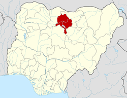
 Wudil Location in Nigeria | |
| Coordinates: 11°49′N 8°51′E / 11.817°N 8.850°ECoordinates: 11°49′N 8°51′E / 11.817°N 8.850°E | |
| Country |
|
| State | Kano State |
| Area | |
| • Total | 362 km2 (140 sq mi) |
| Population (2006 census) | |
| • Total | 185,189 |
| Time zone | WAT (UTC+1) |
| 3-digit postal code prefix | 713 |
| ISO 3166 code | NG.KN.WU |
Wudil is a Local Government Area in Kano State, Nigeria. Its headquarters are in the town of Wudil on the A237 highway.
It has an area of 362 km² and a population of 185,189 at the 2006 census.
The postal code of the area is 713.[1]
References
- ↑ "Post Offices- with map of LGA". NIPOST. Retrieved 2009-10-20.