Wrexham County Borough
 | |
| Geography | |
| Area - Total - % Water |
Ranked 10th 499 km² 0 % |
|---|---|
| Admin HQ | Wrexham Council Office |
| ISO 3166-2 | GB-WRX |
| ONS code | 00NL (ONS) W06000006 (GSS) |
| Demographics | |
| Population: - Total (2011) - Density |
Ranked 10th 134,800 Ranked 13th 268 / km² |
| Ethnicity | 97.6% White 1.4% S. Asian |
| Welsh language - Any skills |
Ranked 10th 22.9% |
| Politics | |
Wrexham County Borough Council http://www.wrexham.gov.uk/ | |
| Control | TBA (council NOC) |
| MPs | |

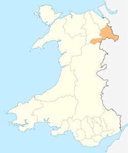
Wrexham County Borough (Welsh: Bwrdeistref Sirol Wrecsam [ˈwrɛksam]) is a local government principal area centred on the town of Wrexham in north-east Wales. The county borough has a population of nearly 135,000 inhabitants. Just under half of the population live either within the town of Wrexham or its surrounding conurbation of urban villages which has a population of around 63,000 people. The remainder live to the south and east of the town in more rural areas. The area has strong links with coal-mining.
The county borough was formed on 1 April 1996. Borough status was inherited from the town of Wrexham, granted over 150 years ago. Most of the area was previously part of the district of Wrexham Maelor - with several communities coming from Glyndŵr - in the county of Clwyd.
The area includes a portion of the eastern half of the historic county of Denbighshire (although not forming part of the principal area of Denbighshire), and two exclaves of historic Flintshire - English Maelor and the parish of Marford and Hoseley.
Government
The region is governed as a unitary authority by Wrexham County Borough Council. Most offices of the council are situated within Wrexham town centre, around Llwyn Isaf and the Civic Centre around Chester Street. The headquarters of the organisation is at the Guild Hall, Queens Square.
Schools
Top performing Secondary Schools in Wrexham County Borough (5 GCSEs, grades A*-C, according to the latest inspection report by Estyn). All Schools English speaking unless stated:
- 84 % The Maelor School, Penley
- 77 % St Joseph's Catholic & Anglican High School, Wrexham
- 61 % Ysgol Morgan Llwyd, Wrexham (Bilingual)
- 59% Ysgol Grango, Rhosllannerchrugog Band 2
- 57 % Darland High School, Rossett
- 46 % Ysgol Rhiwabon, Ruabon
- 41 % Ysgol Clywedog, Wrexham
- 38 % Ysgol Bryn Alyn, Gwersyllt
- 36 % Rhosnesni High School, Wrexham
Twinning
Wrexham is twinned with the German district of Märkischer Kreis and the Polish town of Racibórz.
The first twinning was established on 17 March 1970 between the former Kreis Iserlohn and Wrexham Rural District. Its early success ensured that, after local government reorganisation in both countries in the mid-seventies, the twinning was taken over by the new councils of Märkischer Kreis and Wrexham Maelor Borough Council and, in 1996, by Wrexham County Borough Council.
In 2001 Märkischer Kreis entered a twinning arrangement with Racibórz, a county in Poland, which was formerly part of Silesia, Germany. In September 2002, a delegation from Racibórz visited Wrexham and began discussions about co-operation which led to the signing of Articles of Twinning between Wrexham and Racibórz in March 2004. The Wrexham area has strong historical links with Poland. Following World War II, many service personnel from the Free Polish armed forces who had been injured received treatment at Penley Polish Hospital. Many of their descendants remain in the area.
See also
- List of places in Wrexham County Borough for a list of towns and villages
External links
- Wrexham County Borough at DMOZ
- Wrexham County Borough Council Website
- Electoral Arrangements Order 1998 - description of Wards
- Wrexham Council Ward Map
- Wrexham.com Website
- North Wales Police Wrexham Ward Map
- NHS Review of substance misuse including Ward Deprivation Map and detailed population/age group figures (PDF Viewer Required)
| ||||||||||||||||||||||||||||||||||||
| ||||||