Wreningham
| Wreningham | |
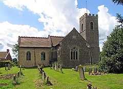 All Saints, Wreningham |
|
 Wreningham |
|
| Area | 6.24 km2 (2.41 sq mi) |
|---|---|
| Population | 451 |
| – density | 72/km2 (190/sq mi) |
| OS grid reference | TM166987 |
| Civil parish | Wreningham |
| District | South Norfolk |
| Shire county | Norfolk |
| Region | East |
| Country | England |
| Sovereign state | United Kingdom |
| Post town | NORWICH |
| Postcode district | NR16 |
| Police | Norfolk |
| Fire | Norfolk |
| Ambulance | East of England |
| EU Parliament | East of England |
Coordinates: 52°32′38″N 1°11′38″E / 52.54385°N 1.19384°E
Wreningham is a village and civil parish in the English county of Norfolk. It is situated some 3 miles (4.8 km) south east of Wymondham and 9 miles (14 km) south west of Norwich.
The civil parish has an area of 6.24 square kilometres and in 2001 had a population of 493 in 199 households. For the purposes of local government, the parish falls within the district of South Norfolk.
From 1808 to 1814 Wreningham hosted a station in the shutter telegraph chain which connected the Admiralty in London to its naval ships in the port of Great Yarmouth.
Superstitions
Wreningham, supposedly, got its name from the Witch and the Wren story. It is said that a witch who lived in Wreningham heard that the Witch Hunters were coming for her. She disguised herself as a Wren and got away.
References
- ^ Ordnance Survey (1999). OS Explorer Map 237 - Norwich. ISBN 0-319-21868-6.
- ^ Office for National Statistics & Norfolk County Council (2001). Census population and household counts for unparished urban areas and all parishes. Retrieved December 2, 2005.
External links
- Map sources for Wreningham.
- Information from Genuki Norfolk on Wreningham.
- Wreningham village website
![]() Media related to Wreningham at Wikimedia Commons
Media related to Wreningham at Wikimedia Commons