Wooster Square Historic District
|
Wooster Square Historic District | |
 | |
|
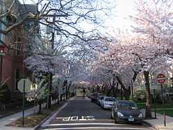
Cherry trees in the streets surrounding Wooster Square | |
 | |
| Location | New Haven, Connecticut |
|---|---|
| Coordinates | 41°18′16″N 72°55′5″W / 41.30444°N 72.91806°WCoordinates: 41°18′16″N 72°55′5″W / 41.30444°N 72.91806°W |
| Area | 40 acres (16 ha) |
| Architect | Austin,Henry |
| Architectural style | Greek Revival, Second Empire, Italianate |
| Governing body | Local |
| NRHP Reference # | 71000914[1] |
| Added to NRHP | August 5, 1971 |
The Wooster Square Historic District covers a 40-acre (16 ha) area that contains most of the Wooster Square neighborhood of New Haven, Connecticut. The district was listed on the National Register of Historic Places in 1971. The district area is bounded roughly by St. John, Olive, and Wooster Streets and I-91.[1][2]
Gallery
-
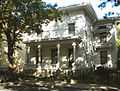
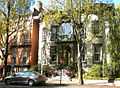
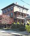
William Lewis House (1850), 613 Chapel St.
-
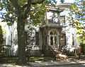
Second Nelson Hotchkiss House (1854), 607 Chapel St.
-

10 Academy St.
-
40 Academy St. (1846)
-
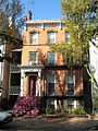
Edward Rowland House (1857), 42 Academy St.
-
323 Greene St. (about 1870).
-
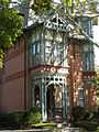
Max Adler House (1879), 311 Greene St. Adler was owner of Strouse, Adler a block away on Olive St.
-
John Robertson House (about 1833), 37-39 Wooster Place.
-
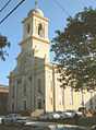
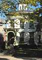
Wooster Square Congregational Church, now St. Michael’s Catholic Church (1855-1904), 29 Wooster Place.
-
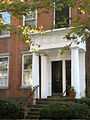
Russell Hotchkiss House (1844), 7 Wooster Place.
See also
References
- ↑ 1.0 1.1 "National Register Information System". National Register of Historic Places. National Park Service. 2009-03-13.
- ↑ _Constance Luyster (November 10, 1970). "National Register of Historic Places Inventory-Nomination: Wooster Square Historic District". National Park Service. and Accompanying 9 photos from 1969 and 1970