Wooroolin, Queensland
| Wooroolin Queensland | |
|---|---|
|
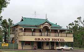
The Grand Hotel | |
 Wooroolin The location of Wooroolin in Queensland | |
| Coordinates | 26°25′0″S 151°49′0″E / 26.41667°S 151.81667°ECoordinates: 26°25′0″S 151°49′0″E / 26.41667°S 151.81667°E |
| Population | 164 (2006 census)[1] |
| Postcode(s) | 4608 |
| Location |
|
| LGA(s) | South Burnett Region |
| State electorate(s) | Nanango |
| Federal Division(s) | Maranoa |
Wooroolin is a town in the South Burnett region of Queensland, Australia. The town is in the South Burnett Region LGA and on the Bunya Highway, 243 kilometres (151 mi) north west of the state capital, Brisbane. At the 2006 census, Wooroolin had a population of 164.[1] Immediately to the east of the town is the Wooroolin Wetland, which is classified as a palustrine wetland, a non-tidal, inland, non-arid, seasonally flooded, vegetated swamp.[2] After successive floods in 2011 and 2013, the wetland burst its banks and flooded Wooroolin for the first time in recorded history. As of 2014, the wetland is still completely full and resembles a large, shallow lake.
References
| Wikimedia Commons has media related to Wooroolin, Queensland. |
- ↑ 1.0 1.1 Australian Bureau of Statistics (25 October 2007). "Wooroolin (Kingaroy Shire) (State Suburb)". 2006 Census QuickStats. Retrieved 2009-01-12.
- ↑ "Wooroolin Wetland: Fire and Biodiversity Management Plan (draft)" (PDF). Caroline Haskard Botanical and Natural Systems Services. May 2006. Retrieved 2009-10-20.
| ||||||||||