Woodland, North Carolina
| Woodland, North Carolina | |
|---|---|
| Town | |
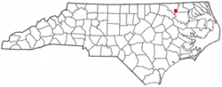 Location of Woodland, North Carolina | |
| Coordinates: 36°19′45″N 77°13′2″W / 36.32917°N 77.21722°WCoordinates: 36°19′45″N 77°13′2″W / 36.32917°N 77.21722°W | |
| Country | United States |
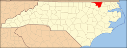
| State | North Carolina |
| County | Northampton |
| Area | |
| • Total | 1.3 sq mi (3.3 km2) |
| • Land | 1.3 sq mi (3.3 km2) |
| • Water | 0.0 sq mi (0.0 km2) |
| Elevation | 69 ft (21 m) |
| Population (2010) | |
| • Total | 809 |
| • Density | 644.6/sq mi (248.9/km2) |
| Time zone | Eastern (EST) (UTC-5) |
| • Summer (DST) | EDT (UTC-4) |
| ZIP code | 27897 |
| Area code(s) | 252 |
| FIPS code | 37-75340[1] |
| GNIS feature ID | 0997584[2] |
Woodland is a town in Northampton County, North Carolina, United States. The population was 809 at the 2010 census. It is part of the Roanoke Rapids, North Carolina Micropolitan Statistical Area.
History
The Woodland-Olney School was listed on the National Register of Historic Places in 1997.[3]
Geography
Woodland is located at 36°19′45″N 77°13′2″W / 36.32917°N 77.21722°W (36.329052, -77.217250).[4]
According to the United States Census Bureau, the town has a total area of 1.3 square miles (3.4 km2), all of it land.
Demographics
As of the census[1] of 2000, there were 833 people, 328 households, and 211 families residing in the town. The population density was 644.6 people per square mile (249.3/km²). There were 356 housing units at an average density of 275.5 per square mile (106.6/km²). The racial makeup of the town was 51.02% White, 47.78% African American, 0.48% Native American, 0.60% from other races, and 0.12% from two or more races. Hispanic or Latino of any race were 0.96% of the population.
There were 328 households out of which 28.7% had children under the age of 18 living with them, 39.6% were married couples living together, 22.9% had a female householder with no husband present, and 35.4% were non-families. 32.3% of all households were made up of individuals and 16.2% had someone living alone who was 65 years of age or older. The average household size was 2.52 and the average family size was 3.19.
In the town the population was spread out with 31.5% under the age of 18, 7.0% from 18 to 24, 21.5% from 25 to 44, 23.4% from 45 to 64, and 16.7% who were 65 years of age or older. The median age was 35 years. For every 100 females there were 77.2 males. For every 100 females age 18 and over, there were 71.5 males.
The median income for a household in the town was $22,125, and the median income for a family was $30,804. Males had a median income of $28,438 versus $23,125 for females. The per capita income for the town was $12,682. About 21.4% of families and 28.1% of the population were below the poverty line, including 40.4% of those under age 18 and 27.3% of those age 65 or over.
References
- ↑ 1.0 1.1 "American FactFinder". United States Census Bureau. Retrieved 2008-01-31.
- ↑ "US Board on Geographic Names". United States Geological Survey. 2007-10-25. Retrieved 2008-01-31.
- ↑ "National Register Information System". National Register of Historic Places. National Park Service. 2010-07-09.
- ↑ "US Gazetteer files: 2010, 2000, and 1990". United States Census Bureau. 2011-02-12. Retrieved 2011-04-23.
| |||||||||||||||||