Woodenbong
| Woodenbong New South Wales | |
|---|---|
|
Woodenbong | |
|
Woodenbong | |
| Coordinates | 28°23′0″S 152°36′0″E / 28.38333°S 152.60000°ECoordinates: 28°23′0″S 152°36′0″E / 28.38333°S 152.60000°E |
| Population | 420 (2006 census)[1] |
| Postcode(s) | 2476 |
| Location | |
| LGA(s) | Tenterfield Shire |
| State electorate(s) | Lismore |
| Federal Division(s) | New England, Page |
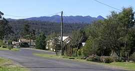
Woodenbong is a rural village in northern New South Wales, Australia, in Kyogle Council. It is 10 km south of the Queensland border. It is situated five kilometres south of the junction of the Summerland Way and the Mount Lindesay Road, which leads to Legume and eventually Tenterfield. At the 2006 census, Woodenbong had a population of 420.[1]
It is 798 km north-east of Sydney, 145 km from Brisbane and 60 km north-west of Kyogle.
The name is derived from an Githabul Tribal Nation word meaning wood ducks on water.
Dairy farming and cattle grazing are the two main industries. It is a very picturesque town nestled among mountains and valleys. A number of National Parks are close to Woodenbong, some of which are declared World Heritage areas.
In New South Wales:
- Border Ranges National Park
- Koreelah National Park
- Toonumbar National Park
- Mount Warning National Park
In Queensland:
References
- ↑ 1.0 1.1 Australian Bureau of Statistics (25 October 2007). "Woodenbong (L) (Urban Centre/Locality)". 2006 Census QuickStats. Retrieved 2 March 2010.
External links
![]() Media related to Woodenbong, New South Wales at Wikimedia Commons
Media related to Woodenbong, New South Wales at Wikimedia Commons
| ||||||||||