Woodbury County, Iowa
| Woodbury County, Iowa | |
|---|---|
 Woodbury County Courthouse in Sioux City | |
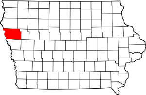 Location in the state of Iowa | |
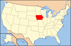 Iowa's location in the U.S. | |
| Founded | 1851 |
| Named for | Levi Woodbury[1] |
| Seat | Sioux City |
| Largest city | Sioux City |
| Area | |
| • Total | 878 sq mi (2,274 km2) |
| • Land | 872.59 sq mi (2,260 km2) |
| • Water | 4.79 sq mi (12 km2), 0.55% |
| Population | |
| • (2010) | 102,172 |
| • Density | 117/sq mi (45/km²) |
| Congressional district | 4th |
| Time zone | Central: UTC-6/-5 |
| Website |
www |
Woodbury County is a county located in the U.S. state of Iowa. As of the 2010 census, the population was 102,172.[2] The county seat is Sioux City.[3]
Woodbury County is included in the Sioux City, IA-NE-SD Metropolitan Statistical Area.[4]
History
Originally established in 1851 as Wahkaw County, the Iowa Legislature in 1853 changed the name to Woodbury County in honor of Levi Woodbury (1789–1851), a senator and Governor of New Hampshire who served as a Supreme Court justice from 1844 until his death.
The first county seat of Wahkaw County was the now-extinct village of Thompsonville; when the Legislature changed the county name to Woodbury, the new county seat became Sergeant's Bluff (now Sergeant Bluff). The county seat was moved to Sioux City in 1856.
The Winnebago Tribe of Nebraska (Ho-Chunk) also owns reservation land in Woodbury County.
Geography

According to the U.S. Census Bureau, the county has a total area of 878 square miles (2,270 km2), of which 873 square miles (2,260 km2) is land and 4.9 square miles (13 km2) (0.6%) is water.[5] It is the third-largest county by area in Iowa.
Major highways
.svg.png) Interstate 29
Interstate 29.svg.png) Interstate 129
Interstate 129 U.S. Highway 20
 U.S. Highway 75
 U.S. Highway 77
 Iowa Highway 12
 Iowa Highway 31
 Iowa Highway 140
 Iowa Highway 141
 Iowa Highway 175
Adjacent counties
- Plymouth County (north)
- Cherokee County (northeast)
- Ida County (east)
- Monona County (south)
- Thurston County, Nebraska (southwest)
- Dakota County, Nebraska (west)
- Union County, South Dakota (northwest)
Demographics
| Historical population | |||
|---|---|---|---|
| Census | Pop. | %± | |
| 1860 | 1,119 | — | |
| 1870 | 6,172 | 451.6% | |
| 1880 | 14,996 | 143.0% | |
| 1890 | 55,632 | 271.0% | |
| 1900 | 54,610 | −1.8% | |
| 1910 | 67,616 | 23.8% | |
| 1920 | 92,171 | 36.3% | |
| 1930 | 101,669 | 10.3% | |
| 1940 | 103,627 | 1.9% | |
| 1950 | 103,917 | 0.3% | |
| 1960 | 107,849 | 3.8% | |
| 1970 | 103,052 | −4.4% | |
| 1980 | 100,884 | −2.1% | |
| 1990 | 98,276 | −2.6% | |
| 2000 | 103,877 | 5.7% | |
| 2010 | 102,172 | −1.6% | |
| Est. 2014 | 102,271 | 0.1% | |
2010 census
The 2010 census recorded a population of 102,172 in the county, with a population density of 117.062/sq mi (45.1980/km2). There were 41,454 housing units, of which 39,052 were occupied.[10]
2000 census

As of the census[11] of 2000, there were 103,877 people, 39,151 households, and 26,426 families residing in the county. The population density was 119 people per square mile (46/km²). There were 41,394 housing units at an average density of 47 per square mile (18/km²). The racial makeup of the county was 87.48% White, 2.02% Black or African American, 1.69% Native American, 2.41% Asian, 0.04% Pacific Islander, 4.37% from other races, and 1.99% from two or more races. 9.11% of the population were Hispanic or Latino of any race.
There were 39,151 households out of which 34.00% had children under the age of 18 living with them, 51.90% were married couples living together, 11.30% had a female householder with no husband present, and 32.50% were non-families. 26.60% of all households were made up of individuals and 11.20% had someone living alone who was 65 years of age or older. The average household size was 2.58 and the average family size was 3.13.
In the county the population was spread out with 27.30% under the age of 18, 10.20% from 18 to 24, 28.30% from 25 to 44, 20.80% from 45 to 64, and 13.40% who were 65 years of age or older. The median age was 34 years. For every 100 females there were 96.10 males. For every 100 females age 18 and over, there were 92.80 males.
The median income for a household in the county was $38,509, and the median income for a family was $46,499. Males had a median income of $31,664 versus $22,599 for females. The per capita income for the county was $18,771. About 7.20% of families and 10.30% of the population were below the poverty line, including 13.60% of those under age 18 and 7.40% of those age 65 or over.
Communities
Cities
Unincorporated communities
Townships
- Arlington
- Banner
- Concord
- Floyd
- Grange
- Grant
- Kedron
- Lakeport
- Liberty
- Liston
- Little Sioux
- Miller
- Morgan
- Moville
- Oto
- Rock
- Rutland
- Sioux City
- Sloan
- Union
- West Fork
- Willow
- Wolf Creek
- Woodbury
See also
References
- ↑ Chicago and North Western Railway Company (1908). A History of the Origin of the Place Names Connected with the Chicago & North Western and Chicago, St. Paul, Minneapolis & Omaha Railways. p. 165.
- ↑ 2.0 2.1 "State & County QuickFacts". United States Census Bureau. Retrieved July 20, 2014.
- ↑ "Find a County". National Association of Counties. Retrieved 2011-06-07.
- ↑ United States Office of Management and Budget. "Update of Statistical Area Definitions and Guidance on Their Uses" (PDF). pp. 5, 36. Archived from the original (PDF) on 2006-05-14. Retrieved 2006-07-21.
- ↑ "US Gazetteer files: 2010, 2000, and 1990". United States Census Bureau. 2011-02-12. Retrieved 2011-04-23.
- ↑ "U.S. Decennial Census". United States Census Bureau. Retrieved July 20, 2014.
- ↑ "Historical Census Browser". University of Virginia Library. Retrieved July 20, 2014.
- ↑ "Population of Counties by Decennial Census: 1900 to 1990". United States Census Bureau. Retrieved July 20, 2014.
- ↑ "Census 2000 PHC-T-4. Ranking Tables for Counties: 1990 and 2000" (PDF). United States Census Bureau. Retrieved July 20, 2014.
- ↑ "Population & Housing Occupancy Status 2010". United States Census Bureau American FactFinder. Retrieved May 9, 2011.
- ↑ "American FactFinder". United States Census Bureau. Retrieved 2008-01-31.
Further reading
- Lensch, R.A. (2006). Soil survey of Woodbury County, Iowa. Washington, D.C.: U.S. Department of Agriculture, Natural Resources Conservation Service.
External links
| Wikimedia Commons has media related to Woodbury County, Iowa. |
 |
Union County, South Dakota | Plymouth County | Cherokee County | |
| Dakota County, Nebraska | |
Ida County | ||
| ||||
| | ||||
| Thurston County, Nebraska | Monona County |
| |||||||||||||||||||||||||||||
Coordinates: 42°23′29″N 96°03′03″W / 42.39139°N 96.05083°W