Wood Township, Clark County, Indiana
| Wood Township | |
|---|---|
| Township | |
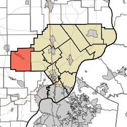 Location of Wood Township in Clark County | |
| Coordinates: 38°27′25″N 85°55′45″W / 38.45694°N 85.92917°WCoordinates: 38°27′25″N 85°55′45″W / 38.45694°N 85.92917°W | |
| Country | United States |
| State | Indiana |
| County | Clark |
| Government | |
| • Type | Indiana township |
| Area | |
| • Total | 38.97 sq mi (100.9 km2) |
| • Land | 38.83 sq mi (100.6 km2) |
| • Water | 0.13 sq mi (0.3 km2) |
| Elevation[1] | 545 ft (166 m) |
| Population (2010) | |
| • Total | 2,747 |
| • Density | 70.7/sq mi (27.3/km2) |
| FIPS code | 18-85166[2] |
| GNIS feature ID | 454063 |
Wood Township is one of twelve townships in Clark County, Indiana. As of the 2010 census, its population was 2,747 and it contained 1,148 housing units.[3]
History
Wood Township was named for George Wood, a pioneer settler.[4]
Geography
According to the 2010 census, the township has a total area of 38.97 square miles (100.9 km2), of which 38.83 square miles (100.6 km2) (or 99.64%) is land and 0.13 square miles (0.34 km2) (or 0.33%) is water.[3] It is 11 miles NW of Louisville, KY.
Cities and towns
Unincorporated towns
- Chestnut Hill
- Starlight
(This list is based on USGS data and may include former settlements.)
Adjacent townships
- Polk Township, Washington County (north)
- Monroe Township (northeast)
- Carr Township (east)
- Lafayette Township, Floyd County (southeast)
- Greenville Township, Floyd County (southwest)
- Jackson Township, Washington County (west)
Major highways
Cemeteries
The township contains several cemeteries: African-American Cemetery near Daisy Hill Cemetery, Borden Town, Daisy Hill, Dow, Emmanuel, Fisher, Gibson, Goss, Goss II, Gruen, Hallett, Johnson, McKinley-Packwood, New Chapel, Newman/Fisher, Pleasant Ridge, Robertson, St. John the Baptist Catholic Church, Walnut Hill, Whitson, and Wood.[5]
References
- ↑ "US Board on Geographic Names". United States Geological Survey. 2007-10-25. Retrieved 2008-01-31.
- ↑ "American FactFinder". United States Census Bureau. Retrieved 2008-01-31.
- ↑ 3.0 3.1 "Population, Housing Units, Area, and Density: 2010 - County -- County Subdivision and Place -- 2010 Census Summary File 1". United States Census. Retrieved 2013-05-10.
- ↑ Biographical and Historical Souvenir for the Counties of Clark, Crawford, Harrison, Floyd, Jefferson, Jennings, Scott, and Washington, Indiana. Chicago Printing Company. 1889. p. 19.
- ↑ Mauk, Lois. "Clark County, Indiana Cemeteries". http://www.usgennet.org/''. USGenNet. Retrieved 7 September 2014.
External links
| |||||||||||||||||||||||||||||||||