Wolcott, Colorado
| Wolcott, Colorado | |
|---|---|
| Census-designated place (CDP) | |
|
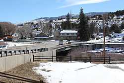
Wolcott | |
 Location in Eagle County and the state of Colorado | |
| Coordinates: 39°42′10″N 106°40′42″W / 39.70278°N 106.67833°WCoordinates: 39°42′10″N 106°40′42″W / 39.70278°N 106.67833°W | |
| Country |
|
| State |
|
| County | Eagle County[1] |
| Elevation[1] | 6,990 ft (2,130 m) |
| Time zone | MST (UTC-7) |
| • Summer (DST) | MDT (UTC-6) |
| ZIP code[2] | 81655 |
| GNIS feature ID | 0204665 |
Wolcott is a census-designated place and a U.S. Post Office located in Eagle County, Colorado, United States. The population as of the 2010 Census was 15.[3] The Wolcott Post Office has the ZIP Code 81655.[2]
Geography
Wolcott is located at 39°42′10″N 106°40′42″W / 39.70278°N 106.67833°W (39.702696,-106.678448).
See also
- Outline of Colorado
- State of Colorado
- Colorado cities and towns
- Colorado census designated places
- Colorado counties
- Colorado metropolitan areas
- Colorado cities and towns
- List of cities and towns in Colorado
- Eagle County, Colorado
References
- ↑ 1.0 1.1 "US Board on Geographic Names". United States Geological Survey. 2007-10-25. Retrieved 2008-01-31.
- ↑ 2.0 2.1 "ZIP Code Lookup" (JAVASCRIPT/HTML). United States Postal Service. January 3, 2007. Retrieved January 3, 2007.
- ↑ Colorado Trend Report 2: State and Complete Places (Sub-state 2010 Census Data). Missouri Census Data Center. Accessed 2011-02-25.
| |||||||||||||||||||||||||
