Wokha district
| Wokha district | |
|---|---|
| District | |
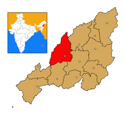 Wokha district's location in Nagaland | |
| Coordinates: 26°06′N 94°16′E / 26.100°N 94.267°ECoordinates: 26°06′N 94°16′E / 26.100°N 94.267°E | |
| Country |
|
| State | Nagaland |
| Seat | Wokha |
| Area | |
| • Total | 1,628 km2 (629 sq mi) |
| Population (2011) | |
| • Total | 166,239 |
| • Density | 100/km2 (260/sq mi) |
| Time zone | IST (UTC+05:30) |
| ISO 3166 code | IN-NL-WO |
| Website | http://wokha.nic.in/ |
Wokha (Pron:/ˈwəʊkə/) is a district of Nagaland state in India.
Geography
It covers an area of 1,628 km². Its capital is the town of Wokha.
Economy
In 2006, the Ministry of Panchayati Raj named Wokha one of the country's 250 most backward districts (out of a total of 640).[1] It is one of the three districts in Nagaland currently receiving funds from the Backward Regions Grant Fund Programme (BRGF).[1]
Demographics
According to the 2011 census Wokha district has a population of 166,239,[2] roughly equal to the nation of Saint Lucia.[3] This gives it a ranking of 595th in India (out of a total of 640).[2] Wokha has a sex ratio of 969 females for every 1000 males,[2] and a literacy rate of 87.6%.[2]
References
- ↑ 1.0 1.1 Ministry of Panchayati Raj (September 8, 2009). "A Note on the Backward Regions Grant Fund Programme". National Institute of Rural Development. Retrieved September 27, 2011.
- ↑ 2.0 2.1 2.2 2.3 "District Census 2011". Census2011.co.in. 2011. Retrieved 2011-09-30.
- ↑ US Directorate of Intelligence. "Country Comparison:Population". Retrieved 2011-10-01.
Saint Lucia 161,557 July 2011 est.
External links
- Official Government website
- List of places in Wokha
 |
Jorhat district, Assam | Mokokchung district | | |
| Golaghat district, Assam | |
Zunheboto district | ||
| ||||
| | ||||
| Kohima district |
| ||||||||||||||||||||||